
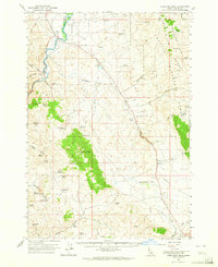
1963 Map of Lone Pine Peak
USGS Topo · Published 1965About this map
The Salmon River and Pahsimeroi River converge near the northern edge of this high-country landscape, framing the agricultural basin of Round Valley. This mid-century survey documents a wilderness transitioning between the river bottoms and the high peaks of the Challis National Forest. A notable concentration of natural resources and historic landmarks is evident, including the Petrified Forest situated near Malm Gulch. The map reveals a network of water sources essential for high-altitude ranching and travel, such as Jenson Cabin Spring, Rosebriar Spring, and Philips Spr. Land management and industrial history are noted by the presence of a Gravel Pit and several established flats like Bradbury Flat and Antelope Flat, which stand in contrast to the steep elevations of Lone Pine Peak and Germer Peak.
Find a feature on this map
53 named features on this map. Tap any name to fly to it.
Don’t see what you’re looking for? This feature index may not catch every label — zoom into the map to look around manually.
Map Details
Editions of this 1963 Lone Pine Peak Map
2 editions found
Other maps of this area

1929 · Bayhorse
USGS Topo · 1:125,000

1935 · Borah Peak
USGS Topo · 1:125,000

1938 · Borah Peak
USGS Topo · 1:125,000

1955 · Dubois
USGS Topo · 1:250,000

1956 · Doublespring
USGS Topo · 1:62,500

1956 · May
USGS Topo · 1:62,500

1956 · Challis
USGS Topo · 1:62,500

1956 · Twin Peaks
USGS Topo · 1:62,500

1957 · Challis
USGS Topo · 1:250,000

1958 · Dubois
USGS Topo · 1:250,000