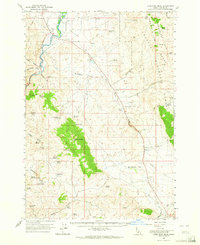
1963 Map of Lone Pine Peak
USGS Topo · Published 1965About this map
Salmon River carving through the Salmon River Valley anchors this mid-century topographic record of Custer County. The landscape is defined by the high elevations of the Challis National Forest, rising to prominent points like Lone Pine Peak and Germer Peak. Local ranching and high-desert life are reflected in the numerous springs and flats that dot the terrain, including Bradbury Flat and Antelope Flat.
Find a feature on this map
49 named features on this map. Tap any name to fly to it.
Don’t see what you’re looking for? This feature index may not catch every label — zoom into the map to look around manually.
Map Details
Editions of this 1963 Lone Pine Peak Map
2 editions found

Other maps of this area

1929 · Bayhorse
USGS Topo · 1:125,000

1935 · Borah Peak
USGS Topo · 1:125,000

1938 · Borah Peak
USGS Topo · 1:125,000

1955 · Dubois
USGS Topo · 1:250,000

1956 · Doublespring
USGS Topo · 1:62,500

1956 · May
USGS Topo · 1:62,500

1956 · Challis
USGS Topo · 1:62,500

1956 · Twin Peaks
USGS Topo · 1:62,500

1957 · Challis
USGS Topo · 1:250,000

1958 · Dubois
USGS Topo · 1:250,000