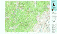
1982 Map of Challis
USGS Topo · Published 1982About this map
Challis and the surrounding high-mountain landscapes of central Idaho are documented here as they appeared in the early 1980s. The terrain is dominated by the Salmon River Mountains and the Lost River Range, where the landscape is carved by the Salmon River and its major tributaries like the Middle Fork Salmon River. This area represents a significant intersection of public lands, including the Frank Church-River of No Return Wilderness and portions of the Challis National Forest.
Find a feature on this map
62 named features on this map. Tap any name to fly to it.
Don’t see what you’re looking for? This feature index may not catch every label — zoom into the map to look around manually.
Map Details
Editions of this 1982 Challis Map
This is the sole edition of this map. No revisions or reprints were ever made.
Other maps of this area

1891 · Bear Valley
USGS Topo · 1:125,000

1893 · Bear Valley
USGS Topo · 1:125,000

1919 · Custer
USGS Topo · 1:125,000

1922 · Custer
USGS Topo · 1:125,000

1929 · Bayhorse
USGS Topo · 1:125,000

1930 · Casto
USGS Topo · 1:125,000

1935 · Borah Peak
USGS Topo · 1:125,000

1938 · Borah Peak
USGS Topo · 1:125,000

1950 · Blackbird Mtn
USGS Topo · 1:62,500

1950 · Salmon
USGS Topo · 1:62,500