Old Maps of Franklin County, Idaho for Metal Detecting
Plan your next treasure hunt with 181 historic maps of Franklin County. Find old homesites, ghost towns, trails, and gathering spots that may be lost to time — perfect for identifying promising metal detecting locations.
- Locate forgotten sites: Uncover places like long-lost settlements, abandoned rail lines, or gathering spots.
- Plan better hunts: Use map overlays combined with LiDAR or satellite views to narrow in on historically rich areas.
- Made for detectorists: Thousands of hobbyists use these maps to discover relics, coins, and hidden history.
Use these historic maps to boost your research and find new opportunities beneath the surface of Franklin County.
Franklin County, ID maps
(181)- 1914 Map of Logan, 1957 Print
 1914 Logan1957 Print · USGSCache Valley thrives in the early nineteen-hundreds as a hub of rail travel and sugar beet processing. Genealogists can locate family homesteads near Stephenson School, trace the Oregon Short Line, or find remote operations like the Amazon Mine.
 - 1915 Map of Preston
 1915 Preston1915 Print · USGSSoutheastern Idaho and northern Utah are defined by their river valleys and early irrigation networks during the mid-1910s. Genealogists can locate family landmarks like the Thatcher Meetinghouse, Egypt School, and the path of the Oregon Short Line.2 unique versions available
 - 1916 Map of Logan
 1916 Logan1916 Print · USGSCache Valley and the northern Wasatch Range come alive in this mid-1910s survey, showing the peak of the local rail-and-sugar economy. Genealogists can locate family holdings like Hardware Ranch, early rural sites like Stephenson School, and the industrial Sugar Factory.4 unique versions available
 - 1918 Map of Preston
 1918 Preston1918 Print · USGSSouthern Idaho and northern Utah are captured just before the close of the Great War, showing a landscape of burgeoning farm towns and irrigation canals. Researchers can trace the Oregon Short Line to early settlements like Preston or locate rural landmarks like the Thatcher Meetinghouse and Egypt School.2 unique versions available
 - 1954 Map of Pocatello, 1963 Print
 1954 Pocatello1963 Print · USGSSoutheast Idaho in the mid-1950s reveals a landscape shaped by massive water reclamation and mountain forests. Researchers can trace the development of the Fort Hall Indian Reservation or locate specific landmarks like the Arbon P O and Emerson School.4 unique versions available
 - 1954 Map of Ogden, 1967 Print
 1954 Ogden1967 Print · USGSThe northern Utah corridor and Wyoming borderlands are captured here in the mid-1950s, showing the region's transition from mountain wilderness to settled valleys. Researchers can trace historic institutions like Utah State University or locate vanished points like Church Butte Station and the Trappist Monastery.3 unique versions available
 - 1954 Map of Brigham City, 1968 Print
 1954 Brigham City1968 Print · USGSNorthern Utah and the edges of the Great Salt Lake are captured here during the mid-fifties, showing the region's transition from pioneer rail hubs to modern military ranges. Researchers can find old sidings like Lemay Siding, the Golden Spike Monument, and settlements like Washakie.4 unique versions available
 - 1955 Map of Preston, 1968 Print
 1955 Preston1968 Print · USGSSoutheast Idaho and western Wyoming are shown in detail during the mid-fifties, from the high Bear River Range to the Green River Basin. Genealogists and collectors can trace the Union Pacific RR through historic towns like Preston, Montpelier, and Afton.3 unique versions available
 - 1958 Map of Ogden
 1958 Ogden1958 Print · USGSNorthern Utah and southwestern Wyoming are captured here during a period of steady growth and military expansion. You can trace the Union Pacific rail lines and early road networks connecting Ogden and Logan to Bear Lake and Evanston.
 - 1958 Map of Pocatello
 1958 Pocatello1958 Print · USGSSoutheastern Idaho in the late fifties was a landscape of expanding reservoirs and historic trails. Genealogists and historians can trace the Old Oregon Trail, locate the Bannock Creek Indian Day School, and study the many Union Pacific rail sidings.2 unique versions available
 - 1958 Map of Preston
 1958 Preston1958 Print · USGSThe high valleys of the Idaho and Wyoming borderlands are captured here in the late fifties, showcasing a landscape of mountain ranching and phosphate mining. Genealogists and historians can locate early settlements like Chesterfield and Bedford or trace the Union Pacific rail lines serving Cokeville.2 unique versions available
 - 1958 Map of Brigham City
 1958 Brigham City1958 Print · USGSNorthern Utah in the late fifties shows a landscape of extremes, from the salt flats to the bustling Bear River Valley. Trace historical routes like the Old Immigrant Trail and locate local landmarks such as the Brigham Sugar Mill and Booth Valley School.
 - 1960 Map of Ogden
 1960 Ogden1960 Print · USGSIn the mid-1950s, this region of the American West balanced military expansion with frontier history along the Union Pacific RR. Genealogists and historians can trace old settlements like Fort Bridger, the residential growth of Washington Terrace, and industrial sites from the Hill AFB complex to the coal mines of Kemmerer.
 - 1962 Map of Brigham City
 1962 Brigham City1962 Print · USGSNorthern Utah in the early sixties reveals a landscape of vast salt flats and growing towns along the Wasatch Front. Researchers can trace the Southern Pacific line past the Golden Spike Monument or locate landmarks like Indian Cave and Donner-Reed Pass.
 - 1962 Map of Preston
 1962 Preston1962 Print · USGSSoutheast Idaho and the Wyoming borderlands are captured here in the early sixties, a time of thriving agricultural valleys and mountain ranching. Researchers can trace the Union Pacific rail lines and find legacy settlements like Montpelier, Afton, and Preston.
 - 1964 Map of Richmond, 1966 Print
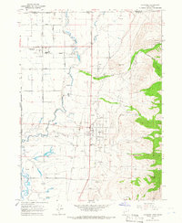 1964 Richmond1966 Print · USGSThe northern Cache Valley comes alive in the mid-1960s, showing the agricultural heartland along the Idaho-Utah border. Genealogists and local historians can trace family land near Lewiston, the Sugar Refinery, and the Union Pacific rail lines.
 - 1964 Map of Clarkston, 1966 Print
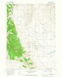 1964 Clarkston1966 Print · USGSSettled at the foot of the western mountains in the 1960s, this area around Clarkston shows a transition from high forest to fertile valley floor. Genealogists and historians can locate the local Cem, the Gravel Pit, and family-named landmarks like Myler Grove and Archibald Hollow.2 unique versions available
 - 1964 Map of Trenton, 1966 Print
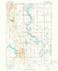 1964 Trenton1966 Print · USGSThe Cache Valley at the height of the mid-century shows a landscape of river-fed agriculture and rail-side settlements along the Utah-Idaho border. Local researchers can trace the historic Union Pacific tracks through Trenton or locate the Cornish Cem and Newton Reservoir.2 unique versions available
 - 1968 Map of Malad Summit, 1971 Print
 1968 Malad Summit1971 Print · USGSThe high pass at Malad Summit served as a vital corridor through the Idaho mountains during the late 1960s. Researchers can locate remote resource sites like a Mill and Mine, and trace old routes through the Caribou National Forest via a pack trail.2 unique versions available
 - 1968 Map of Oxford, 1971 Print
 1968 Oxford1971 Print · USGSThe Marsh Valley corridor comes to life in this late 1960s survey, showing the vital transit and water networks of southern Idaho. Trace family roots at the Oxford Cem and explore the historic geography of Red Rock Pass and Swanlake.
 - 1968 Map of Clifton, 1971 Print
 1968 Clifton1971 Print · USGSIn the late sixties, the ranching country near Clifton remained a world of mountain basins and complex water rights. Genealogists and local historians can trace the paths of the Pack Trail through North Fork Mine Hollow or locate high-elevation landmarks like Weston Peak and Davis Basin.3 unique versions available
 - 1968 Map of Weston Canyon, 1971 Print
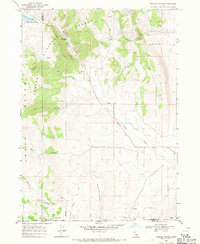 1968 Weston Canyon1971 Print · USGSFranklin and Oneida counties meet in this late-1960s survey of the Idaho-Utah borderlands, where mountain canyons give way to high-desert flats. Genealogists and historians can locate remote landmarks like Standing Rock, Weston Creek Reservoir, and the Washboards.2 unique versions available
 - 1969 Map of Tony Grove Creek, 1973 Print
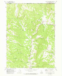 1969 Tony Grove Creek1973 Print · USGSHigh in the Cache National Forest during the late sixties, this survey captures the intersection of mountainous recreation and resource history. Trace the trails leading to the Amazon Mine, explore the Beaver Mtn Ski Area, or locate the Tony Grove Memorial Guard Station.
 - 1969 Map of Midnight Mtn, 1973 Print
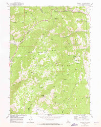 1969 Midnight Mtn1973 Print · USGSThe Bear Lake Range in the late sixties reveals a landscape of high-country basins and deep canyons along the Bear Lake and Franklin county line. Trace historic routes via the PACK TRAIL and JEEP TRAIL to remote landmarks like Midnight Mtn, Midnight Lake, and Danish Flat.
 - 1969 Map of Egan Basin, 1973 Print
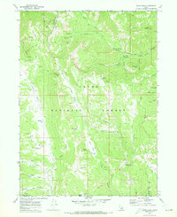 1969 Egan Basin1973 Print · USGSThe high Bear River Range at the Idaho-Utah border is shown here in the late sixties, where the Cache National Forest landscape remains wild and roadless. Researchers can trace historic access routes like Danish Pass or locate geological features such as Minnetonka Cave and the Sinks.2 unique versions available
Showing maps 1-25 of 181
Top cities of Franklin County
- Preston historical maps
- Franklin historical maps
- Dayton historical maps
- Weston historical maps
- Clifton historical maps
- Oxford historical maps
Frequently asked questions
- What are the different types of historical maps available for Franklin County?
- What is the oldest map of Franklin County?
- Where can I purchase historical maps of Franklin County for my home or office?
- Where can I download high-res historical maps of Franklin County?
- Are there historical topographic maps available for Franklin County?
- Is there historical aerial imagery available for Franklin County?
- Where are historical maps of Franklin County sourced from?