Old Maps of Idaho County, Idaho for Metal Detecting
Plan your next treasure hunt with 1,452 historic maps of Idaho County. Find old homesites, ghost towns, trails, and gathering spots that may be lost to time — perfect for identifying promising metal detecting locations.
- Locate forgotten sites: Uncover places like long-lost settlements, abandoned rail lines, or gathering spots.
- Plan better hunts: Use map overlays combined with LiDAR or satellite views to narrow in on historically rich areas.
- Made for detectorists: Thousands of hobbyists use these maps to discover relics, coins, and hidden history.
Use these historic maps to boost your research and find new opportunities beneath the surface of Idaho County.
Idaho County, ID maps
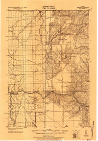
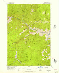
(1,452)- 1901 Map of Hamilton
 1901 Hamilton1901 Print · USGSThe Bitterroot Valley in the late nineteenth century is a landscape of emerging rail towns and sophisticated irrigation. Trace the development of early Hamilton and Victor alongside the Northern Pacific Railway and historic canals like Republican Ditch.6 unique versions available
 - 1911 Map of Lolo, 1954 Print
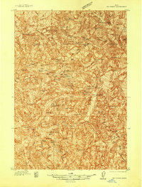
 1911 Lolo1954 Print · USGSThe Bitterroot wilderness at the dawn of the Forest Service era is documented here through its early camps and trail networks. Researchers can locate remote outposts like Moose City, the Clearwater Gold and Copper Company, and the historic Indian Post Office landmark.
 - 1912 Map of Missoula
 1912 Missoula1912 Print · USGSWestern Montana at the end of the frontier era shows a landscape of growing rail hubs and remote mountain outposts. Researchers can trace early river crossings like Alberts Ferry, the grounds of Ft Missoula, and vanished schools such as Big Flat School.4 unique versions available
 - 1913 Map of Lolo
 1913 Lolo1913 Print · USGSThe Bitterroot wilderness of the early 1900s is documented here through a web of mining camps, ranger stations, and high mountain passes. Genealogists and researchers can locate remote sites like Moose City, Williams Ranch, and the Clearwater Gold and Copper Company.2 unique versions available
 - 1922 Map of He Devil
 1922 He Devil1922 Print · USGSThe Seven Devils Mountains of the early 1920s reveal a landscape of remote mining claims and high-elevation ranching camps. Researchers can locate historical sites like the Winchester Mine, Mc Gaffees Ranch, and Jacks Cabin.
 - 1924 Map of Kamiah
 1924 Kamiah1924 Print · USGSNorth-central Idaho settlements thrive along the Clearwater River and upland plateaus during the mid-twenties. Genealogists and historians can trace the paths of the Northern Pacific railroad through rail towns like Volmer, Cottonwood, and the river crossing at Kamiah.
 - 1924 Map of Weippe
 1924 Weippe1924 Print · USGSNorth-central Idaho in the early 1920s is captured here, from the prairie settlements to the deep river canyons of the Clearwater. Genealogists can trace early homesteaders like G.W. Ford or locate long-gone post offices at Tahoe and Lowell.
 - 1931 Map of Buffalo Hump, 1957 Print
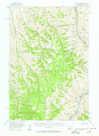
 1931 Buffalo Hump1957 Print · USGSIdaho County’s high backcountry was a hub of gold mining and remote ranching in the years between the world wars. Genealogists and historians can locate family lands like the McComas Ranch and trace the operations of the Mother Lode Mine or New York Mine.
 - 1934 Map of Buffalo Hump
 1934 Buffalo Hump1934 Print · USGSIdaho County mining activity and forest settlement are captured here during the 1930s, documenting a remote region of the Nez Perce National Forest. Researchers can locate specific claims like the Mother Lode Mine or trace family roots at Orogrande and McComas Ranch.
 - 1937 Map of Big Creek
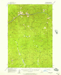
 1937 Big Creek1937 Print · USGSMid-century mining activity in the Idaho backcountry centers on the remote outposts of Edwardsburg and Big Creek. Genealogists and historians can trace lode claims like the Golden Hand Mine and Moscow Mine alongside early structures like Hand Cabin.2 unique versions available
 - 1938 Map of Riggins
 1938 Riggins1938 Print · USGSRiggins and the canyon of the Salmon River appear here in the late 1930s, showing a landscape defined by mining, ranching, and forest management. Genealogists and historians can trace family-named sites like McMillians Mine, the Black Bear Inn, and the Middle District School.2 unique versions available
 - 1942 Map of Big Creek
 1942 Big Creek1942 Print · USGSThe remote Idaho backcountry during the 1930s is revealed as a landscape of isolated cabins and active lode mines. Genealogists and historians can trace the foundations of local industry at the Golden Hand Mine, find early homesteads like Mahan Cabin, and locate the small settlement of Edwardsburg.
 - 1945 Map of Riggins
 1945 Riggins1945 Print · USGSRiggins and the deep river canyons of central Idaho are captured here just before the mid-century, showing the isolated ranching and forest-service life of the era. Researchers can locate remote homesteads and outposts like Hinkley Cabin, the Middle District Sch, and Old Pollock.
 - 1954 Map of Kernan Point, 1958 Print
 1954 Kernan Point1958 Print · USGSThe Snake River canyon and the Oregon-Idaho border are captured here in the mid-1950s, showing a landscape defined by isolated ranching life. Genealogists and historians can trace the remote Litch Ranch, Somers Ranch, and the Kneeland Place during this era.3 unique versions available
 - 1955 Map of Pullman, 1963 Print
 1955 Pullman1963 Print · USGSThe Palouse and Clearwater regions are captured here in the mid-1950s, showing the height of the rail-and-river economy. Genealogists and historians can trace rail lines like the Camas Prairie RR, find local landmarks like Whitman County Memorial Cem, and locate early academic centers at Washington State University and the University of Idaho.3 unique versions available
 - 1955 Map of Grangeville, 1964 Print
 1955 Grangeville1964 Print · USGSThe high country of the Idaho-Oregon border comes alive in the mid-1950s, showing the deep river canyons and mountain peaks. Trace the Union Pacific RR through the valleys or locate settlements like Grangeville, Joseph, and the shoreline of Wallowa Lake.4 unique versions available
 - 1956 Map of Burgdorf, 1957 Print
 1956 Burgdorf1957 Print · USGSIdaho’s backcountry reveals its mining and forestry heritage in the mid-fifties, from the banks of the Salmon River to the high peaks. Genealogists and researchers can trace old prospecting sites like the Golden Anchor Mine and remote cabins such as Hackett Cabin.3 unique versions available
 - 1956 Map of Warren, 1957 Print
 1956 Warren1957 Print · USGSRemote Idaho gold mining camps and wilderness ranches appear in this mid-fifties survey of the Salmon River canyon. Genealogists and researchers can trace the isolated Shep Ranch, the riverside Mackay Bar, and historic mining operations like the War Eagle Mine.3 unique versions available
 - 1956 Map of Elk City, 1963 Print
 1956 Elk City1963 Print · USGSThe Idaho backcountry in the mid-fifties remains a landscape of isolated mining camps and remote forest outposts. Researchers can trace historical mining operations at Stibnite Mine and Blackbird Mine or locate riverside landmarks like Mackay Bar and Campbell's Ferry.3 unique versions available
 - 1956 Map of Hamilton, 1970 Print
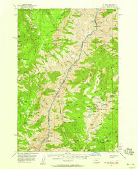
 1956 Hamilton1970 Print · USGSThe Bitterroot Valley and surrounding high country are captured here during the mid-fifties, showing the region's transition into a modern forest-and-rail hub. Genealogists and historians can trace family-named sites and early infrastructure from Fort Missoula to towns like Stevensville and Darby along the Northern Pacific line.2 unique versions available
 - 1957 Map of He Devil, 1958 Print
 1957 He Devil1958 Print · USGSThe high country of the Idaho-Oregon border is mapped here in the late fifties, centered on the dramatic Snake River Canyon. Trace the footprint of local history through outposts like Horse Creek Cabin and the site of the Rankin Mill (Aband).4 unique versions available
 - 1958 Map of Pullman
 1958 Pullman1958 Print · USGSThe Palouse and Clearwater regions are captured here in the late fifties, showing the vital river-and-rail connection between eastern Washington and northern Idaho. Local historians can trace the paths of the Camas Prairie RR and Union Pacific RR as they serve towns like Colfax, Kamiah, and Nezperce.2 unique versions available
 - 1959 Map of Grangeville
 1959 Grangeville1959 Print · USGSThe high alpine peaks and deep river canyons of the Idaho-Oregon borderlands are captured in the late fifties. Researchers can trace the Union Pacific RR through the valleys to settlements like Enterprise, Union, and Grangeville.2 unique versions available
 - 1959 Map of Hamilton
 1959 Hamilton1959 Print · USGSThe Bitterroot Valley and surrounding wilderness are captured in the late fifties, showing a landscape defined by forestry and river-based settlement. Researchers can trace the Lolo Trail or locate historical points like Fort Missoula and the Fred Burr Reservoir.
 - 1960 Map of Elk City
 1960 Elk City1960 Print · USGSThe Central Idaho wilderness and Bitterroot Range are captured here during the peak of mid-century industrial mining. Researchers can trace remote backcountry settlements like Burgdorf and Warren, alongside major mineral sites including the Blackbird Mine and Ima Mine.2 unique versions available
Showing maps 1-25 of 1,452
Top cities of Idaho County
- Grangeville historical maps
- Cottonwood historical maps
- Kooskia historical maps
- Riggins historical maps
- Stities historical maps
- Ferdinand historical maps
See more
Frequently asked questions
- What are the different types of historical maps available for Idaho County?
- What is the oldest map of Idaho County?
- Where can I purchase historical maps of Idaho County for my home or office?
- Where can I download high-res historical maps of Idaho County?
- Are there historical topographic maps available for Idaho County?
- Is there historical aerial imagery available for Idaho County?
- Where are historical maps of Idaho County sourced from?