Old Maps of Jefferson County, Idaho for Hiking & Exploration
Hike through history with 190 historic maps of Jefferson County. Explore old trails, ghost towns, and forgotten backroads — perfect for outdoor adventurers and local explorers.
- Rediscover forgotten places: Map out old mining camps, roads, and footpaths that no longer exist on modern maps.
- Layer with modern tools: Combine with LiDAR or satellite views to plan hikes through historical terrain.
- Made for exploration: Popular among hikers, overlanders, and local history lovers.
Use these maps to find adventure and explore the hidden past of Jefferson County.
Jefferson County, ID maps
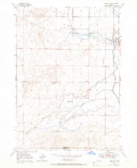
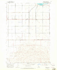
(190)- 1948 Map of Rigby, 1959 Print
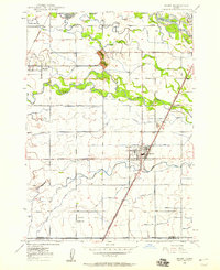 1948 Rigby1959 Print · USGSThe Upper Snake River Valley comes to life in this post-war survey, showing the agricultural engine of Jefferson County. Genealogists and local historians can trace the irrigation network through dozens of named features like the Rigby Canal or locate landmarks such as Garfield Sch and the Little Buttes.
 - 1948 Map of Lewisville, 1959 Print
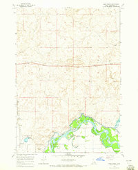
 1948 Lewisville1959 Print · USGSSoutheastern Idaho's agricultural heartland is captured here in the late 1940s, showing a complex web of canals and riverfront settlements. Researchers can trace family roots through the Lewisville Cemetery, Midway High Sch, and the rail stops at Roberts and Bassett.3 unique versions available
 - 1949 Map of Rigby
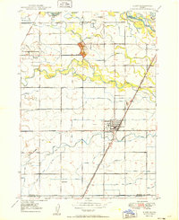 1949 Rigby1949 Print · USGSJefferson County in the late 1940s is defined by a massive irrigation network surrounding Rigby and Menan. Genealogists and historians can trace the paths of the Union Pacific, locate the Garfield Sch, and study the complex system of the Burgess Canal.3 unique versions available
 - 1949 Map of Lewisville
 1949 Lewisville1949 Print · USGSEastern Idaho's irrigation and rail networks are expertly detailed here in the late 1940s as the Snake River valley prospered. Genealogists and local historians can trace the foundations of Lewisville, locate the Central Cem, and find rural landmarks like Grant School.
 - 1949 Map of Roberts, 1959 Print
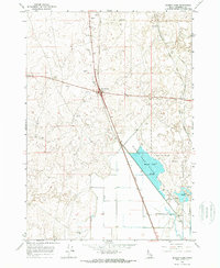
 1949 Roberts1959 Print · USGSThe Upper Snake River Plain comes alive in the late 1940s, showing a landscape defined by industrial irrigation and rail-side settlements. Genealogists and historians can trace the foundations of local communities at Lewisville Cem, Grant Sch, and Oakland Valley.
 - 1949 Map of Roberts, 1966 Print
 1949 Roberts1966 Print · USGSIn the Idaho high desert at the close of the 1940s, the village of Roberts stands at the intersection of rail and water. Local researchers can trace the detailed irrigation network of Mc Carthy Ditch and the Union Pacific line as it skirts Market Lake.4 unique versions available
 - 1950 Map of Ririe
 1950 Ririe1950 Print · USGSSoutheast Idaho at mid-century reveals a landscape transformed by the Snake River and its vast irrigation network. Researchers can trace family ties through Ririe and Sunnydell, or locate rural landmarks like Clark Sch and Sutton Cem.3 unique versions available
 - 1950 Map of Roberts
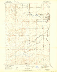 1950 Roberts1950 Print · USGSMid-century Jefferson County agriculture is centered on the settlement of Roberts during a period of heavy reliance on rail and irrigation. Researchers can trace the path of the Union Pacific or the complex water network of Taylor Slough and Larsen Ditch.
 - 1950 Map of Rigby, 1953 Print
 1950 Rigby1953 Print · USGSThe Snake River valley in the early postwar years was a thriving network of irrigated farms and railroad towns. Genealogists and local historians can trace the foundations of Rigby and Ririe, locating vanished landmarks like Bucks Sch (Aband) or Milo Cem.
 - 1951 Map of Heise, 1952 Print
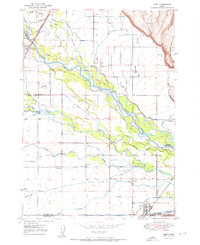
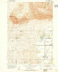
 1951 Heise1952 Print · USGSMadison and Jefferson counties are defined by a complex irrigation network and thermal springs in the early fifties. Genealogists and historians can trace the Union Pacific line near Byrne or locate family sites by Elkhorn Warm Spring and Butler Island.3 unique versions available
 - 1951 Map of Menan Buttes, 1953 Print
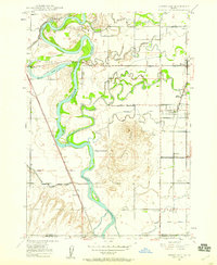
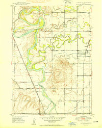
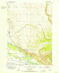
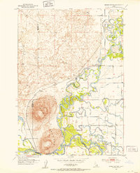 1951 Menan Buttes1953 Print · USGSMadison and Jefferson County lands in the early fifties show a river-driven landscape defined by the convergence of the Henrys Fork and Snake River. Researchers can locate the Beaver Dick Cemetery, the Historic Monument Site of First Ferry, and the Independence Sch.11 unique versions available
 - 1951 Map of Plano, 1953 Print
 1951 Plano1953 Print · USGSFremont and Madison counties are captured here in the early 1950s as irrigation canals transformed the desert into farmland. Genealogists can locate family names and burial sites at the Plano Cem near Plano and trace the path of the Independent Canal.2 unique versions available
 - 1955 Map of Dubois
 1955 Dubois1955 Print · USGSThe high desert and mountain passes of eastern Idaho and western Montana are captured here during the mid-fifties. Researchers can trace the Union Pacific rail line through Dubois or locate the National Reactor Testing Station.4 unique versions available
 - 1955 Map of Idaho Falls, 1963 Print
 1955 Idaho Falls1963 Print · USGSThe Snake River Plain and its surrounding volcanic peaks are captured in the late fifties, showing the region's unique mix of nuclear research and high-desert ranching. Trace the industrial footprint of the National Reactor Testing Station or find old mining sites like Empire Mine.5 unique versions available
 - 1955 Map of Driggs, 1967 Print
 1955 Driggs1967 Print · USGSEastern Idaho and Western Wyoming appear at a mid-century crossroads as the river valleys were fully settled and the high peaks protected. Genealogists and researchers can trace the rail towns of Rexburg and Driggs or follow the Snake River from Irwin to the Palisades Reservoir.3 unique versions available
 - 1958 Map of Driggs
 1958 Driggs1958 Print · USGSThe high Teton peaks and Snake River valleys are captured here in the mid-fifties, showing the region's agricultural and wilderness boundaries. Researchers can trace the Union Pacific rail corridor through Rexburg or locate early settlements like Clementsville and Tetonia.2 unique versions available
 - 1958 Map of Dubois
 1958 Dubois1958 Print · USGSThe high divide between Idaho and Montana comes alive in this mid-century survey, from the mining camps of the Lemhi Range to the ranchlands of Centennial Valley. Trace historic operations at the Copper Queen Mine, the route of the Union Pacific RR, and the scientific work at the Sheep experimental station.2 unique versions available
 - 1958 Map of Idaho Falls
 1958 Idaho Falls1958 Print · USGSEastern Idaho in the late fifties showcases the rapid expansion of agricultural and scientific outposts across its volcanic plains. Researchers can locate remote sites like Atomic City, mineral interests at White Knob Mine, and the cultural grounds of St Marys Mission.2 unique versions available
 - 1962 Map of Driggs
 1962 Driggs1962 Print · USGSThe Idaho-Wyoming borderlands are captured here in the early sixties, showing the peaks and valleys of the northern Rockies. Genealogists and historians can trace rail lines like the Union Pacific RR and isolated outposts like the National Elk Refuge or the Fort Hall Indian Reservation.
 - 1964 Map of Kettle Butte NE, 1965 Print
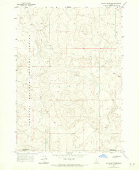
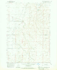
 1964 Kettle Butte NE1965 Print · USGSJefferson and Bonneville Counties meet in this high-desert Idaho survey from the mid-sixties, an era of expanding water infrastructure. Researchers can trace early ranching and water management through numerous sites like Well 4898 and the Kettle Butte Drain.2 unique versions available
 - 1964 Map of Kettle Butte NW, 1965 Print
 1964 Kettle Butte NW1965 Print · USGSSoutheastern Idaho's desert landscape was dominated by atomic research in the mid-1960s. Researchers can trace the sprawling boundaries of the National Reactor Testing Station across the line between Jefferson Co and Bonneville Co.2 unique versions available
 - 1964 Map of Terreton, 1965 Print
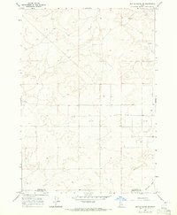
 1964 Terreton1965 Print · USGSJefferson County during the mid-1960s shows a unique intersection of desert agriculture and federal research. Genealogists and historians can trace the irrigation networks of the Owsley Canal and early local settlements like Terreton and Terre.
 - 1964 Map of Market Lake, 1965 Print
 1964 Market Lake1965 Print · USGSThe Jefferson County high desert in the mid-1960s reveals a landscape defined by critical water management and transport hubs. Researchers can trace the legacy of the Union Pacific through Sage Junction and explore the historic extent of the Market Lake wetlands.
 - 1964 Map of Deer Parks, 1965 Print
 1964 Deer Parks1965 Print · USGSThe Snake River floodplain in the mid-1960s reveals a complex landscape of islands and irrigation. Researchers can trace the path of the Union Pacific railroad or locate features like Kellers Island and the Market Lake Canal.2 unique versions available
 - 1964 Map of Cedar Butte SW, 1965 Print
 1964 Cedar Butte SW1965 Print · USGSRanchlands and high-desert water sources define this Idaho landscape in the mid-sixties. Researchers can trace the path of Medicine Lodge Creek and locate several scattered Well and Wells across the Clark Co and Jefferson Co line.
Showing maps 1-25 of 190
Top cities of Jefferson County
- Rigby historical maps
- Menan historical maps
- Roberts historical maps
- Ririe historical maps
- Lewisville historical maps
- Mud Lake historical maps
Frequently asked questions
- What are the different types of historical maps available for Jefferson County?
- What is the oldest map of Jefferson County?
- Where can I purchase historical maps of Jefferson County for my home or office?
- Where can I download high-res historical maps of Jefferson County?
- Are there historical topographic maps available for Jefferson County?
- Is there historical aerial imagery available for Jefferson County?
- Where are historical maps of Jefferson County sourced from?