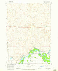
1964 Map of Deer Parks
USGS Topo · Published 1965About this map
The Snake River winds through this Jefferson County landscape, creating a complex network of waterways including Kellers Island and several secondary channels. The riparian environment is defined by the Deer Parks and the Market Lake State Wildlife Management Area, where the intersection of natural hydrology and early irrigation is evident. Artificial water management is represented by the Market Lake Canal, while the natural topography features numerous smaller water sources like East Springs and the meandering Oxbow Slough.
Find a feature on this map
16 named features on this map. Tap any name to fly to it.
Don’t see what you’re looking for? This feature index may not catch every label — zoom into the map to look around manually.
Map Details
Editions of this 1964 Deer Parks Map
2 editions found
Other maps of this area

1948 · Rigby
USGS Topo · 1:24,000

1948 · Lewisville
USGS Topo · 1:24,000

1949 · Rigby
USGS Topo · 1:24,000

1949 · Lewisville
USGS Topo · 1:24,000

1949 · Roberts
USGS Topo · 1:62,500

1949 · Roberts
USGS Topo · 1:24,000

1950 · Roberts
USGS Topo · 1:24,000

1950 · Rigby
USGS Topo · 1:62,500
1951 · Menan Buttes
USGS Topo · 1:24,000

1951 · Plano
USGS Topo · 1:24,000