Old Maps of Lewis County, Idaho for Genealogy
Trace your family roots with 134 historic maps of Lewis County. These high-res maps reveal old neighborhoods, homesites, landmarks, and streets — helping you uncover where your ancestors lived and how the area evolved over time.
- Explore historic neighborhoods: Identify where your relatives may have lived in the 1800s or 1900s.
- Compare maps over time: Trace the changes in streets, buildings, and landmarks for multi-generational research.
- Perfect for genealogy & ancestry research: Used by family historians and researchers to map out lineage and migration.
These maps are an incredible resource for exploring your personal connection to Lewis County's past.
Lewis County, ID maps
(134)- 1924 Map of Kamiah
 1924 Kamiah1924 Print · USGSNorth-central Idaho settlements thrive along the Clearwater River and upland plateaus during the mid-twenties. Genealogists and historians can trace the paths of the Northern Pacific railroad through rail towns like Volmer, Cottonwood, and the river crossing at Kamiah.
 - 1955 Map of Pullman, 1963 Print
 1955 Pullman1963 Print · USGSThe Palouse and Clearwater regions are captured here in the mid-1950s, showing the height of the rail-and-river economy. Genealogists and historians can trace rail lines like the Camas Prairie RR, find local landmarks like Whitman County Memorial Cem, and locate early academic centers at Washington State University and the University of Idaho.3 unique versions available
 - 1955 Map of Grangeville, 1964 Print
 1955 Grangeville1964 Print · USGSThe high country of the Idaho-Oregon border comes alive in the mid-1950s, showing the deep river canyons and mountain peaks. Trace the Union Pacific RR through the valleys or locate settlements like Grangeville, Joseph, and the shoreline of Wallowa Lake.4 unique versions available
 - 1958 Map of Pullman
 1958 Pullman1958 Print · USGSThe Palouse and Clearwater regions are captured here in the late fifties, showing the vital river-and-rail connection between eastern Washington and northern Idaho. Local historians can trace the paths of the Camas Prairie RR and Union Pacific RR as they serve towns like Colfax, Kamiah, and Nezperce.2 unique versions available
 - 1958 Map of Culdesac, 1960 Print
 1958 Culdesac1960 Print · USGSThe Nez Perce and Lewis county borderlands in the late fifties show a landscape of steep canyons and high grain prairies. Trace the winding Camas Prairie RR through the tunnels of Culdesac Hill or locate the historic Slickpoo St Joseph Mission.2 unique versions available
 - 1959 Map of Grangeville
 1959 Grangeville1959 Print · USGSThe high alpine peaks and deep river canyons of the Idaho-Oregon borderlands are captured in the late fifties. Researchers can trace the Union Pacific RR through the valleys to settlements like Enterprise, Union, and Grangeville.2 unique versions available
 - 1963 Map of Boles, 1965 Print
 1963 Boles1965 Print · USGSThe high plateau of the Joseph Plains meets the deep canyon of the Salmon River in the early sixties. Researchers can trace the isolated settlement of Boles, find the location of a Soldiers Grave, and locate remote river landmarks like White House Bar.2 unique versions available
 - 1963 Map of Rattlesnake Ridge, 1965 Print
 1963 Rattlesnake Ridge1965 Print · USGSThe remote Salmon River canyon and the high spine of Idaho's back-country are detailed here in the early 1960s. Researchers can locate isolated landmarks like Flynn Creek Ranch and the Camp Thomas (Site) along a network of primitive trails.2 unique versions available
 - 1967 Map of Mohler, 1971 Print
 1967 Mohler1971 Print · USGSThe high plateau of Lewis County is captured here in the late sixties, where the small community of Mohler meets the breaks of Big Canyon Creek. Researchers can locate Russell Cem, trace the Boise Meridian, and find old Gravel Pits along Holes Creek.
 - 1967 Map of Fletcher, 1971 Print
 1967 Fletcher1971 Print · USGSHigh on the Idaho prairie in the late sixties, this survey shows the rural settlement patterns above the canyonlands. Genealogists and local historians can locate the Fletcher Cemetery and trace the paths of Big Canyon Creek and Holes Creek.
 - 1967 Map of Kamiah, 1971 Print
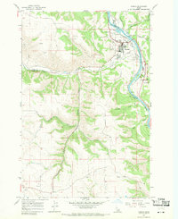 1967 Kamiah1971 Print · USGSThe Clearwater River valley and Camas Prairie plateaus meet here in the late sixties, showcasing a landscape of steep grades and riverfront settlements. Genealogists can locate family sites at Teh La Pa Low Cem or Winona Cem and trace the paths of the Tram Road and Woodland Grade.2 unique versions available
 - 1967 Map of Craigmont, 1971 Print
 1967 Craigmont1971 Print · USGSLewis County during the late 1960s shows a landscape of productive grain farming and deep canyon breaks. Genealogists can locate family sites near the IOOF Cem or St Maurus Cem, and trace the path of Lawyer Creek through the prairie.
 - 1967 Map of Hoover Point, 1971 Print
 1967 Hoover Point1971 Print · USGSThe Salmon River canyon in the late 1960s reveals a wilderness shaped by early mining and mountain transport. Trace the winding path of the Old RR Grade, locate the Deer Creek Mine, and follow the remote Jeep Trail network across Hoover Point.2 unique versions available
 - 1967 Map of Westlake, 1971 Print
 1967 Westlake1971 Print · USGSThe high plateau of Lewis and Idaho Counties meets the deep canyons of the Salmon River in the late sixties. Trace the remnants of the Old Railroad Grade near Westlake or follow the river through Long Canyon and Snow Hole Rapids.2 unique versions available
 - 1967 Map of Sixmile Creek, 1971 Print
 1967 Sixmile Creek1971 Print · USGSThe Clearwater River canyon and the elevated Camas Prairie define this Idaho landscape in the late sixties. Researchers can trace the borders of the Nez Perce Indian Reservation and locate early infrastructure like the Substation and remote Jeep Trails.3 unique versions available
 - 1967 Map of Keuterville, 1971 Print
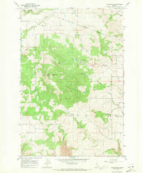 1967 Keuterville1971 Print · USGSKeuterville and the surrounding Camas Prairie are captured in the late sixties as the area balanced institutional growth with its ranching roots. Researchers can trace local landmarks like St Gertrude Academy and the Cem, or locate the Cottonwood Job Corps Center near Cottonwood Butte.
 - 1967 Map of Cottonwood NE, 1971 Print
 1967 Cottonwood NE1971 Print · USGSThe Nez Perce Indian Reservation plateau in the late sixties shows a landscape of deep creek canyons and remote upland cemeteries. Researchers can trace family roots at Holy Trinity Cem and Meadow Cr Cem or locate old industrial sites like the Quarry near Meadow Creek.
 - 1967 Map of Peck, 1971 Print
 1967 Peck1971 Print · USGSPeck and the surrounding canyonlands of Nez Perce County are captured in the late sixties as the railroad still served the riverside. Genealogists and historians can locate several rural landmarks including Old Good Hope Cem, Good Hope Ch, and the high-elevation Angel Ridge Cem.
 - 1967 Map of Orofino West, 1971 Print
 1967 Orofino West1971 Print · USGSClearwater County at the end of the 1960s shows a landscape of steep river valleys and high farming ridges. Researchers can trace historical footprints at Russell, Gilbert Church, and the Riverside Cemetery along the Clearwater River.
 - 1967 Map of Nezperce, 1971 Print
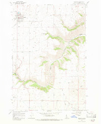 1967 Nezperce1971 Print · USGSThe Camas Prairie of Lewis County comes into focus in the late 1960s, showing the agricultural heart of the Nez Perce Indian Reservation. Genealogists and local historians can locate Nezperce Cem, the Big Butte Sch, and the community of Winona.
 - 1967 Map of Woodland, 1971 Print
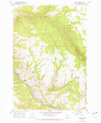 1967 Woodland1971 Print · USGSThe Idaho backcountry near the Clearwater River is documented here in the late sixties, showing the high Camas Prairie meeting the national forest. Researchers can locate the small settlements of Woodland and Harrisburg, or trace the steep Woodland Grade down to the Clearwater River.3 unique versions available
 - 1967 Map of Winchester East, 1971 Print
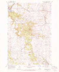 1967 Winchester East1971 Print · USGSThe Nez Perce reservation highlands of Lewis County come into focus during the late 1960s, showing the early development of Winchester State Park. Local historians can trace the Old Railroad Grade and locate the Morrow Cem and Pine Grove School.2 unique versions available
 - 1967 Map of Orofino East, 1971 Print
 1967 Orofino East1971 Print · USGSThe Clearwater River valley and the western edge of the Camas Prairie are captured here in the late 1960s. Researchers can trace the development of Orofino and locate local landmarks such as Hill Cem, Fraser, and the High Sch.2 unique versions available
 - 1968 Map of Winchester West, 1971 Print
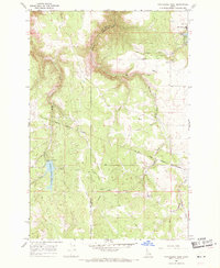 1968 Winchester West1971 Print · USGSThe plateau around Winchester and the Nez Perce Reservation comes to life in the late 1960s, showing a land of deep canyons and timbered hills. Trace the winding Old Railroad Grade and find water features like Soldiers Meadow Reservoir and Lapwai Lake.
 - 1979 Map of Kamiah, 1986 Print
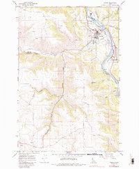 1979 Kamiah1986 Print · USGSThe Clearwater River valley and Camas Prairie are captured here as they appeared in the late 1960s and 1970s. Researchers can locate tribal landmarks like the Teh La Pa Low Cem, the settlement of Winona, and the Nez Perce National Historical Park.
Showing maps 1-25 of 134
Top cities of Lewis County
Frequently asked questions
- What are the different types of historical maps available for Lewis County?
- What is the oldest map of Lewis County?
- Where can I purchase historical maps of Lewis County for my home or office?
- Where can I download high-res historical maps of Lewis County?
- Are there historical topographic maps available for Lewis County?
- Is there historical aerial imagery available for Lewis County?
- Where are historical maps of Lewis County sourced from?