
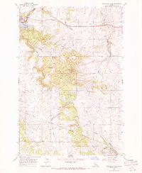
1967 Map of Fletcher
USGS Topo · Published 1971About this map
Fletcher serves as the primary settlement hub in this 1967 Idaho survey, situated on the high prairie ground above a series of deep, branching canyon systems. The landscape is defined by the sharp transition between the agricultural plateaus and the steep drainages of Big Canyon Creek and Sixmile Canyon. This topography created a natural boundary between Nez Perce and Lewis Counties, which follows the winding course of the creek beds. A notable concentrated area of interest for genealogists is the Fletcher Cemetery, located just north of the town center. The map reveals a rural economy dependent on the land, marked by isolated structures and a Gravel Pit south of town. The intricate network of smaller drainages, such as Holes Creek and the distinctively named Posthole Canyon, highlights the erosive forces that have carved the Nez Perce Indian Reservation landscape into its modern form.
Find a feature on this map
8 named features on this map. Tap any name to fly to it.
Don’t see what you’re looking for? This feature index may not catch every label — zoom into the map to look around manually.
Map Details
Editions of this 1967 Fletcher Map
This is the sole edition of this map. No revisions or reprints were ever made.
Other maps of this area

1924 · Kamiah
USGS Topo · 1:125,000

1955 · Pullman
USGS Topo · 1:250,000

1958 · Pullman
USGS Topo · 1:250,000

1958 · Culdesac
USGS Topo · 1:62,500

1967 · Mohler
USGS Topo · 1:24,000

1967 · Craigmont
USGS Topo · 1:24,000

1967 · Cottonwood NE
USGS Topo · 1:24,000

1967 · Peck
USGS Topo · 1:24,000

1967 · Orofino West
USGS Topo · 1:24,000
1967 · Winchester East
USGS Topo · 1:24,000