Old Maps of Calhoun County, Illinois for Metal Detecting
Plan your next treasure hunt with 126 historic maps of Calhoun County. Find old homesites, ghost towns, trails, and gathering spots that may be lost to time — perfect for identifying promising metal detecting locations.
- Locate forgotten sites: Uncover places like long-lost settlements, abandoned rail lines, or gathering spots.
- Plan better hunts: Use map overlays combined with LiDAR or satellite views to narrow in on historically rich areas.
- Made for detectorists: Thousands of hobbyists use these maps to discover relics, coins, and hidden history.
Use these historic maps to boost your research and find new opportunities beneath the surface of Calhoun County.
Calhoun County, IL maps
(126)- 1903 Map of O'Fallon
 1903 O'Fallon1903 Print · USGSSt. Charles County at the turn of the century is a labyrinth of river islands and rail lines at the confluence of the Missouri and Mississippi. Researchers can trace old river landings like Cap Au Gris Landing and family-named settlements from Moscow Mills to New Melle.5 unique versions available
 - 1927 Map of St. Charles, 1955 Print
 1927 St. Charles1955 Print · USGSThe Missouri and Mississippi rivers meet in this mid-century survey, showcasing a landscape of fertile bottomlands and early aviation hubs. Genealogists can trace family footprints through dozens of rural landmarks like St Stanislaus Seminary, Orchard Farm, and Cul de Sac Sch.2 unique versions available
 - 1930 Map of Pearl
 1930 Pearl1930 Print · USGSThe Illinois River valley in the late 1920s shows a landscape of river-bottom farms and rugged bluff-top settlements. Genealogists can locate family landmarks like Miller Cem, Farmers Ridge Ch, and schools such as Summit Grove Sch or Village Green Sch.3 unique versions available
 - 1930 Map of Nebo
 1930 Nebo1930 Print · USGSThe Mississippi River bottomlands and Pike County bluffs are shown here in the late twenties, featuring a landscape of sloughs and rail-dependent towns. Trace family roots at Wildcat Cem or locate rural landmarks like Riprap Landing and Old Baptist Sch.
 - 1930 Map of Hardin
 1930 Hardin1930 Print · USGSCalhoun County's narrow peninsula is captured here between the two great rivers during the late Prohibition era. Genealogists and local researchers can locate numerous rural landmarks like Indian Creek Ch, Oases Ch, and a high concentration of schoolhouses including South Lincoln Sch.2 unique versions available
 - 1931 Map of Brussels
 1931 Brussels1931 Print · USGSThe peninsula between the Illinois and Mississippi Rivers is captured here in the early 1930s, showcasing a network of river landings and ridge-top settlements. Genealogists can trace family roots through numerous local landmarks like Golden Eagle, Point Pleasant, and Nichols Sch.2 unique versions available
 - 1933 Map of Saint Charles
 1933 Saint Charles1933 Print · USGSThe confluence of the Missouri and Mississippi rivers in the early thirties reveals a landscape of fertile river bottoms and emerging suburban rail towns. Genealogists and researchers can trace old school districts like Cul de Sac Sch and historic sites such as St Stanislaus Seminary.3 unique versions available
 - 1934 Map of Nebo
 1934 Nebo1934 Print · USGSThe Mississippi River borderlands in the mid-1930s reveal a landscape of river-and-rail commerce and high-ground settlements. Researchers can trace family history through the locations of Corinth Cem, the Greenwing Club, and rural schoolhouses like Farris Sch.4 unique versions available
 - 1934 Map of Hardin, 1956 Print
 1934 Hardin1956 Print · USGSThe river bluffs of Calhoun and Greene counties come alive in this mid-1930s survey of the Mississippi River and Illinois River valleys. Genealogists can trace family roots through numerous rural landmarks like Indian Creek Ch, St Andrew Ch, and the Pecan Grove Sch.2 unique versions available
 - 1938 Map of Hardin
 1938 Hardin1938 Print · USGSThe river-bound peninsula of Calhoun County is shown here in the 1930s, caught between the shifting chutes of the Mississippi and the Illinois rivers. Genealogists can trace family roots through numerous rural landmarks like Gilead Cemetery, the Poor Farm, and small communities such as Batchtown and Hamburg.2 unique versions available
 - 1939 Map of Brussels, 1955 Print
 1939 Brussels1955 Print · USGSThe confluence of the Illinois and Mississippi rivers defines this pre-war era, where river landings and ferries still anchored local life. Genealogists can trace family footprints at Old Rock Ch, numerous rural schools like Black Jack Sch, and the West Point Ferry.
 - 1942 Map of Nebo
 1942 Nebo1942 Print · USGSThe Mississippi River floodplain and the rising knobs of Missouri appear here as they were in the early 1940s. Genealogists can trace a dense network of rural landmarks, from Salem Sch and Corinth Ch to the riverfront at Clarksville and Annada.2 unique versions available
 - 1943 Map of Brussels
 1943 Brussels1943 Print · USGSThe river bottomlands near the Missouri and Illinois border come alive in the 1940s, showing a network of ferries, landings, and rail lines. Trace family history through local landmarks like Lone Tree Indian Mound, Boones Lick Road, and St Peters.2 unique versions available
 - 1948 Map of Quincy
 1948 Quincy1948 Print · USGSThe Mississippi and Illinois River valleys are captured at a post-war crossroads as rail and river travel met the expanding highway system. Genealogists can trace family settlements from Quincy to Hannibal and smaller towns like Vandalia and Jerseyville.2 unique versions available
 - 1949 Map of Saint Louis
 1949 Saint Louis1949 Print · USGSGreater St. Louis and its surrounding river valleys are captured here just after the war, showing the metropolitan core and the rural Ozark fringe. Researchers can trace the sprawling rail network of the Wabash RR or locate landmarks like Meramec Caverns Airport and Scott Air Force Base.2 unique versions available
 - 1950 Map of Pearl, 1956 Print
 1950 Pearl1956 Print · USGSThe Illinois River valley in the mid-1950s reveals a landscape of river-bottom farms and bluff-side settlements. Local researchers can trace family roots through numerous rural landmarks like Farmers Ridge Ch, Miller Cem, and Robley Sch.
 - 1954 Map of Kampville, 1959 Print
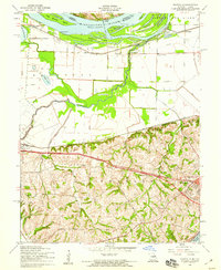 1954 Kampville1959 Print · USGSMid-century St. Charles County reveals a riverfront landscape defined by the convergence of the Mississippi and Missouri rivers. Researchers can trace historic river landings and family landmarks like Kampville Sch, the Golden Eagle Ferry, and the Methodist Cem.4 unique versions available
 - 1954 Map of Winfield, 1959 Print
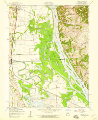 1954 Winfield1959 Print · USGSThe confluence of the Mississippi and Cuivre Rivers is captured in the mid-1950s, showing a landscape defined by levees and rail. Trace family roots at Hayden Sch or Winfield, and locate old river landings like Beech Landing.3 unique versions available
 - 1954 Map of Brussels, 1959 Print
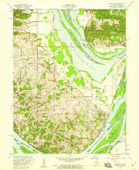 1954 Brussels1959 Print · USGSThe peninsula of Calhoun County in the mid-1950s is defined by its position between the Mississippi and Illinois Rivers. Genealogists and historians can trace old river life through Brussels, rural schools like Fruitland Sch, and sites like Lone Tree Indian Mound.3 unique versions available
 - 1954 Map of Grafton, 1959 Print
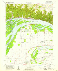 1954 Grafton1959 Print · USGSThe confluence of the Illinois and Mississippi Rivers is captured here in the mid-1950s, showing a landscape defined by dramatic bluffs and low-lying chutes. Genealogists can locate family landmarks like Scenic Hill Cem and old country schoolhouses such as Pleasant Union Sch and Lake View Sch.4 unique versions available
 - 1954 Map of Brussels, 1960 Print
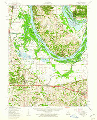 1954 Brussels1960 Print · USGSThe confluence of the Mississippi and Illinois Rivers comes alive in the mid-1950s, showing a landscape shaped by river transport and rail. Trace the routes of the Wabash Railroad or find family history at All Saints Village and Dardenne Cem.2 unique versions available
 - 1954 Map of St. Charles, 1960 Print
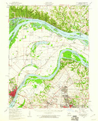 1954 St. Charles1960 Print · USGSThe river confluence near St. Louis during the mid-fifties reveals a landscape balancing traditional river life with rapid suburban and aviation growth. Genealogists and historians can trace family roots through sites like St Stanislaus Seminary Cem, Portage Des Sioux, and the campus of Principia College.2 unique versions available
 - 1956 Map of Quincy, 1967 Print
 1956 Quincy1967 Print · USGSThe river and rail corridors of the Illinois-Missouri border are documented here during the mid-1950s. Researchers can trace historic river landings and regional transit hubs from Quincy and Hannibal to smaller settlements like Meredosia and Roodhouse.3 unique versions available
 - 1962 Map of St. Louis
 1962 St. Louis1962 Print · USGSThe mid-century gateway to the west shows the metropolitan expansion of St Louis alongside its critical river confluences. Genealogists and historians can trace the rail corridors of the Missouri Pacific RR and settlements from Fulton to De Soto.
 - 1963 Map of St. Louis, 1970 Print
 1963 St. Louis1970 Print · USGSSt. Louis and its surrounding river valleys are captured here during the peak of mid-century suburban expansion and industrial activity. Trace the historic rail routes of the Norfolk and Western Ry or locate the St Louis Ordnance Plant and early stretches of US Highway 66.4 unique versions available
Showing maps 1-25 of 126
Top cities of Calhoun County
- Hardin historical maps
- Kampsville historical maps
- Batchtown historical maps
- Brussels historical maps
- Hamburg historical maps
Frequently asked questions
- What are the different types of historical maps available for Calhoun County?
- What is the oldest map of Calhoun County?
- Where can I purchase historical maps of Calhoun County for my home or office?
- Where can I download high-res historical maps of Calhoun County?
- Are there historical topographic maps available for Calhoun County?
- Is there historical aerial imagery available for Calhoun County?
- Where are historical maps of Calhoun County sourced from?