1960s Maps of Clinton County, Illinois
Explore 10 historic maps of Clinton County from the 1960s. These maps offer a rare glimpse into what life looked like during the 1960s — showing old roads, neighborhoods, homes, and landmarks that have changed or disappeared over time.
Whether you're researching your family's past, planning a metal detecting trip, or studying how Clinton County's landscape evolved across the 1960s, these high-resolution maps are a powerful tool for exploring the history of this region.
- Focus on a specific era: All maps on this page are from the 1960s, giving you a focused view of this time period.
- See what’s changed: Compare century-old streets, trails, and buildings to today's modern landscape using overlays and satellite layers.
- Research with precision: Use these maps for genealogy, historical research, land use analysis, or educational projects.
- View, download, or print: Maps are fully viewable online in high resolution, and can be downloaded or printed for your own records.
Start exploring Clinton County's history through authentic maps from the 1960s. This is your window into the past.
Clinton County, IL maps
(10)- 1962 Map of Belleville
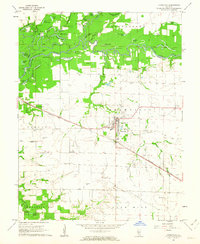
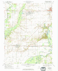
 1962 Belleville1962 Print · USGSSouthern Illinois in the late fifties reveals a landscape of industrial growth and ancient landmarks before the full expansion of the interstate system. Genealogists can trace family names and rural post offices near Centralia, Salem, and the historic Monks Mound.
 - 1962 Map of Okawville, 1963 Print
 1962 Okawville1963 Print · USGSWashington County during the early 1960s reveals a landscape defined by the winding Kaskaskia River and the steady commerce of the rail lines. Researchers can trace ancestral roots through numerous local landmarks like St Pauls Ch, Klasing Sch, and the IOOF Cem.2 unique versions available
 - 1962 Map of St. Rose, 1963 Print
 1962 St. Rose1963 Print · USGSThe rural borderlands of Clinton and Madison counties are captured here in the early sixties. Researchers can locate the Lake Branch Cemetery, the small cluster of Sebastopol, and early property lines near Shoal Creek.2 unique versions available
 - 1962 Map of Breese, 1963 Print
 1962 Breese1963 Print · USGSClinton County’s rural and rail landscape is captured here in the early sixties as small towns flourished along the dual rail lines. Genealogists and historians can trace family roots at St Dominics Cem, Damiansville, and the grounds of Mater Dei High Sch.2 unique versions available
 - 1968 Map of Stolletown, 1971 Print
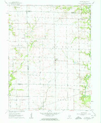
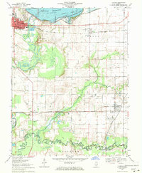
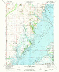
 1968 Stolletown1971 Print · USGSClinton County during the late 1960s was a landscape where traditional farming met the growing energy industry and new water management projects. Researchers can locate family landmarks like St Peters Cem, the local Ford Sch, and the emerging Carlyle Reservoir.
 - 1969 Map of Beckemeyer, 1971 Print
 1969 Beckemeyer1971 Print · USGSClinton County thrived as a center for rail, oil, and river trade in the late sixties. Genealogists and local historians can trace family plots at Beckemeyer Cem or St Cecelias Cem while exploring the Bartelso Oil Field and river bottomlands.
 - 1969 Map of Boulder, 1971 Print
 1969 Boulder1971 Print · USGSClinton County and the surrounding river bottoms are captured here in the late sixties as the newly formed Carlyle Reservoir altered the landscape. Genealogists can trace numerous family burial sites like Old Carter Cem and Hawkins Cem near the oil derricks of the Patoka Field.
 - 1969 Map of Centralia West, 1971 Print
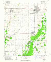
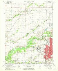 1969 Centralia West1971 Print · USGSCentralia and Wamac are shown at a peak of industrial and institutional growth in the late sixties. Researchers can trace family roots through numerous sites like Bethlehem Cem, Kaskaskia College, and the busy Junction City (Glen Ridge Station).2 unique versions available
 - 1969 Map of Carlyle, 1971 Print
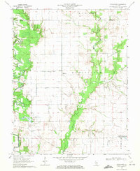
 1969 Carlyle1971 Print · USGSClinton and Washington counties appear here in the late sixties as the local landscape was being redefined by large-scale water management and oil production. Researchers can trace family sites like Posey Cem and St Marys Sch alongside the active Huey South Oil Field and the Baltimore and Ohio rail corridor.
 - 1969 Map of Keyesport, 1971 Print
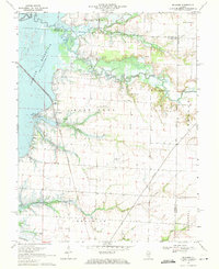
 1969 Keyesport1971 Print · USGSThe Kaskaskia River valley in the late sixties reveals a landscape shaped by the new reservoir and recreational growth. Genealogists and local historians can locate McKendree Cem, trace the Burlington Northern line, and see the Keyesport Oil Field.2 unique versions available
End of results
Showing maps 1-10 of 10
Top cities of Clinton County
- Breese historical maps
- Carlyle historical maps
- Trenton historical maps
- Aviston historical maps
- Germantown historical maps
- Beckemeyer historical maps
See more
Frequently asked questions
- What are the different types of historical maps available for Clinton County?
- What is the oldest map of Clinton County?
- Where can I purchase historical maps of Clinton County for my home or office?
- Where can I download high-res historical maps of Clinton County?
- Are there historical topographic maps available for Clinton County?
- Is there historical aerial imagery available for Clinton County?
- Where are historical maps of Clinton County sourced from?