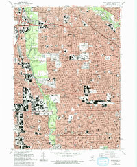
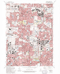
1990s Maps of Cook County, Illinois
Explore 60 historic maps of Cook County from the 1990s. These maps offer a rare glimpse into what life looked like during the 1990s — showing old roads, neighborhoods, homes, and landmarks that have changed or disappeared over time.
Whether you're researching your family's past, planning a metal detecting trip, or studying how Cook County's landscape evolved across the 1990s, these high-resolution maps are a powerful tool for exploring the history of this region.
- Focus on a specific era: All maps on this page are from the 1990s, giving you a focused view of this time period.
- See what’s changed: Compare century-old streets, trails, and buildings to today's modern landscape using overlays and satellite layers.
- Research with precision: Use these maps for genealogy, historical research, land use analysis, or educational projects.
- View, download, or print: Maps are fully viewable online in high resolution, and can be downloaded or printed for your own records.
Start exploring Cook County's history through authentic maps from the 1990s. This is your window into the past.
Cook County, IL maps
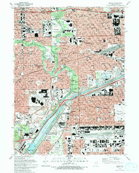
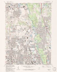
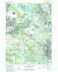
(60)- 1990 Map of Dyer, 1991 Print
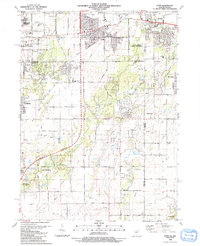 1990 Dyer1991 Print · USGSSuburban development meets the rural prairie at the Illinois and Indiana border in the early nineties. Researchers can trace family sites from Sauk Village to Dyer, including St James Cem and the small settlement of Kreitzburg.
 - 1990 Map of Steger, 1991 Print
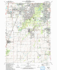 1990 Steger1991 Print · USGSThe south Chicago suburbs of Will and Cook Counties appear in full growth during the late twentieth century. Genealogists and local historians can trace family locations through sites like Evergreen Hill Cem, S Liborius Sch, and the Balmoral Park Racetrack.
 - 1990 Map of Frankfort, 1991 Print
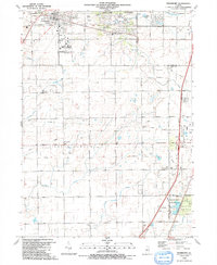 1990 Frankfort1991 Print · USGSWill County's transition from prairie farmland to suburban community is captured here as the nineties approached. Genealogists and local historians can trace family plots at St Peters Cem and Union Cem, or follow the path of the Old Indian Boundary.
 - 1991 Map of Kankakee
 1991 Kankakee1991 Print · USGSThe Illinois-Indiana borderlands come into focus during the early nineties, centered on the growing Kankakee valley and its sprawling drainage systems. Trace the rail-and-river economy through landmarks like the Wilton Railroad Grade, the Manteno State Hospital, and the historic Old Pioneer Cem.
 - 1991 Map of Lake Calumet, 1992 Print
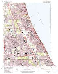
 1991 Lake Calumet1992 Print · USGSChicago's industrial southeast side and the Indiana borderlands are captured here at a time of heavy rail and river transit. Genealogists can locate family-named neighborhoods and parish schools like St Michael Sch, Robertsdale, and Altgeld Gardens.
 - 1991 Map of Calumet City, 1992 Print
 1991 Calumet City1992 Print · USGSThe Illinois and Indiana borderlands are captured here in the early nineties, showing the dense intersection of industry and nature. Researchers can trace family roots through local landmarks like Holy Cross Cemetery, Oakland Cem, and Thornridge High Sch.2 unique versions available
 - 1992 Map of Elgin
 1992 Elgin1992 Print · USGSElgin and the Fox River valley settlements are shown during a period of rapid growth in the early nineties. Researchers can trace the layout of the Elgin State Hospital, locate old family plots in Bluff City Cem, and follow the Chicago and North Western rail line.
 - 1993 Map of Englewood
 1993 Englewood1993 Print · USGSChicago's southwestern neighborhoods are captured here in the early nineties, showing a landscape defined by heavy rail and industrial canals. Researchers can trace local history through the many neighborhood institutions like the International Amphitheatre, Maria High Sch, and the rail hub at Elsdon.2 unique versions available
 - 1993 Map of Highland Park
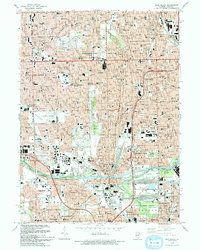
 1993 Highland Park1993 Print · USGSThe North Shore suburbs flourish along the Lake Michigan coast in the early nineties as modern expressways intersect with historic rail lines. Genealogists and local historians can trace legacy sites like Fort Sheridan, Lake Forest College, and Deerfield Cem.
 - 1993 Map of Harvey
 1993 Harvey1993 Print · USGSSouth Cook County in the early nineties shows a landscape of maturing suburban centers and heavy rail infrastructure. Trace local family history and community growth through sites like Homewood Mem Gdns (Cem), Bloom High Sch, and the Illinois Central Railroad.
 - 1993 Map of Tinley Park
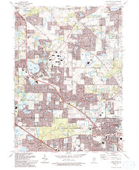
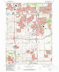 1993 Tinley Park1993 Print · USGSSuburban development sweeps across the Cook and Will County line in the early nineties, revealing a landscape of rapid growth and community expansion. Genealogists and local historians can trace family-named sites like Hickory Cem and Frankfort Cem or find vanished landmarks like the Drive-in Theater.
 - 1993 Map of Berwyn
 1993 Berwyn1993 Print · USGSThe western suburbs of Chicago and the busy Des Plaines riverfront are captured here in the early nineties. Genealogists and researchers can trace local landmarks like Waldheim Cemetery, the Brookfield Zoo, and the Hines VA Hospital.2 unique versions available
 - 1993 Map of Hinsdale
 1993 Hinsdale1993 Print · USGSThe western suburbs of Chicago are seen in their late-century maturity, where the residential grids of Hinsdale and La Grange meet major transit corridors. Genealogists and local historians can locate prominent memorial sites like Mt Carmel Cemetery and schools like Bethany Seminary.
 - 1993 Map of Park Ridge
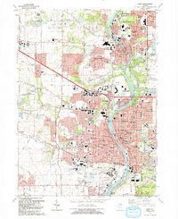
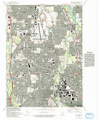 1993 Park Ridge1993 Print · USGSNorthern Cook County is shown in the early nineties as a fully developed suburban landscape centered on the Glenview Naval Air Station. Genealogists and historians can trace local institutions and burial sites including St Adalbert Cem and Ridgewood Cemetery.
 - 1993 Map of Jackson Park
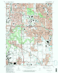
 1993 Jackson Park1993 Print · USGSThe South Side of Chicago and its iconic lakefront are captured here in the early nineties, showcasing a high-density urban grid of schools, hospitals, and parks. Researchers can trace the layout of the University of Chicago campus or locate family plots in the expansive Oakwoods Cemetery.
 - 1993 Map of Blue Island
 1993 Blue Island1993 Print · USGSThe south side of Chicago and its neighboring suburbs are shown in the early nineties as a mature urban landscape. Researchers can trace family sites near St Casimir Cemetery and Burr Oak Cemetery or locate historic institutions like Morgan Park Academy.2 unique versions available
 - 1993 Map of Wheeling
 1993 Wheeling1993 Print · USGSThe northern Chicago suburbs expanded rapidly during the early nineties, centered on the Des Plaines River corridor. Genealogists and local historians can trace school district growth and family plots at Wheeling Cem, St Joseph Sch, and Willow Lawn Cem.2 unique versions available
 - 1993 Map of Evanston
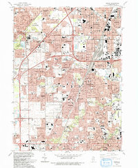
 1993 Evanston1993 Print · USGSThe North Shore suburbs of Evanston and Wilmette are shown here during the early nineties, revealing a dense grid of lakefront neighborhoods and prestigious institutions. Genealogists and local historians can trace the grounds of Calvary Cemetery, Loyola University, and the unique Bahai Temple.
 - 1993 Map of Chicago Loop
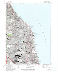
 1993 Chicago Loop1993 Print · USGSChicago in the early nineties displays a massive urban landscape anchored by its iconic shoreline and central business district. Genealogists and historians can trace family plots in Rosehill Cemetery or locate historic landmarks like the Sears Tower and the Merchandise Mart.2 unique versions available
 - 1993 Map of Elmhurst
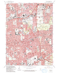
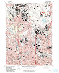 1993 Elmhurst1993 Print · USGSSuburban Chicago thrives in the early nineties, showing the massive footprint of O'Hare International Airport alongside growing residential tracts. Genealogists and historians can trace local landmarks like Elmhurst College, Arlington Cemetery, and York High School.
 - 1993 Map of Sag Bridge
 1993 Sag Bridge1993 Print · USGSCook County and the surrounding forest preserves appear in high detail during the early nineties as suburban expansion met historic industrial waterways. Researchers can trace the legacy of the region through landmarks like Fairmount Cemetery, Hastings, and the Chicago Sanitary and Ship Canal.
 - 1993 Map of Lake Zurich
 1993 Lake Zurich1993 Print · USGSThe Lake-Cook county border area is shown during its early 1990s suburban transformation. Genealogists and historians can trace family markers at Fairfield Cem and locate historic community hubs like the Long Grove Ch and Quentin Corners.2 unique versions available
 - 1993 Map of Barrington
 1993 Barrington1993 Print · USGSNorthern Illinois riverside towns and residential enclaves are shown in the early nineties as they expanded around the Fox River. Researchers can trace the rail corridor and locate White Cem, St Ann Sch, and Lake Barrington.
 - 1993 Map of River Forest
 1993 River Forest1993 Print · USGSThe western suburbs of Chicago and the Des Plaines River valley are shown in great detail during the early nineties. Genealogists can locate family sites at St Joseph Cemetery or Waldheim Cemetery and trace schools like St Vincent Ferrer School.2 unique versions available
 - 1993 Map of Lombard
 1993 Lombard1993 Print · USGSDuPage County communities like Lombard and Glen Ellyn are shown in the early nineties during a period of intense suburban maturity. Genealogists and local historians can trace parish sites like St Johns Cem and Sacred Heart Ch alongside the protected grounds of Churchill Woods Co For Presv.
Showing maps 1-25 of 60
Top cities of Cook County
- Chicago historical maps
- Cicero historical maps
- Arlington Heights historical maps
- Evanston historical maps
- Des Plaines historical maps
- Berwyn historical maps
See more
Frequently asked questions
- What are the different types of historical maps available for Cook County?
- What is the oldest map of Cook County?
- Where can I purchase historical maps of Cook County for my home or office?
- Where can I download high-res historical maps of Cook County?
- Are there historical topographic maps available for Cook County?
- Is there historical aerial imagery available for Cook County?
- Where are historical maps of Cook County sourced from?