Old Maps of Rogers Park Township, Chicago for Hiking & Exploration
Hike through history with 31 historic maps of Rogers Park Township. Explore old trails, ghost towns, and forgotten backroads — perfect for outdoor adventurers and local explorers.
- Rediscover forgotten places: Map out old mining camps, roads, and footpaths that no longer exist on modern maps.
- Layer with modern tools: Combine with LiDAR or satellite views to plan hikes through historical terrain.
- Made for exploration: Popular among hikers, overlanders, and local history lovers.
Use these maps to find adventure and explore the hidden past of Rogers Park Township.
Rogers Park Township, Chicago maps
(31)- 1889 Map of Chicago
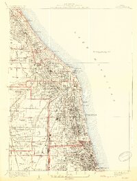
 1889 Chicago1889 Print · USGSChicago in the late Victorian era was a sprawling rail and maritime titan on the shores of Lake Michigan. Genealogists and historians can trace the early urban grid and massive rail yards of the Belt Railroad and Chicago and Northwestern R.R.
 - 1891 Map of Chicago
 1891 Chicago1891 Print · USGSChicago was a booming rail and water hub in the late nineteenth century, just before the turn of the century. Trace the intricate network of the Illinois and Michigan Canal and major lines like the Wisconsin Central R.R. and Belt Railroad.
 - 1899 Map of Evanston
 1899 Evanston1899 Print · USGSThe Illinois lakefront north of Chicago was undergoing rapid suburbanization during the late nineteenth century. Genealogists and historians can trace the early street grids of Evanston and Winnetka along the Chicago and Northwestern rail line.3 unique versions available
 - 1900 Map of Chicago
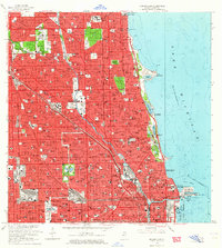
 1900 Chicago1900 Print · USGSChicago at the turn of the century shows a city of massive infrastructure, from its emerging park system to its complex rail hubs. Researchers can trace the development of early neighborhoods like Mayfair and South Lynn or locate grounds like Rose Hill Cemetery and the historic Illinois and Michigan Canal.
 - 1901 Map of Chicago
 1901 Chicago1901 Print · USGSChicago was a booming industrial and rail hub in the late nineteenth century, defined by its lakefront and canal systems. Genealogists and urban historians can trace early neighborhood boundaries and rail corridors through Elsdon, Chicago Lawn, and Rose Hill Cemetery.5 unique versions available
 - 1928 Map of Evanston
 1928 Evanston1928 Print · USGSThe North Shore suburbs and the northern edge of Chicago are seen in detail during the late 1920s. Local researchers can trace early residential growth near Northwestern University and locate landmarks like the Gross Pt L H or Calvary Cemetery.5 unique versions available
 - 1929 Map of Chicago Loop, 1939 Print
 1929 Chicago Loop1939 Print · USGSChicago and its lakefront are captured here between the world wars, showing a city defined by its rigid grid and grand public parks. Genealogists and historians can trace old neighborhoods near Rose Hill Cemetery, the grounds of Loyola University, or the original layout of the Municipal Pier.2 unique versions available
 - 1953 Map of Evanston, 1955 Print
 1953 Evanston1955 Print · USGSThe North Shore suburbs and northern Chicago lakefront are captured in the mid-1950s as these rail-connected communities reached their peak maturity. Researchers can trace historic campus footprints at Northwestern University or locate family sites near Calvary Cemetery and New Trier High Sch.
 - 1953 Map of Chicago Loop, 1956 Print
 1953 Chicago Loop1956 Print · USGSMid-century Chicago is captured here at a moment of significant infrastructure expansion and urban density. Genealogists and historians can trace neighborhood parish schools like St Michael High Sch, local cemeteries such as Rosehill Cemetery, and the rise of the Congress Street Expressway.
 - 1953 Map of Chicago, 1964 Print
 1953 Chicago1964 Print · USGSThe southern Lake Michigan shoreline was rapidly modernizing in the mid-fifties, balancing heavy industry with its famous academic centers. Researchers can trace the footprints of Notre Dame University or locate vanished sites like the Kingsbury Ordnance Plant and Meigs Field.5 unique versions available
 - 1957 Map of Chicago
 1957 Chicago1957 Print · USGSThe industrial heartland and southern Great Lakes shoreline are captured here during the peak of mid-century growth. Researchers can trace the massive Gary Steel Works, the grounds of the University of Notre Dame, and the early paths of the Tri-State Tollway.
 - 1958 Map of Racine, 1971 Print
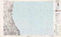
 1958 Racine1971 Print · USGSThe Lake Michigan shoreline in the late fifties was a study in contrasts between the industrial bustle of Kenosha and the quiet woods of the Allegan State Forest. Genealogists and historians can trace the urban footprint of Evanston or locate strategic sites like Fort Sheridan and the Wind Point Light.3 unique versions available
 - 1962 Map of Racine
 1962 Racine1962 Print · USGSThe Lake Michigan shoreline in the early sixties reveals a fascinating contrast between the dense industrial rail hubs of RACINE and CHICAGO and the forested dunes of Michigan. Local historians can trace military installations like Fort Sheridan or explore the numerous inland retreats around Paw Paw Lake and Sister Lakes.
 - 1963 Map of Evanston, 1964 Print
 1963 Evanston1964 Print · USGSThe North Shore suburbs of Chicago thrive during the early sixties, showcasing a landscape of established lakeside communities and prestigious universities. Genealogists and local historians can trace family locations near Calvary Cemetery or the historic Indian Boundary Treaty Line.5 unique versions available
 - 1963 Map of Chicago Loop, 1964 Print
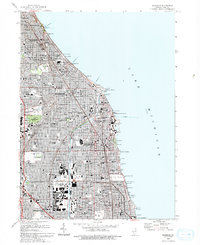
 1963 Chicago Loop1964 Print · USGSChicago's north side neighborhoods and the Loop are captured in the early sixties as the modern expressway system reshaped the urban grid. Researchers can trace historic parish boundaries through sites like St Hyacinth Sch or locate long-standing landmarks like Riverview Park and Rosehill Cemetery.3 unique versions available
 - 1980 Map of Chicago
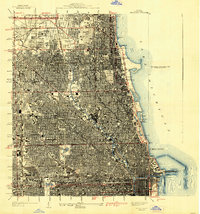
 1980 Chicago1980 Print · USGSThe Chicago metropolitan area and the industrial shores of Northwest Indiana are captured here at the start of the 1980s. Genealogists and local historians can trace the vast urban landscape through landmarks like Loyola University, St Casimir Cemetery, and the busy docks of Calumet Harbor.
 - 1980 Map of Waukegan
 1980 Waukegan1980 Print · USGSThe Illinois North Shore and Lake Michigan coastline appear at a point of high development in the early eighties. Trace the expansive grounds of the Great Lakes Naval Training Center, Fort Sheridan, and historic Northwestern University.
 - 1993 Map of Evanston
 1993 Evanston1993 Print · USGSThe North Shore suburbs of Evanston and Wilmette are shown here during the early nineties, revealing a dense grid of lakefront neighborhoods and prestigious institutions. Genealogists and local historians can trace the grounds of Calvary Cemetery, Loyola University, and the unique Bahai Temple.
 - 1993 Map of Chicago Loop
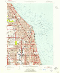
 1993 Chicago Loop1993 Print · USGSChicago in the early nineties displays a massive urban landscape anchored by its iconic shoreline and central business district. Genealogists and historians can trace family plots in Rosehill Cemetery or locate historic landmarks like the Sears Tower and the Merchandise Mart.2 unique versions available
 - 1995 Map of Evanston, 1999 Print
 1995 Evanston1999 Print · USGSThe North Shore's residential and institutional landscape is captured here in the late twentieth century. Genealogists and historians can trace the campuses of Northwestern University, the Bahai Temple, and the sprawling Calvary Cemetery.
 - 1997 Map of Chicago Loop, 1999 Print
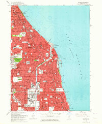
 1997 Chicago Loop1999 Print · USGSChicago at the end of the twentieth century remains a city of grand parks and intricate waterways. Genealogists and urban historians can trace the vast grounds of Rosehill Cemetery or locate neighborhood landmarks like St Mary of the Angels Ch and Navy Pier.
 - 2012 Map of Evanston, 2012 Print
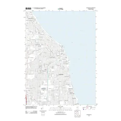 2012 Evanston2012 Print · USGSCovers Rogers Park Township, including Chicago, Evanston, and other nearby areas
 - 2012 Map of Chicago Loop, 2012 Print
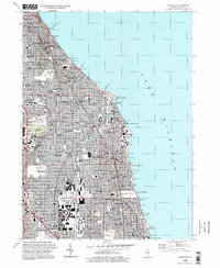
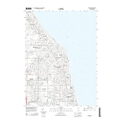
 2012 Chicago Loop2012 Print · USGSCovers Rogers Park Township, including Chicago, Lincolnwood, and other nearby areas
 - 2015 Map of Chicago Loop, 2015 Print
 2015 Chicago Loop2015 Print · USGSCovers Rogers Park Township, including Chicago, Lincolnwood, and other nearby areas
 - 2015 Map of Evanston, 2015 Print
 2015 Evanston2015 Print · USGSCovers Rogers Park Township, including Chicago, Evanston, and other nearby areas
Showing maps 1-25 of 31
Top cities near Rogers Park Township
- Chicago historical maps
- Cicero historical maps
- Evanston historical maps
- Skokie historical maps
- Des Plaines historical maps
- Berwyn historical maps
See more
Top neighborhoods of Rogers Park Township
- Rogers Park historical maps
- Little India historical maps
- Jarvis Square historical maps
- Glenwood Arts District historical maps
Frequently asked questions
- What are the different types of historical maps available for Rogers Park Township?
- What is the oldest map of Rogers Park Township?
- Where can I purchase historical maps of Rogers Park Township for my home or office?
- Where can I download high-res historical maps of Rogers Park Township?
- Are there historical topographic maps available for Rogers Park Township?
- Is there historical aerial imagery available for Rogers Park Township?
- Where are historical maps of Rogers Park Township sourced from?