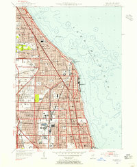
1953 Map of Evanston
USGS Topo · Published 1955About this map
The North Shore communities of Cook County are shown here in a period of established suburban growth along the Lake Michigan coastline. The urban layout is defined by the proximity of the Chicago North Shore and Milwaukee RR and the Chicago and North Western Ry, which facilitated the development of residential areas like Kenilworth, Wilmette, and Winnetka. Educational and institutional landmarks anchor these neighborhoods, including the prominent lakeside campus of Northwestern University and Loyola University further south.
Find a feature on this map
88 named features on this map. Tap any name to fly to it.
Don’t see what you’re looking for? This feature index may not catch every label — zoom into the map to look around manually.
Map Details
Editions of this 1953 Evanston Map
This is the sole edition of this map. No revisions or reprints were ever made.
Other maps of this area

1889 · Chicago
USGS Topo · 1:62,500

1891 · Chicago
USGS Topo · 1:62,500

1891 · Riverside
USGS Topo · 1:62,500

1893 · Riverside
USGS Topo · 1:62,500

1899 · Evanston
USGS Topo · 1:62,500

1900 · Chicago
USGS Topo · 1:62,500

1900 · Riverside
USGS Topo · 1:62,500

1900 · Highwood
USGS Topo · 1:62,500

1901 · Riverside
USGS Topo · 1:62,500

1901 · Chicago
USGS Topo · 1:62,500