1990s Maps of Douglas County, Illinois
Explore 15 historic maps of Douglas County from the 1990s. These maps offer a rare glimpse into what life looked like during the 1990s — showing old roads, neighborhoods, homes, and landmarks that have changed or disappeared over time.
Whether you're researching your family's past, planning a metal detecting trip, or studying how Douglas County's landscape evolved across the 1990s, these high-resolution maps are a powerful tool for exploring the history of this region.
- Focus on a specific era: All maps on this page are from the 1990s, giving you a focused view of this time period.
- See what’s changed: Compare century-old streets, trails, and buildings to today's modern landscape using overlays and satellite layers.
- Research with precision: Use these maps for genealogy, historical research, land use analysis, or educational projects.
- View, download, or print: Maps are fully viewable online in high resolution, and can be downloaded or printed for your own records.
Start exploring Douglas County's history through authentic maps from the 1990s. This is your window into the past.
Douglas County, IL maps
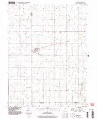
(15)- 1998 Map of Newman, 2002 Print
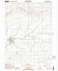 1998 Newman2002 Print · USGSDouglas and Edgar counties come into focus during the late 1990s, centered on the residential grid of Newman. Genealogists and local historians can locate Pleasant Ridge Cem, trace the waters of Brushy Fork, and find rural landmarks like Palermo Ch.
 - 1998 Map of Arcola, 2002 Print
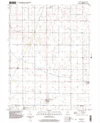
 1998 Arcola2002 Print · USGSThe Douglas and Coles county line area is shown in the late 1990s as a productive landscape of oil fields and prairie towns. Trace family roots at Township Cemetery or explore landmarks like the Cooks Mills Consolidated Oil Field and Galton.
 - 1998 Map of Allerton, 2002 Print
 1998 Allerton2002 Print · USGSEast-central Illinois farmlands near the turn of the millennium show a landscape shaped by the Little Vermilion River and the East Branch Embarras River. Genealogists can locate Lost Grove Cem and rural landmarks like Sch No 6 or the small settlement of Hastings.
 - 1998 Map of Brocton, 2002 Print
 1998 Brocton2002 Print · USGSThe prairie of Edgar and Douglas counties was well-established by the late 1990s, centered on the village of Brocton. Genealogists can trace family names at Zimmerman Cem or Scott Cem and locate the small settlement of Isabel.
 - 1998 Map of Murdock, 2003 Print
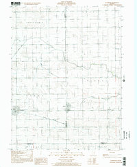
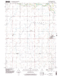
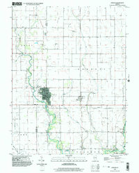
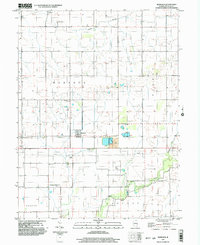 1998 Murdock2003 Print · USGSThe rural prairie of Douglas County is captured in the late nineties, showing a landscape defined by agriculture and coal mining. Researchers can trace family history at Wesley Chapel and Murdock Cem or locate industrial sites like the Mine Shaft and Mine Dump.
 - 1998 Map of Oakland, 2003 Print
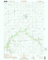
 1998 Oakland2003 Print · USGSThe Embarras River valley near the Coles and Douglas county line is captured here in the late 1990s as it winds past Oakland. Genealogists and researchers can locate several family burial grounds like Rosedale Cem and Berry Cem or trace the grounds of the Prairie Observatory.
 - 1998 Map of Arthur, 2003 Print
 1998 Arthur2003 Print · USGSArthur and its surrounding prairie landscape are documented here at the close of the twentieth century, showing a unique intersection of faith-based schooling and heavy industry. Genealogists and historians can trace family-named sites like Yoder Cemetery and the German School alongside the active Cooks Mills Oil Field.
 - 1998 Map of Villa Grove NW, 2003 Print
 1998 Villa Grove NW2003 Print · USGSChampaign County at the close of the twentieth century reveals a highly organized agricultural landscape shaped by the Embarras River. Researchers can trace local heritage through sites like Jessee Cem, St Mary Sch, and the Townhall in Crittenden.
 - 1998 Map of Ivesdale, 2003 Print
 1998 Ivesdale2003 Print · USGSIvesdale and the surrounding prairie townships appear in detail during the late nineties as the region's agricultural and drainage networks matured. Researchers can locate family burial sites at St Joseph Cem and Rice Cem or trace the early aviation footprint of the Kirwan Landing Strip.
 - 1998 Map of Tolono, 2003 Print
 1998 Tolono2003 Print · USGSChampaign County prairie life is centered on the railway and road corridors of the late twentieth century. Genealogists and local historians can trace family ties through several rural burial grounds, including Rock Cem, Sadorus Cem, and St Marys Cem.
 - 1998 Map of Hindsboro, 2003 Print
 1998 Hindsboro2003 Print · USGSThe eastern Illinois prairie near the Douglas and Coles county line is captured in the late nineties, showcasing a meticulously gridded agricultural landscape. Genealogists can trace family footprints near Hindsboro, Filson, and the rural Mt Gilead Ch.
 - 1998 Map of Longview, 2003 Print
 1998 Longview2003 Print · USGSThe rural borderlands of Champaign and Douglas counties are documented here in the late 1990s, showing a landscape defined by farming and small-town junctions. Local historians can trace family roots through sites like Lynn Grove Cemetery, Broadlands, and the Immaculate Conception Church.
 - 1998 Map of Villa Grove, 2003 Print
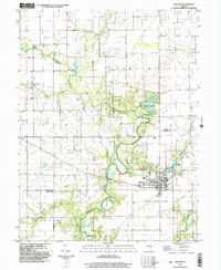
 1998 Villa Grove2003 Print · USGSDouglas County agriculture and river life are on full display in this late-nineties survey. Genealogists can locate several rural burial grounds like Antioch Cem and Broadus Cem or trace the winding Embarras River past Camargo.
 - 1998 Map of Atwood, 2003 Print
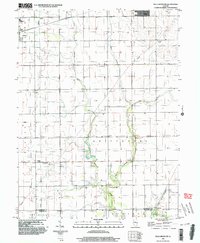
 1998 Atwood2003 Print · USGSAtwood and its surrounding townships show a classic Illinois prairie landscape near the turn of the millennium. Researchers can trace family sites from Mackville Cem to Antioch Ch and locate small rural aviation hubs like Cooch Landing Strip.
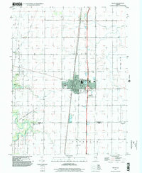
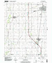
 - 1999 Map of Tuscola, 2003 Print
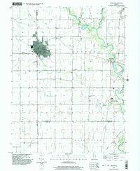
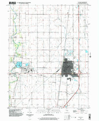 1999 Tuscola2003 Print · USGSDouglas County's seat and the surrounding Illinois prairie are shown at the turn of the century during a period of steady civic growth. Genealogists and local historians can locate specific landmarks like the Bache Memorial Ch, Chicken Bristle, and Maple Grove Cem.
End of results
Showing maps 1-15 of 15
Top cities of Douglas County
- Tuscola historical maps
- Arcola historical maps
- Villa Grove historical maps
- Newman historical maps
- Camargo historical maps
- Hindsboro historical maps
See more
Frequently asked questions
- What are the different types of historical maps available for Douglas County?
- What is the oldest map of Douglas County?
- Where can I purchase historical maps of Douglas County for my home or office?
- Where can I download high-res historical maps of Douglas County?
- Are there historical topographic maps available for Douglas County?
- Is there historical aerial imagery available for Douglas County?
- Where are historical maps of Douglas County sourced from?