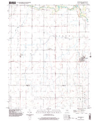
1998 Map of Hindsboro
USGS Topo · Published 2003About this map
Hindsboro anchor's the southeastern corner of this Illinois landscape, which transitioned into the late 20th century as a structured agricultural grid defined by the boundaries of Bowdre and Arcola townships. The map documents the rural settlement patterns near the border of Douglas and Coles counties, where small communities like Kemp and Filson sit along the section lines. The drainage of the land is visible through the winding course of the Embarras River and its tributaries, including Scattering Fork and Deer Creek. Local genealogy and social history are centered on landmarks such as Mt Gilead Ch, which serves as a focal point for the surrounding farms. The presence of a prominent Pipeline cutting through the terrain reflects the industrial infrastructure that shares the landscape with traditional Midwestern farming tracts.
Find a feature on this map
14 named features on this map. Tap any name to fly to it.
Don’t see what you’re looking for? This feature index may not catch every label — zoom into the map to look around manually.
Map Details
Editions of this 1998 Hindsboro Map
This is the sole edition of this map. No revisions or reprints were ever made.
Other maps of this area

1935 · Arcola
USGS Topo · 1:48,000

1936 · Oakland
USGS Topo · 1:48,000

1940 · Arcola
USGS Topo · 1:62,500

1942 · Oakland
USGS Topo · 1:62,500

1950 · Tuscola
USGS Topo · 1:62,500

1956 · Villa Grove
USGS Topo · 1:62,500

1958 · Decatur
USGS Topo · 1:250,000

1961 · Decatur
USGS Topo · 1:250,000
1975 · Tuscola SE
USGS Topo · 1:24,000
1982 · Villa Grove
USGS Topo · 1:24,000