1970s Maps of Hamilton County, Illinois
Explore 12 historic maps of Hamilton County from the 1970s. These maps offer a rare glimpse into what life looked like during the 1970s — showing old roads, neighborhoods, homes, and landmarks that have changed or disappeared over time.
Whether you're researching your family's past, planning a metal detecting trip, or studying how Hamilton County's landscape evolved across the 1970s, these high-resolution maps are a powerful tool for exploring the history of this region.
- Focus on a specific era: All maps on this page are from the 1970s, giving you a focused view of this time period.
- See what’s changed: Compare century-old streets, trails, and buildings to today's modern landscape using overlays and satellite layers.
- Research with precision: Use these maps for genealogy, historical research, land use analysis, or educational projects.
- View, download, or print: Maps are fully viewable online in high resolution, and can be downloaded or printed for your own records.
Start exploring Hamilton County's history through authentic maps from the 1970s. This is your window into the past.
Hamilton County, IL maps
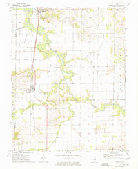
(12)- 1971 Map of Boyleston, 1973 Print
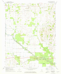 1971 Boyleston1973 Print · USGSSouthern Illinois farming and drainage systems are in full view here in the early 1970s. Genealogists and historians can trace family burial sites like Clark Cem, rural schools like Boyleston Sch, and the winding path of the Skillet Fork.
 - 1971 Map of Burnt Prairie, 1973 Print
 1971 Burnt Prairie1973 Print · USGSSoutheastern Illinois reveals a landscape of active petroleum extraction and family homesteads in the early seventies. Genealogists and historians can trace numerous rural burial grounds like Koontz Cem and Gifford Cem alongside the heavy rail presence of the Baltimore and Ohio RR.
 - 1973 Map of Wayne City, 1975 Print
 1973 Wayne City1975 Print · USGSSouthern Illinois in the early 1970s shows a landscape of small rail-side villages and rural cemeteries along the Skillet Fork. Genealogists can trace family roots at Baltimore Cem or locate the old Oak Grove Sch near Mayberry.
 - 1973 Map of Bluford, 1975 Print
 1973 Bluford1975 Print · USGSJefferson and Wayne Counties appear here in the early 1970s as centers of rail transport and petroleum production. Researchers can trace family history through landmarks like Long Prairie Cem, Bluford Sch, and the Markham City Oil Field.2 unique versions available
 - 1974 Map of Dahlgren, 1977 Print
 1974 Dahlgren1977 Print · USGSSouthern Illinois prairie life in the mid-1970s is centered on the rail junctions of Dahlgren and Belle Rive. Genealogists can trace family names through dozens of rural sites, including St Johns Cem, Sugar Camp Ch, and Little Egypt Youth Camp.
 - 1974 Map of McLeansboro, 1977 Print
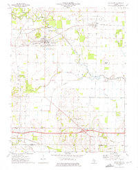
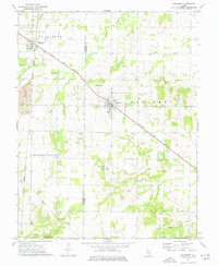
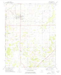
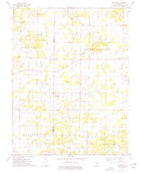
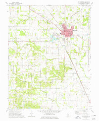 1974 McLeansboro1977 Print · USGSMcLeansboro and its surrounding townships are shown in detail during the mid-1970s as the regional rail and agricultural economy flourished. Genealogists can locate numerous family burial grounds and country churches, such as Knight Prairie Cem, Webbs Chapel, and Marys Chapel Cem.
 - 1974 Map of Enfield, 1977 Print
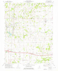
 1974 Enfield1977 Print · USGSEnfield and the surrounding White County prairie lands are shown here in the mid-1970s at the height of the local rail and oil era. Genealogists and historians can trace numerous rural landmarks like Wesley Chapel, Sharon Ch, and the Enfield Cem.
 - 1974 Map of Bungay, 1977 Print
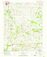
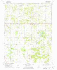
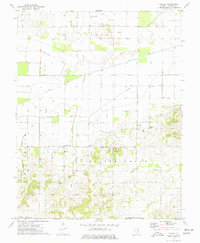 1974 Bungay1977 Print · USGSHamilton County's oil-producing landscape is captured here in the mid-seventies, showing a rural economy driven by petroleum and rail. Genealogists can trace family landmarks like Springer Cem and rural centers such as Blairsville and Christian Chapel.
 - 1974 Map of Springerton, 1977 Print
 1974 Springerton1977 Print · USGSWhite and Hamilton Counties appear in the mid-1970s as a landscape of productive bottomlands and tight-knit rural communities. Genealogists can locate several local burial sites such as Kitty Sweeten Cem and Hammack Cem, or trace the rail route of the Baltimore and Ohio through Springerton.
 - 1974 Map of Thackeray, 1977 Print
 1974 Thackeray1977 Print · USGSHamilton County was a landscape of both industry and leisure in the mid-seventies, defined by active oil production and the emerging state conservation lands. Genealogists can trace family names through landmarks like Munsell Cem, Nipper Corner, and Sneed Ch.
 - 1974 Map of Macedonia, 1977 Print
 1974 Macedonia1977 Print · USGSFranklin and Hamilton counties met in a landscape of quiet prairie and productive oil fields during the mid-seventies. Genealogists can trace family roots through numerous local landmarks like Atchisson Cem, Jacksonville Cem, and the village of Macedonia.
 - 1974 Map of Belle Prairie City, 1977 Print
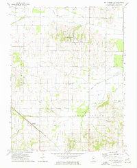 1974 Belle Prairie City1977 Print · USGSHamilton County in the mid-seventies retains its quiet rural character, centered on agricultural settlements and the railroad. Genealogists can trace family locations near Piopolis or locate burial sites at Blooming Grove Cem and Rawls Cem.
End of results
Showing maps 1-12 of 12
Top cities of Hamilton County
- McLeansboro historical maps
- Dahlgren historical maps
- Broughton historical maps
- Belle Prairie City historical maps
Frequently asked questions
- What are the different types of historical maps available for Hamilton County?
- What is the oldest map of Hamilton County?
- Where can I purchase historical maps of Hamilton County for my home or office?
- Where can I download high-res historical maps of Hamilton County?
- Are there historical topographic maps available for Hamilton County?
- Is there historical aerial imagery available for Hamilton County?
- Where are historical maps of Hamilton County sourced from?