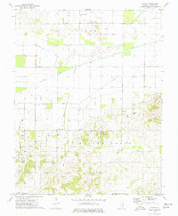
1974 Map of Bungay
USGS Topo · Published 1977About this map
Aden, Blairsville, and Bungay center this Hamilton County landscape during a period of significant petroleum extraction and agricultural drainage. The terrain is defined by the heavy footprint of the energy industry, with the Crouch Oil Field, Bungay Oil Field, and Beaver Creek Oil Field sprawling across the township lines. Dozens of individual Oil Wells are noted, illustrating the intensive development of the Illinois Basin during the mid-1970s.
Find a feature on this map
30 named features on this map. Tap any name to fly to it.
Don’t see what you’re looking for? This feature index may not catch every label — zoom into the map to look around manually.
Map Details
Editions of this 1974 Bungay Map
This is the sole edition of this map. No revisions or reprints were ever made.
Other maps of this area

1941 · Enfield
USGS Topo · 1:62,500

1942 · McLeansboro
USGS Topo · 1:62,500

1944 · Enfield
USGS Topo · 1:62,500

1945 · McLeansboro
USGS Topo · 1:62,500

1947 · Wayne City
USGS Topo · 1:62,500

1948 · Fairfield
USGS Topo · 1:62,500

1958 · Belleville
USGS Topo · 1:250,000

1962 · Belleville
USGS Topo · 1:250,000
1971 · Boyleston
USGS Topo · 1:24,000
1971 · Burnt Prairie
USGS Topo · 1:24,000