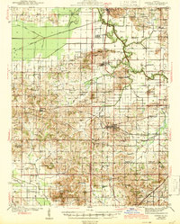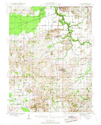
1941 Map of Enfield
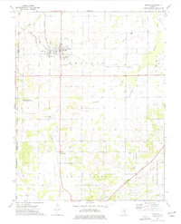
USGS Topo · Published 1968About this map
Enfield and Springerton anchor this 1941 landscape, which is defined by an incredibly dense network of rural school districts and crossroads churches. The map documents the intricate social geography of White and Hamilton counties during the mid-twentieth century, featuring dozens of named schoolhouses like Satisfaction Sch, Doeskin Sch, and Uppenblock Sch. Many of these locations, along with places like the McIntosh Settlement, represent the foundations of local family history in southern Illinois.
Find a feature on this map
138 named features on this map. Tap any name to fly to it.
Don’t see what you’re looking for? This feature index may not catch every label — zoom into the map to look around manually.
Map Details
Editions of this 1941 Enfield Map
This is the sole edition of this map. No revisions or reprints were ever made.
Historical Maps of Mill Shoals Through Time
8 maps found