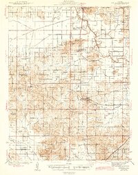
1944 Map of Enfield
USGS Topo · Published 1944About this map
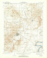
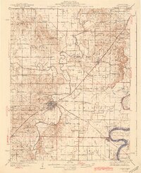
Enfield and Mill Shoals serve as the primary hubs in this agricultural and industrial landscape where the Hamilton Co and White Co border bisects a network of rural schoolhouses and churches. The importance of rail commerce is evident in the converging lines of the Louisville and Nashville and the Baltimore and Ohio railroads, which facilitated movement through the varied terrain of Nubbin Ridge and Pig Ridge. Rural social life is anchored by family and community landmarks such as Jacobs Camp and McIntosh Settlement, alongside dozens of local schools like Doeskin Sch and Trousdale Sch. The drainage pattern, dominated by Skillet Fork and Sevenmile Creek, highlights the topographical challenges faced by early settlers in this pocket of Southern Illinois. Genealogists can trace family connections through specifically named sites like Johnson Cem and Digby Cem.
Find a feature on this map
82 named features on this map. Tap any name to fly to it.
Don’t see what you’re looking for? This feature index may not catch every label — zoom into the map to look around manually.
Map Details
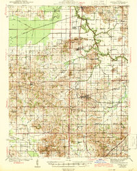
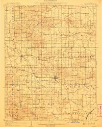
Editions of this 1944 Enfield Map
2 editions found
Other maps of this area

1905 · Eldorado
USGS Topo · 1:62,500

1905 · New Haven
USGS Topo · 1:62,500

1906 · New Haven
USGS Topo · 1:62,500

1906 · Eldorado
USGS Topo · 1:62,500
1908 · Galatia
USGS Topo · 1:62,500
1938 · Galatia
USGS Topo · 1:62,500
1940 · Carmi
USGS Topo · 1:62,500
1941 · Enfield
USGS Topo · 1:62,500
1942 · McLeansboro
USGS Topo · 1:62,500
1943 · Carmi
USGS Topo · 1:62,500