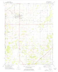
1974 Map of Enfield
USGS Topo · Published 1977About this map
Enfield serves as the central hub of this 1970s survey, situated at the busy intersection of the Louisville and Nashville and Baltimore and Ohio railroads. The landscape is a detailed look at White and Hamilton counties during a period of active resource extraction, marked by numerous Oil Wells and a prominent Tank Farm near the southwestern corner of the village. The rural character of the region is preserved through numerous community anchors, including Wesley Chapel, Sharon Ch, and several family cemeteries such as Rice Cem and Johnson Cem.
Find a feature on this map
34 named features on this map. Tap any name to fly to it.
Don’t see what you’re looking for? This feature index may not catch every label — zoom into the map to look around manually.
Map Details
Editions of this 1974 Enfield Map
This is the sole edition of this map. No revisions or reprints were ever made.
Other maps of this area

1905 · Eldorado
USGS Topo · 1:62,500

1905 · New Haven
USGS Topo · 1:62,500

1906 · New Haven
USGS Topo · 1:62,500

1906 · Eldorado
USGS Topo · 1:62,500

1940 · Carmi
USGS Topo · 1:62,500

1941 · Enfield
USGS Topo · 1:62,500

1943 · Carmi
USGS Topo · 1:62,500

1944 · Enfield
USGS Topo · 1:62,500

1949 · Paducah
USGS Topo · 1:250,000

1949 · New Haven
USGS Topo · 1:62,500