1900s (20th Century) Maps of Watseka, Illinois
Explore 11 historic maps of Watseka from the 1900s (20th Century). These maps offer a rare glimpse into what life looked like during the 1900s — showing old roads, neighborhoods, homes, and landmarks that have changed or disappeared over time.
Whether you're researching your family's past, planning a metal detecting trip, or studying how Watseka's landscape evolved across the 1900s, these high-resolution maps are a powerful tool for exploring the history of this region.
- Focus on a specific era: All maps on this page are from the 1900s, giving you a focused view of this time period.
- See what’s changed: Compare century-old streets, trails, and buildings to today's modern landscape using overlays and satellite layers.
- Research with precision: Use these maps for genealogy, historical research, land use analysis, or educational projects.
- View, download, or print: Maps are fully viewable online in high resolution, and can be downloaded or printed for your own records.
Start exploring Watseka's history through authentic maps from the 1900s. This is your window into the past.
Watseka, IL maps
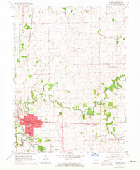
(11)- 1935 Map of Watseka
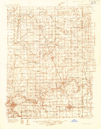 1935 Watseka1935 Print · USGSIroquois County in the mid-1930s is a landscape of thriving rail-side villages and rural school districts connected by a dense rail network. Researchers can trace family history through dozens of landmarks like Independence Sch, Mt Taber Ch, and St Joseph Cem.
 - 1939 Map of Watseka
 1939 Watseka1939 Print · USGSIroquois County and the Illinois-Indiana borderlands are captured here during the mid-1930s as a thriving rail and agricultural corridor. Researchers can trace dozens of country schools like Weygandt Sch, small communities like Beaverville, and the grounds of the County Farm.2 unique versions available
 - 1944 Map of Gilman, 1966 Print
 1944 Gilman1966 Print · USGSIroquois County at the end of the Second World War reveals a dense network of prairie schoolhouses and rail towns. Genealogists can trace family names through Clark Cem and dozens of country schools like Swival Sch or Ross Farm Sch.2 unique versions available
 - 1946 Map of Gilman
 1946 Gilman1946 Print · USGSIroquois County at the close of World War II is a landscape defined by the iron rails and the prairie. Researchers can trace rural school districts like Old Burg Sch and locate ancestral burial grounds such as Bardon Cem and Pierce Cem.2 unique versions available
 - 1953 Map of Danville, 1965 Print
 1953 Danville1965 Print · USGSIndiana and Illinois crossroads come to life in this mid-century survey as the interstate era begins to reshape the river-and-rail landscape. Genealogists and collectors can trace the historic paths of the Nickel Plate railroad or locate smaller communities like Veedersburg, Goodland, and Bismarck.3 unique versions available
 - 1955 Map of Danville
 1955 Danville1955 Print · USGSThe Indiana-Illinois borderlands during the mid-fifties reveal a landscape of thriving rail hubs and university towns. Researchers can trace the legacy of Purdue University, the Tippecanoe Battlefield, and the path of the Pennsylvania RR.
 - 1956 Map of Danville
 1956 Danville1956 Print · USGSMid-century Indiana and Illinois are captured here as the river-and-rail economy evolved into the modern highway era. Researchers can trace ancestral roots and old transport lines through Logansport, Battle Ground, and the dams at Lake Shafer.
 - 1964 Map of Watseka, 1965 Print
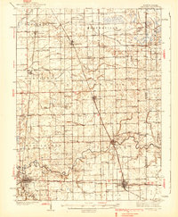
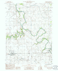
 1964 Watseka1965 Print · USGSWatseka sits at a strategic river confluence in the mid-1960s, serving as a vital rail junction for the Chicago and Eastern Illinois. Local historians can trace family plots at Oak Hill Cemetery and locate vanished rural landmarks like Prairie Dell Ch.
 - 1984 Map of Watseka, 1985 Print
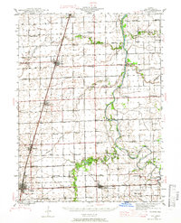
 1984 Watseka1985 Print · USGSThe Illinois-Indiana borderlands thrived on a dense rail and river network during the mid-eighties. Genealogists and local historians can trace the foundations of rural life through landmarks like St Josephs College, the Iroquois Hospital, and towns like Milford and Beaverville.
 - 1986 Map of Crescent City
 1986 Crescent City1986 Print · USGSIroquois County at the mid-eighties shows a landscape of river confluences and rural infrastructure. Researchers can trace the paths of the Iroquois River and Spring Creek or locate local landmarks like the Radio Towers WGFA and the Cem.
 - 1990 Map of Watseka, 1991 Print
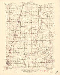
 1990 Watseka1991 Print · USGSThe Illinois and Indiana borderlands are captured here in the early nineties, showing a landscape defined by prairie drainage and rail lines. You can trace family roots through settlements like L'Erable and Raub or locate landmarks such as Saint Josephs College.
End of results
Showing maps 1-11 of 11
Top cities near Watseka
- Milford historical maps
- Clifton historical maps
- Sheldon historical maps
- Chebanse historical maps
- Cissna Park historical maps
- Ashkum historical maps
See more
Frequently asked questions
- What are the different types of historical maps available for Watseka?
- What is the oldest map of Watseka?
- Where can I purchase historical maps of Watseka for my home or office?
- Where can I download high-res historical maps of Watseka?
- Are there historical topographic maps available for Watseka?
- Is there historical aerial imagery available for Watseka?
- Where are historical maps of Watseka sourced from?