Old Maps of Glen Carbon, Illinois for Hiking & Exploration
Hike through history with 49 historic maps of Glen Carbon. Explore old trails, ghost towns, and forgotten backroads — perfect for outdoor adventurers and local explorers.
- Rediscover forgotten places: Map out old mining camps, roads, and footpaths that no longer exist on modern maps.
- Layer with modern tools: Combine with LiDAR or satellite views to plan hikes through historical terrain.
- Made for exploration: Popular among hikers, overlanders, and local history lovers.
Use these maps to find adventure and explore the hidden past of Glen Carbon.
Glen Carbon, IL maps
(49)- 1888 Map of St. Louis
 1888 St. Louis1888 Print · USGSThe Illinois bottomlands across from St. Louis come alive in the late nineteenth century as a massive railroad hub emerging from the river wetlands. Researchers can trace early rail junctions and settlements like French Village, the ancient Monks Mound, and the industrial waterfronts of Brooklyn and East St Louis.
 - 1907 Map of Belleville
 1907 Belleville1907 Print · USGSSouthwestern Illinois is seen at a height of rail-driven expansion in the early twentieth century. Trace genealogy and land history in Belleville, O'Fallon, and Summerfield along the Vandalia System and other regional lines.3 unique versions available
 - 1927 Map of Alton
 1927 Alton1927 Print · USGSThe industrial and riverfront corridor of the Mississippi and Missouri confluence is captured here during a period of heavy rail and ferry traffic. Researchers can trace historic family locations through dozens of rural landmarks like Monticello Seminary, Greenwood Cem, and the City of St Louis Farms.
 - 1927 Map of Edwardsville, 1957 Print
 1927 Edwardsville1957 Print · USGSMadison County at the end of the twenties shows a landscape defined by coal mining and a complex web of steam and electric rail. Genealogists and historians can trace family-named landmarks and rural hubs like the Klondike Mine, St Johns Ch, and dozens of country schools from Yorkville Sch to Sylvan Hill Sch.
 - 1932 Map of Edwardsville
 1932 Edwardsville1932 Print · USGSMadison County in the early thirties was a bustling intersection of coal mining and heavy rail. Genealogists can trace family names through dozens of rural schools and landmarks like the Klondike Mine, Sunset Hills Cem, and Le Claire.2 unique versions available
 - 1934 Map of Alton
 1934 Alton1934 Print · USGSThe confluence of the Mississippi and Missouri rivers in the early 1930s shows a dense industrial and rail corridor centered on Alton. Genealogists and researchers can trace dozens of rural schools and landmarks like Monticello Seminary, Mt Olive Church, and the City of St Louis Farms.2 unique versions available
 - 1935 Map of Monks Mound
 1935 Monks Mound1935 Print · USGSThe American Bottoms near East St. Louis come alive in the mid-1930s, showing a unique landscape where ancient earthworks meet industrial rail expansion. Researchers can trace the layout of Cahokia Mounds State Park alongside defunct social landmarks like the Fairmont Jockey Club and Madison Kennel Club.3 unique versions available
 - 1937 Map of Collinsville
 1937 Collinsville1937 Print · USGSSouthwestern Illinois thrives in the mid-1930s as a hub of rail traffic and coal-country commerce. Genealogists and local historians can trace family locations near Chinatown, Donkville, and numerous country schools like Bethel Sch or Spring Valley Sch.2 unique versions available
 - 1948 Map of Wood River, 1955 Print
 1948 Wood River1955 Print · USGSMadison County industrial hubs and river lowlands are captured here in the late 1940s as the regional energy sector expanded. Genealogists and historians can trace the foundations of Wood River refineries alongside local landmarks like St Paul Ch and the North Coal Mine.
 - 1949 Map of Saint Louis
 1949 Saint Louis1949 Print · USGSGreater St. Louis and its surrounding river valleys are captured here just after the war, showing the metropolitan core and the rural Ozark fringe. Researchers can trace the sprawling rail network of the Wabash RR or locate landmarks like Meramec Caverns Airport and Scott Air Force Base.2 unique versions available
 - 1950 Map of Edwardsville
 1950 Edwardsville1950 Print · USGSEdwardsville and Glen Carbon are shown as thriving railroad and coal hubs at mid-century. Researchers can trace family roots through the numerous named schools and cemeteries like Pin Oak Sch, St James Cem, and the Black Diamond Coal Mine.2 unique versions available
 - 1951 Map of Wood River
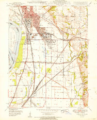 1951 Wood River1951 Print · USGSThe industrial heart of Madison County comes into focus in the early 1950s, showing the massive refining operations and rail hubs along the Mississippi. Researchers can trace local history through the Oil Refinery sites, Bohm Sch, and Sunset Hill Cem.
 - 1954 Map of Collinsville, 1959 Print
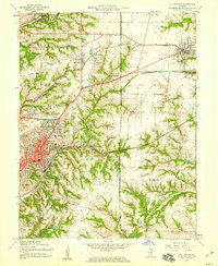 1954 Collinsville1959 Print · USGSMid-century Madison County reveals an era of thriving rail junctions and local neighborhood schools. Genealogists and local historians can trace family locations through landmarks like Finland Cem, Troy Crossing, and Lanham Sch.4 unique versions available
 - 1954 Map of Edwardsville, 1959 Print
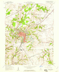 1954 Edwardsville1959 Print · USGSEdwardsville and Glen Carbon are shown during the mid-fifties at a peak of rail activity, where six different lines converge. Local historians can trace family roots through numerous burial sites like Woodlawn Cem and old schoolhouses including Pin Oak Sch and Goshen Sch.4 unique versions available
 - 1954 Map of Monks Mound, 1959 Print
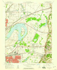 1954 Monks Mound1959 Print · USGSThe Madison County bottomlands in the mid-1950s show a fascinating landscape of prehistoric earthworks and modern rail yards. Genealogists and historians can trace family-named schools and sites like Bullfrog Station Sch, Moellenbrocks, and the massive Monks Mound.5 unique versions available
 - 1954 Map of Edwardsville, 1960 Print
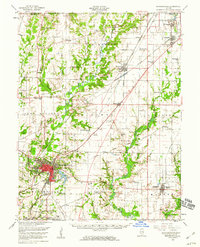 1954 Edwardsville1960 Print · USGSMadison County in the mid-fifties reveals a landscape defined by the intersection of coal-era rail lines and expanding suburban settlements. Local historians can trace the legacy of small-town institutions like Quercus Grove Sch, the residential tracts of LeClaire, and the industrial footprint of the Mine Dump near Worden.
 - 1955 Map of Wood River, 1959 Print
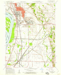 1955 Wood River1959 Print · USGSMid-century Madison County thrives at the junction of heavy industry and historic bottomlands as the postwar rail network expands. Researchers can trace family roots through the Wanda Cem or locate the Indian Mounds and the Sunset Speedway.4 unique versions available
 - 1955 Map of Alton, 1960 Print
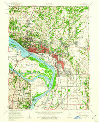 1955 Alton1960 Print · USGSThe industrial riverfronts and expanding rail corridors of the Metro East are captured here in the mid-fifties. Researchers can trace the development of Alton State Hospital, the grounds of Monticello College, and historic sites like Fort Bellefontaine.2 unique versions available
 - 1958 Map of Belleville, 1973 Print
 1958 Belleville1973 Print · USGSSouthern Illinois during the mid-twentieth century reveals a landscape of industrial growth and massive new reservoirs. Genealogists and historians can trace the paths of the Illinois Central RR through towns like Centralia or locate landmarks such as Emerald Mound and the Looking Glass Prairie.3 unique versions available
 - 1962 Map of St. Louis
 1962 St. Louis1962 Print · USGSThe mid-century gateway to the west shows the metropolitan expansion of St Louis alongside its critical river confluences. Genealogists and historians can trace the rail corridors of the Missouri Pacific RR and settlements from Fulton to De Soto.
 - 1962 Map of Belleville
 1962 Belleville1962 Print · USGSSouthern Illinois in the late fifties reveals a landscape of industrial growth and ancient landmarks before the full expansion of the interstate system. Genealogists can trace family names and rural post offices near Centralia, Salem, and the historic Monks Mound.
 - 1963 Map of St. Louis, 1970 Print
 1963 St. Louis1970 Print · USGSSt. Louis and its surrounding river valleys are captured here during the peak of mid-century suburban expansion and industrial activity. Trace the historic rail routes of the Norfolk and Western Ry or locate the St Louis Ordnance Plant and early stretches of US Highway 66.4 unique versions available
 - 1966 Map of St. Louis
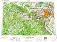 1966 St. Louis1966 Print · USGSThe St. Louis metropolitan area and its surrounding river valleys are captured here during the mid-sixties era of suburban growth and industrial strength. Genealogists and historians can trace the foundations of local communities through sites like Old Pioneer Cem, Parks College, and the Jefferson Barracks Military Reservation.
 - 1985 Map of St Louis
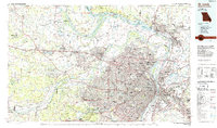 1985 St Louis1985 Print · USGSThe St. Louis metropolitan area and its river confluences are captured here during a period of significant suburban expansion in the 1980s. Genealogists and historians can trace the development of older neighborhoods and landmarks like Jefferson Barracks, Cahokia Mounds State Park, and Washington University.3 unique versions available
 - 1985 Map of Carlyle Lake
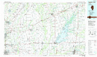 1985 Carlyle Lake1985 Print · USGSSouthwestern Illinois in the mid-eighties shows a landscape of growing commuter suburbs and massive water management projects. Genealogists and historians can locate family plots at Lakeview Memorial Gardens Cem or trace the early footprint of Southern Illinois Univ (Edwardsville).2 unique versions available
Showing maps 1-25 of 49
Top cities near Glen Carbon
- St. Louis historical maps
- Belleville historical maps
- O'Fallon historical maps
- Granite City historical maps
- Edwardsville historical maps
- Alton historical maps
See more
Top neighborhoods of Glen Carbon
- Glen Carbon Crossing historical maps
- Heritage Estates historical maps
- Meridian Hills North historical maps
- Oak Ridge Estates historical maps
- Forest Grove historical maps
- Glen Hills historical maps
See more
Frequently asked questions
- What are the different types of historical maps available for Glen Carbon?
- What is the oldest map of Glen Carbon?
- Where can I purchase historical maps of Glen Carbon for my home or office?
- Where can I download high-res historical maps of Glen Carbon?
- Are there historical topographic maps available for Glen Carbon?
- Is there historical aerial imagery available for Glen Carbon?
- Where are historical maps of Glen Carbon sourced from?