1940s Maps of Mason County, Illinois
Explore 9 historic maps of Mason County from the 1940s. These maps offer a rare glimpse into what life looked like during the 1940s — showing old roads, neighborhoods, homes, and landmarks that have changed or disappeared over time.
Whether you're researching your family's past, planning a metal detecting trip, or studying how Mason County's landscape evolved across the 1940s, these high-resolution maps are a powerful tool for exploring the history of this region.
- Focus on a specific era: All maps on this page are from the 1940s, giving you a focused view of this time period.
- See what’s changed: Compare century-old streets, trails, and buildings to today's modern landscape using overlays and satellite layers.
- Research with precision: Use these maps for genealogy, historical research, land use analysis, or educational projects.
- View, download, or print: Maps are fully viewable online in high resolution, and can be downloaded or printed for your own records.
Start exploring Mason County's history through authentic maps from the 1940s. This is your window into the past.
Mason County, IL maps
(9)- 1942 Map of Delavan
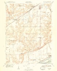
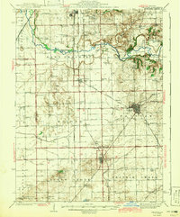 1942 Delavan1942 Print · USGSTazewell County's fertile plains are captured in the early 1940s, showing a landscape defined by busy rail junctions and a dense grid of country schoolhouses. Researchers can trace family roots through landmarks like St Lukes Ch, South Pekin, and rural schools such as Oak Hill Sch.3 unique versions available
 - 1944 Map of Beardstown, 1959 Print
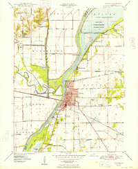
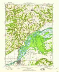 1944 Beardstown1959 Print · USGSBeardstown and the Illinois River valley are shown here in the mid-forties, capturing a landscape of shifting river channels and rural school districts. Genealogists can trace family names through landmarks like Griggs Chapel, McClung School, and Sheldons Grove.2 unique versions available
 - 1947 Map of St. David, 1982 Print
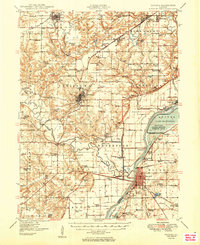
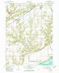 1947 St. David1982 Print · USGSFulton County industrial and river life are captured here in the late 1940s as large-scale extraction reshapes the prairie. Genealogists can trace family footprints at Salem Cem or locate vanished rural schools such as Elm Tree Sch and Maples Mill.
 - 1947 Map of Havana, 1984 Print
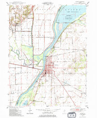 1947 Havana1984 Print · USGSHavana and the Illinois River valley are captured here in the late 1940s, showing a landscape defined by rail transport and river management. Genealogists can trace family roots through numerous rural landmarks like Laurel Hill Cemetery, Waterford Union Ch, and the Morton School.
 - 1948 Map of St. David
 1948 St. David1948 Print · USGSCoal country meets the Illinois River valley in the late 1940s as strip mining reshapes the landscape near St. David. Genealogists can locate numerous country schools like Science Hill Sch and Morning Star Sch alongside the Chicago Burlington and Quincy rail line.2 unique versions available
 - 1948 Map of Havana
 1948 Havana1948 Print · USGSHavana and the Illinois River valley are captured here in the late 1940s, showing a landscape of river-bend settlements and archaeological sites. Genealogists and historians can trace Dickson Mounds State Park, Laurel Hill Cemetery, and rural schools like Nailrod Sch.2 unique versions available
 - 1948 Map of Mason City, 1963 Print
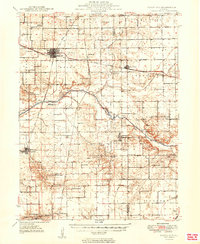
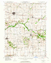 1948 Mason City1963 Print · USGSCentral Illinois farming and rail life are at the forefront of this late 1940s survey. Genealogists and local historians can trace family-named sites like Johnson Valley Mine and North Sangamon Ch, alongside a dense network of rural schools.2 unique versions available
 - 1949 Map of Havana
 1949 Havana1949 Print · USGSThe Illinois River valley in the late 1940s reveals a landscape transitioning between coal mining and conservation. Genealogists and local historians can trace family roots through dozens of rural schools and landmarks like Dickson Mounds State Park, Mound Chapel, and the St Marys Cem near Lewistown.3 unique versions available
 - 1949 Map of Mason City
 1949 Mason City1949 Print · USGSCentral Illinois rail hubs and prairie farmsteads are captured here just after the war, showing the intersection of three major railroads. Genealogists can locate family landmarks like Honey Heart School, Johnson Valley Mine, and the Irish Grove Church.2 unique versions available
End of results
Showing maps 1-9 of 9
Top cities of Mason County
- Havana historical maps
- Mason City historical maps
- Manito historical maps
- Easton historical maps
- Kilbourne historical maps
- Bath historical maps
See more
Frequently asked questions
- What are the different types of historical maps available for Mason County?
- What is the oldest map of Mason County?
- Where can I purchase historical maps of Mason County for my home or office?
- Where can I download high-res historical maps of Mason County?
- Are there historical topographic maps available for Mason County?
- Is there historical aerial imagery available for Mason County?
- Where are historical maps of Mason County sourced from?