1990s Maps of Carbon Cliff, Illinois
Explore 3 historic maps of Carbon Cliff from the 1990s. These maps offer a rare glimpse into what life looked like during the 1990s — showing old roads, neighborhoods, homes, and landmarks that have changed or disappeared over time.
Whether you're researching your family's past, planning a metal detecting trip, or studying how Carbon Cliff's landscape evolved across the 1990s, these high-resolution maps are a powerful tool for exploring the history of this region.
- Focus on a specific era: All maps on this page are from the 1990s, giving you a focused view of this time period.
- See what’s changed: Compare century-old streets, trails, and buildings to today's modern landscape using overlays and satellite layers.
- Research with precision: Use these maps for genealogy, historical research, land use analysis, or educational projects.
- View, download, or print: Maps are fully viewable online in high resolution, and can be downloaded or printed for your own records.
Start exploring Carbon Cliff's history through authentic maps from the 1990s. This is your window into the past.
Carbon Cliff, IL maps
(3)- 1991 Map of Coal Valley, 1992 Print
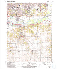 1991 Coal Valley1992 Print · USGSThe confluence of the Rock and Green Rivers defines the landscape of southeastern Rock Island County in the early 1990s. Genealogists and local historians can trace family-named sites like Bowlesburg Cem, Arrowhead Ranch, and Good Shepherd Sch.
 - 1991 Map of Silvis, 1992 Print
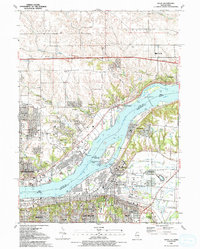 1991 Silvis1992 Print · USGSThe riverfront communities of the Quad Cities thrive along both banks of the Mississippi in the early nineties. Genealogists and local historians can locate family landmarks like Fairview Cem, Forest Grove Sch, and the Quad City Downs racetrack.
 - 1992 Map of Green Rock
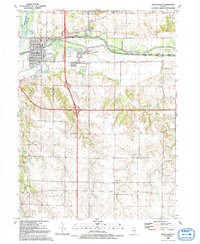 1992 Green Rock1992 Print · USGSHenry County is captured in the early 1990s as a landscape of historic waterways and quiet rural crossroads. Genealogists and local historians can trace family-named sites like Dayton Cem and Warner or follow the path of the Hennepin Canal.
End of results
Showing maps 1-3 of 3
Top cities near Carbon Cliff
- Davenport historical maps
- Moline historical maps
- Bettendorf historical maps
- Rock Island historical maps
- East Moline historical maps
- Silvis historical maps
See more
Frequently asked questions
- What are the different types of historical maps available for Carbon Cliff?
- What is the oldest map of Carbon Cliff?
- Where can I purchase historical maps of Carbon Cliff for my home or office?
- Where can I download high-res historical maps of Carbon Cliff?
- Are there historical topographic maps available for Carbon Cliff?
- Is there historical aerial imagery available for Carbon Cliff?
- Where are historical maps of Carbon Cliff sourced from?