1990s Maps of Will County, Illinois
Explore 35 historic maps of Will County from the 1990s. These maps offer a rare glimpse into what life looked like during the 1990s — showing old roads, neighborhoods, homes, and landmarks that have changed or disappeared over time.
Whether you're researching your family's past, planning a metal detecting trip, or studying how Will County's landscape evolved across the 1990s, these high-resolution maps are a powerful tool for exploring the history of this region.
- Focus on a specific era: All maps on this page are from the 1990s, giving you a focused view of this time period.
- See what’s changed: Compare century-old streets, trails, and buildings to today's modern landscape using overlays and satellite layers.
- Research with precision: Use these maps for genealogy, historical research, land use analysis, or educational projects.
- View, download, or print: Maps are fully viewable online in high resolution, and can be downloaded or printed for your own records.
Start exploring Will County's history through authentic maps from the 1990s. This is your window into the past.
Will County, IL maps
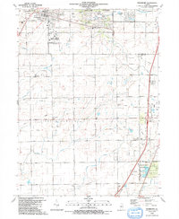
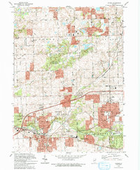
(35)- 1990 Map of Dyer, 1991 Print
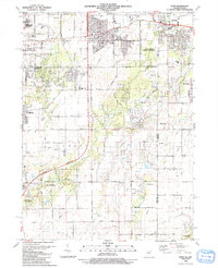 1990 Dyer1991 Print · USGSSuburban development meets the rural prairie at the Illinois and Indiana border in the early nineties. Researchers can trace family sites from Sauk Village to Dyer, including St James Cem and the small settlement of Kreitzburg.
 - 1990 Map of Manhattan, 1991 Print
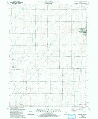
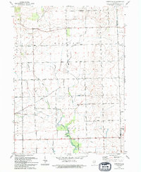
 1990 Manhattan1991 Print · USGSWill County’s transition from prairie farmland to residential expansion is captured here in the late twentieth century. Researchers can trace the heritage of local parishes and school districts through landmarks like St Joseph Cem, Green Garden Ch, and the Tyler Sch.
 - 1990 Map of Peotone, 1991 Print
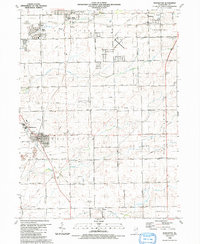
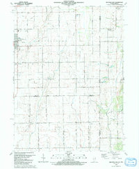
 1990 Peotone1991 Print · USGSThe eastern Illinois prairie near the Will and Kankakee county line is captured here as the towns of Peotone and Manteno expanded in the late twentieth century. Trace local genealogy and civic history through St Paul Ch, Peotone Cem, and the Illinois Central Gulf rail corridor.
 - 1990 Map of Steger, 1991 Print
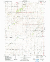
 1990 Steger1991 Print · USGSThe south Chicago suburbs of Will and Cook Counties appear in full growth during the late twentieth century. Genealogists and local historians can trace family locations through sites like Evergreen Hill Cem, S Liborius Sch, and the Balmoral Park Racetrack.
 - 1990 Map of Frankfort, 1991 Print
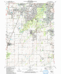
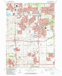
 1990 Frankfort1991 Print · USGSWill County's transition from prairie farmland to suburban community is captured here as the nineties approached. Genealogists and local historians can trace family plots at St Peters Cem and Union Cem, or follow the path of the Old Indian Boundary.
 - 1990 Map of Beecher West, 1991 Print
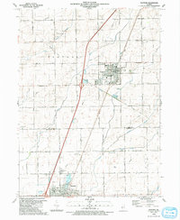
 1990 Beecher West1991 Print · USGSEastern Will County and northern Kankakee County are shown here as the nineteenth-century farm grid met late-century infrastructure. Genealogists can locate family sites near Heusing Cem, St Pauls Ch, or the small rail-side community of Sollitt.
 - 1990 Map of Beecher East, 1991 Print
 1990 Beecher East1991 Print · USGSThe Illinois-Indiana borderlands are captured here in the late twentieth century, showing a landscape of small farming communities and country roads. Genealogists and researchers can locate St Pauls Ch, trace the Old Railroad Grade, and find quiet cemeteries like Brunswick Cem.
 - 1990 Map of Wilton Center, 1991 Print
 1990 Wilton Center1991 Print · USGSWilton Center and the surrounding townships of Peotone and Rockville are captured here in the late twentieth century. Genealogists can locate family sites at the Wilton Center Cem and West Peotone Cem or trace the Old Railroad Grade near Andres.
 - 1991 Map of Ottawa
 1991 Ottawa1991 Print · USGSNorth-central Illinois in the early nineties remains a vital corridor of river commerce and heavy rail. Genealogists and historians can trace the legacy of industrial mining near Morris or explore the river-bluff geography of Starved Rock State Park and Buffalo Rock.
 - 1991 Map of Kankakee
 1991 Kankakee1991 Print · USGSThe Illinois-Indiana borderlands come into focus during the early nineties, centered on the growing Kankakee valley and its sprawling drainage systems. Trace the rail-and-river economy through landmarks like the Wilton Railroad Grade, the Manteno State Hospital, and the historic Old Pioneer Cem.
 - 1993 Map of Tinley Park
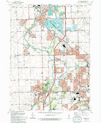
 1993 Tinley Park1993 Print · USGSSuburban development sweeps across the Cook and Will County line in the early nineties, revealing a landscape of rapid growth and community expansion. Genealogists and local historians can trace family-named sites like Hickory Cem and Frankfort Cem or find vanished landmarks like the Drive-in Theater.
 - 1993 Map of Sag Bridge
 1993 Sag Bridge1993 Print · USGSCook County and the surrounding forest preserves appear in high detail during the early nineties as suburban expansion met historic industrial waterways. Researchers can trace the legacy of the region through landmarks like Fairmount Cemetery, Hastings, and the Chicago Sanitary and Ship Canal.
 - 1993 Map of Wilmington, 1994 Print
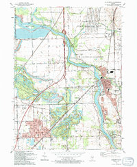 1993 Wilmington1994 Print · USGSThe Kankakee River valley in the early nineties shows a landscape defined by industrial legacy and conservation efforts. Researchers can locate family landmarks like Mt Olive Cem and trace the rail sidings at Hitts Siding and Webster Siding.
 - 1993 Map of Aurora South, 1994 Print
 1993 Aurora South1994 Print · USGSThe Fox River corridor shows significant suburban growth in the early nineties as residential developments expand around Oswego. Genealogists and local historians can trace family sites at Oswego Prairie Cemetery and the small settlement of Wolfs.
 - 1993 Map of Joliet, 1994 Print
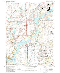
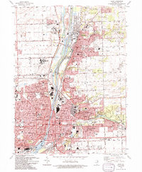 1993 Joliet1994 Print · USGSJoliet and Lockport are shown at a peak of industrial and institutional development in the early 1990s. Researchers can trace historic cemeteries like Mt Olivet Cemetery or the footprints of the Stateville Correctional Center and the Lockport Locks.
 - 1993 Map of Mokena, 1994 Print
 1993 Mokena1994 Print · USGSSuburban development meets historic township borders in this early nineties survey of Will County. Genealogists and historians can trace family plots at Brooks Cem and St Marys Cem or locate the village of Marley along the rail line.
 - 1993 Map of Symerton, 1994 Print
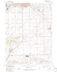
 1993 Symerton1994 Print · USGSWill County agriculture meets military history in the early nineties as the vast Joliet Ammunitions Plant borders rural township life. Trace family roots and vanished rail lines near Symerton, Ritchie, and the Star Grove Cem.
 - 1993 Map of Minooka, 1994 Print
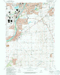
 1993 Minooka1994 Print · USGSMinooka and its river-bound neighbors appear here in the early nineties, showing a landscape defined by massive industrial works and deep prairie roots. Trace the intersection of old and new through the Dresden Station Nuclear Powerplant, the Illinois and Michigan Canal State Trail, and St Marys Cem.
 - 1993 Map of Romeoville, 1994 Print
 1993 Romeoville1994 Print · USGSThe suburbs of Will and DuPage counties show significant growth in the early nineties as residential neighborhoods expand near the industrial canal corridor. Genealogists can locate Resurrection Cemetery and Alexander Cem, while historians can trace the paths of the Atchison Topeka and Santa Fe RR through Romeo.
 - 1993 Map of Yorkville SE, 1994 Print
 1993 Yorkville SE1994 Print · USGSKendall and Will counties maintain their rural character in the early nineties, defined by the winding branches of the Aux Sable. Trace local genealogy at the Naausay Cem or follow the historic Indian Reservation Boundary through Seward and Naausay.
 - 1993 Map of Plainfield, 1994 Print
 1993 Plainfield1994 Print · USGSWill County in the early nineties shows a landscape of suburban growth and preserved river corridors north of Joliet. Researchers can locate family sites at Plainfield Cemetery, trace the Du Page River, or find the Servant of Mary Convent.
 - 1993 Map of Normantown, 1994 Print
 1993 Normantown1994 Print · USGSWill County’s transition from prairie farmland to bustling suburban corridor is captured here in the early nineties. Genealogists and local researchers can trace family landmarks like Vermont Cem, the Wheatland-Salem Ch, and the rail lines of the Elgin Joliet and Eastern RR.
 - 1993 Map of Channahon, 1994 Print
 1993 Channahon1994 Print · USGSThe industrial and natural landscapes of Channahon and Minooka meet in the 1990s at the river forks. Genealogists and historians can trace family-named sites like Troutman Grove Cem alongside the sprawling Joliet Ammunitions Plant.
 - 1993 Map of Elwood, 1994 Print
 1993 Elwood1994 Print · USGSSouth of Joliet in the early nineties, this area showcases the heavy industrial and military infrastructure surrounding the village of Elwood. Genealogists and historians can locate Brown Cem, Oak Villa Sch, and the sprawling Joliet Ammunitions Plant.
 - 1997 Map of Sag Bridge, 1999 Print
 1997 Sag Bridge1999 Print · USGSCook and DuPage Counties are shown in the late 1990s, where industrial engineering meets the expansive forest preserves of the Des Plaines River valley. Researchers can trace the layout of the Argonne National Laboratory Reservation and historic sites like St James Ch or Hastings.
Showing maps 1-25 of 35
Top cities of Will County
- Joliet historical maps
- Bolingbrook historical maps
- Romeoville historical maps
- New Lenox historical maps
- Homer Glen historical maps
- Lockport historical maps
See more
Frequently asked questions
- What are the different types of historical maps available for Will County?
- What is the oldest map of Will County?
- Where can I purchase historical maps of Will County for my home or office?
- Where can I download high-res historical maps of Will County?
- Are there historical topographic maps available for Will County?
- Is there historical aerial imagery available for Will County?
- Where are historical maps of Will County sourced from?