Old Maps of Will County, Illinois for Hiking & Exploration
Hike through history with 224 historic maps of Will County. Explore old trails, ghost towns, and forgotten backroads — perfect for outdoor adventurers and local explorers.
- Rediscover forgotten places: Map out old mining camps, roads, and footpaths that no longer exist on modern maps.
- Layer with modern tools: Combine with LiDAR or satellite views to plan hikes through historical terrain.
- Made for exploration: Popular among hikers, overlanders, and local history lovers.
Use these maps to find adventure and explore the hidden past of Will County.
Will County, IL maps
(224)- 1890 Map of Des Plaines
 1890 Des Plaines1890 Print · USGSThe Des Plaines valley and southern Cook County are shown here in the late nineteenth century as a hub of canal and rail transit. Genealogists can trace family roots in early settlements like Lemont, Orland, and Mokena or locate vanished stops like Johnston Station.
 - 1892 Map of Morris
 1892 Morris1892 Print · USGSGrundy County thrives as a transportation nexus in the 1890s, where the legendary canal system meets a growing web of iron rails. Trace early industrial footprints in Coal City or follow the path of the Illinois and Michigan Canal through Morris.3 unique versions available
 - 1892 Map of Joliet
 1892 Joliet1892 Print · USGSWill County at the end of the nineteenth century was a bustling intersection of canal trade and heavy rail. Genealogists can trace the early streets of Joliet and Lockport or locate long-standing rural landmarks like Caton Farm and Grinton.6 unique versions available
 - 1892 Map of Wilmington
 1892 Wilmington1892 Print · USGSWill County at the end of the nineteenth century is defined by its strategic river confluences and a rapidly expanding rail network. Genealogists and local historians can trace the early footprints of Wilmington and Braidwood, or find vanished rail stops like Blodget and Drummond.3 unique versions available
 - 1894 Map of Des Plaines
 1894 Des Plaines1894 Print · USGSCook and Will counties in the 1890s are defined by the convergence of major rail lines and early waterway transit. Genealogists and historians can trace the foundations of Lemont, Mokena, and New Lenox along lines like the Wabash R. R. and the Illinois and Michigan Canal.
 - 1900 Map of Des Plaines
 1900 Des Plaines1900 Print · USGSCook and Will counties at the turn of the century reveal a landscape of massive canal engineering and burgeoning railroad junctions. Researchers can trace ancestral farmsteads and old station stops from Sag Bridge Sta. to the early streets of Tinley Park and Mokena.
 - 1901 Map of Des Plaines
 1901 Des Plaines1901 Print · USGSCook and Will County communities thrive along a dense network of nineteenth-century canals and rail lines. Genealogists and local historians can trace early property patterns and rail stops in Willow Springs, Tinley Park, and Gooding's Grove.5 unique versions available
 - 1918 Map of Wilmington
 1918 Wilmington1918 Print · USGSWill County in the late teens is a landscape shaped by the convergence of major rivers and several historic rail lines. Genealogists and historians can trace numerous rural schoolhouses like Red Brick School and Schweizer School alongside river towns such as Wilmington and Channahon.5 unique versions available
 - 1918 Map of Morris
 1918 Morris1918 Print · USGSGrundy County at the end of the Great War is a landscape defined by the Illinois River and a bustling coal industry. Researchers can trace historic school districts like Jugtown School, the path of the Michigan and Illinois Canal, and early mining settlements such as Carbon Hill and Eileen.3 unique versions available
 - 1923 Map of Joliet
 1923 Joliet1923 Print · USGSJoliet and the Des Plaines River valley are shown here in the 1920s, a hub of heavy industry and vital shipping canals. Genealogists and local historians can trace family roots through numerous country schools like Spaulding School, the Du Page Church, and the expansive State Penitentiary Farm.5 unique versions available
 - 1923 Map of Herscher, 1959 Print
 1923 Herscher1959 Print · USGSKankakee and Will Counties in the early twenties show a landscape defined by busy rail junctions and a dense network of rural school districts. Genealogists and researchers can locate family-named landmarks and infrastructure like the Lehigh Stone Co Quarry, Appel Siding, and Essex Center School.2 unique versions available
 - 1925 Map of Yorkville
 1925 Yorkville1925 Print · USGSKendall County in the mid-twenties shows a landscape of river-valley commerce and a dense network of interurban electric rail lines. Genealogists can locate family-named schoolhouses like Tamarack School and rural hubs such as Platteville and Helmar.2 unique versions available
 - 1925 Map of Herscher
 1925 Herscher1925 Print · USGSKankakee and Grundy counties appear here during the 1920s as a thriving corridor of railroads and rural schools. Genealogists can trace family names through landmarks like Yates School, Clarke City, and the Lehigh Stone Co Quarry.2 unique versions available
 - 1928 Map of Sag Bridge
 1928 Sag Bridge1928 Print · USGSThe Des Plaines valley in the late 1920s reveals a complex network of canals and railways connecting Lemont and Willow Springs. Trace early twentieth-century landmarks like Visitation Boys Camp, Fairmont Cemetery, and the Derby School.4 unique versions available
 - 1929 Map of Tinley Park
 1929 Tinley Park1929 Print · USGSThe Cook and Will County borderlands appear here in the late twenties, showing the early suburban footprints of Tinley Park and Orland Park. Researchers can trace rural school locations like Sedan Prairie School or family sites near the Frankfort Cemetery.3 unique versions available
 - 1929 Map of Brisbane
 1929 Brisbane1929 Print · USGSWill County’s rural prairie was a nexus of steam rail traffic in the late twenties, centered on the village of Brisbane. Genealogists and rail historians can trace the paths of the Michigan Central and Wabash lines alongside local landmarks like Murphy Sch.2 unique versions available
 - 1929 Map of Mokena
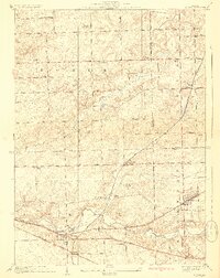 1929 Mokena1929 Print · USGSWill County's rural landscape is captured here in the late 1920s, when small schoolhouses and railroads defined the community. Researchers can trace family history at Brooks Cemetery or follow the Wabash tracks through Hadley and Alpine.3 unique versions available
 - 1929 Map of Dyer, 1946 Print
 1929 Dyer1946 Print · USGSThe industrial suburbs and agricultural lands of the Illinois-Indiana border are captured here in the late 1920s. Researchers can trace the path of the Lincoln Highway and locate long-standing landmarks like the Cats Corner School or Strassburg School.
 - 1930 Map of Dyer
 1930 Dyer1930 Print · USGSThe Illinois-Indiana borderlands appear in the late twenties during a period of industrial and automotive growth. Genealogists and local historians can trace early schoolhouse locations like Cats Corner School and the path of the famous Lincoln Highway near Dyer.
 - 1930 Map of Frankfort
 1930 Frankfort1930 Print · USGSThe village of Frankfort sits at the junction of the Elgin, Joliet, and Eastern and the historic Sauk Trail in the late twenties. Trace local history at the Washington Royal School, Rahm School, and Pleasant Hill Cem.2 unique versions available
 - 1930 Map of Steger
 1930 Steger1930 Print · USGSThe southern outskirts of Chicago thrived as a rail and industrial nexus in the late twenties. Genealogists and historians can trace the early footprints of South Chicago Heights and Matteson, locating landmarks like St Annes Church and the Calvary Cemetery.2 unique versions available
 - 1949 Map of Peotone
 1949 Peotone1949 Print · USGSWill County’s rural townships are captured in the late 1940s, a period of transition for its railroad hubs and farming communities. Genealogists can locate family-named landmarks and country schools like Fivemile Grove Sch, Pfundstein Sch, and the St Peter Cem.2 unique versions available
 - 1949 Map of Crete
 1949 Crete1949 Print · USGSWill County and the surrounding borderlands are captured here in the late 1940s as a busy intersection of rail and road. Genealogists can locate dozens of country schools and churches like Beebe Grove Sch, St Annes Ch, and Crete Cem.
 - 1953 Map of Tinley Park, 1955 Print
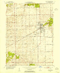 1953 Tinley Park1955 Print · USGSThe Cook and Will County border areas are shown here during the early fifties growth of Tinley Park and Orland Park. Researchers can find family-named landmarks like Hickory Cem and long-standing schools such as Summit Hill Sch and Kirby Sch.
 - 1953 Map of Mokena, 1955 Print
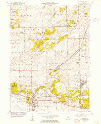 1953 Mokena1955 Print · USGSWill County's agricultural heartland is captured mid-century as the rail-centered towns of Mokena and New Lenox began to expand. Genealogists and historians can locate numerous rural landmarks, including St Johns Cem, the Wabash railroad, and Wells Corner Sch.
Showing maps 1-25 of 224
Top cities of Will County
- Joliet historical maps
- Bolingbrook historical maps
- Romeoville historical maps
- New Lenox historical maps
- Homer Glen historical maps
- Lockport historical maps
See more
Frequently asked questions
- What are the different types of historical maps available for Will County?
- What is the oldest map of Will County?
- Where can I purchase historical maps of Will County for my home or office?
- Where can I download high-res historical maps of Will County?
- Are there historical topographic maps available for Will County?
- Is there historical aerial imagery available for Will County?
- Where are historical maps of Will County sourced from?