2020s Maps of Gibson County, Indiana
Explore 22 historic maps of Gibson County from the 2020s. These maps offer a rare glimpse into what life looked like during the 2020s — showing old roads, neighborhoods, homes, and landmarks that have changed or disappeared over time.
Whether you're researching your family's past, planning a metal detecting trip, or studying how Gibson County's landscape evolved across the 2020s, these high-resolution maps are a powerful tool for exploring the history of this region.
- Focus on a specific era: All maps on this page are from the 2020s, giving you a focused view of this time period.
- See what’s changed: Compare century-old streets, trails, and buildings to today's modern landscape using overlays and satellite layers.
- Research with precision: Use these maps for genealogy, historical research, land use analysis, or educational projects.
- View, download, or print: Maps are fully viewable online in high resolution, and can be downloaded or printed for your own records.
Start exploring Gibson County's history through authentic maps from the 2020s. This is your window into the past.
Gibson County, IN maps
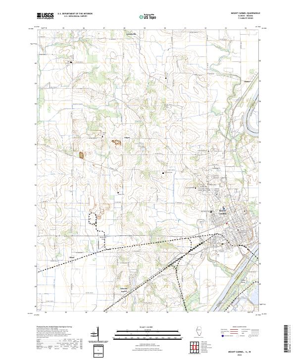
(22)- 2021 Map of Mount Carmel, 2021 Print
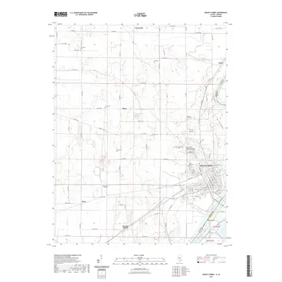 2021 Mount Carmel2021 Print · USGSCovers Gibson County, including Mount Carmel, White River, and other nearby areas
 - 2021 Map of Keensburg, 2021 Print
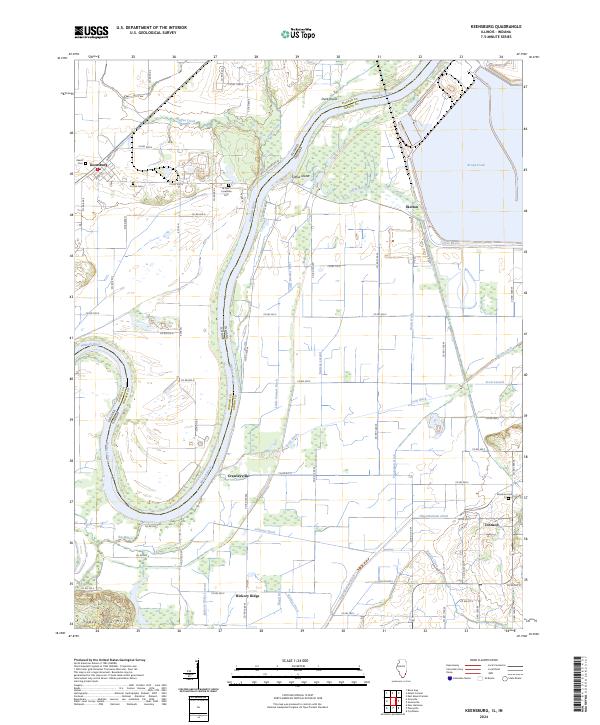
 2021 Keensburg2021 Print · USGSCovers Gibson County, including Keensburg, Rochester, and other nearby areas
 - 2021 Map of Grayville, 2021 Print
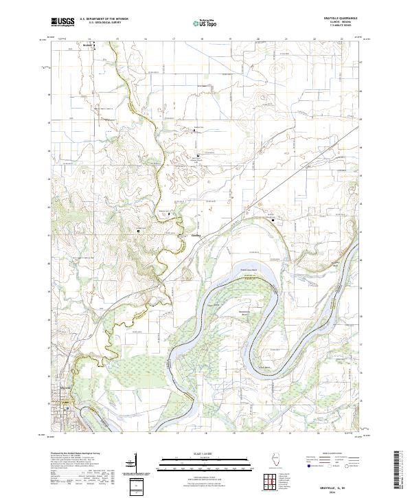
 2021 Grayville2021 Print · USGSCovers Gibson County, including Grayville, Browns, and other nearby areas
 - 2022 Map of Decker, 2022 Print
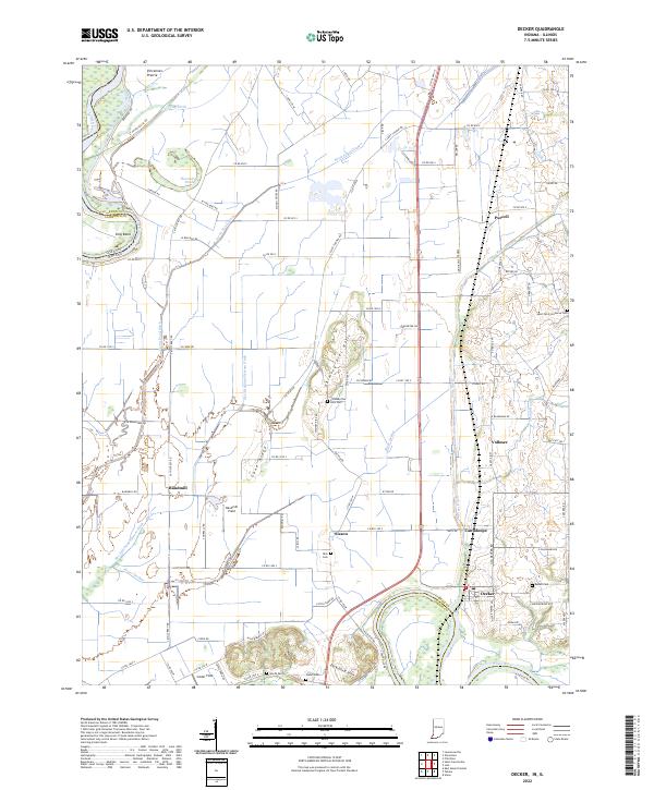 2022 Decker2022 Print · USGSSouthern Knox County at the turn of the 2020s shows a landscape of river-fed agriculture and small crossroads settlements. Genealogists can locate family burial grounds like Dick Cem and Warth Cem or trace the rail-and-river geography of Decker and Purcell.
 - 2022 Map of Patoka, 2022 Print
 2022 Patoka2022 Print · USGSIndiana's river bottomlands are captured here in the early twenty-first century as the White River and Patoka River converge. Researchers can locate numerous family burial grounds like Milburn Cem and Hitch Cem, or trace landmarks like Hull Airport and Bald Hill.
 - 2022 Map of Owensville, 2022 Print
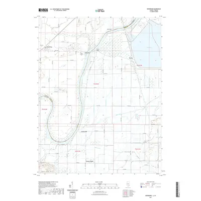
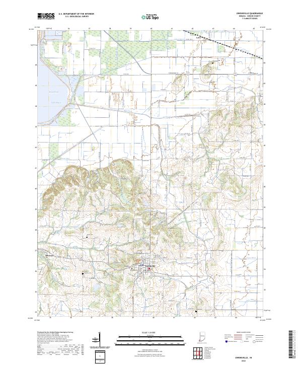 2022 Owensville2022 Print · USGSSouthern Gibson County is documented here in the early twenty-first century, showing the established agricultural grid around Owensville. Researchers can trace local heritage through numerous burial sites like Mauck Cem and the historic settlement of Lyles.
 - 2022 Map of Princeton, 2022 Print
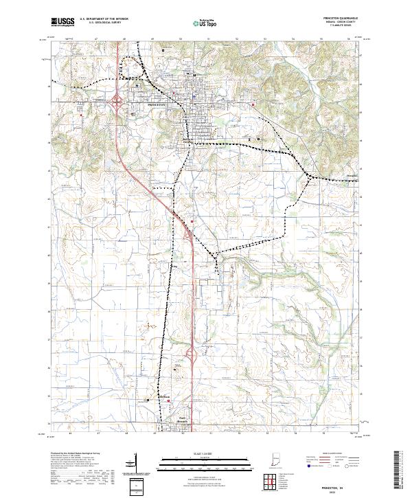 2022 Princeton2022 Print · USGSGibson County at the start of the 2020s shows a landscape of established towns and rural farmsteads tied together by historic drainages. Genealogists can locate family sites at Walnut Hill Cem or Odd Fellows Cem and trace the civic center around the Gibson County Courthouse.
 - 2022 Map of Iona, 2022 Print
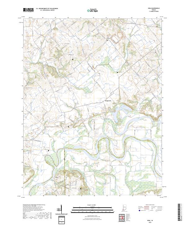 2022 Iona2022 Print · USGSThe rural borders of Knox, Gibson, and Pike counties come into focus in this contemporary survey of the White River valley. Genealogists can locate numerous historic burial sites such as Odd Fellows Cem and Saint Peter Lutheran Cem near the settlements of Iona and Giro.
 - 2022 Map of Poseyville, 2022 Print
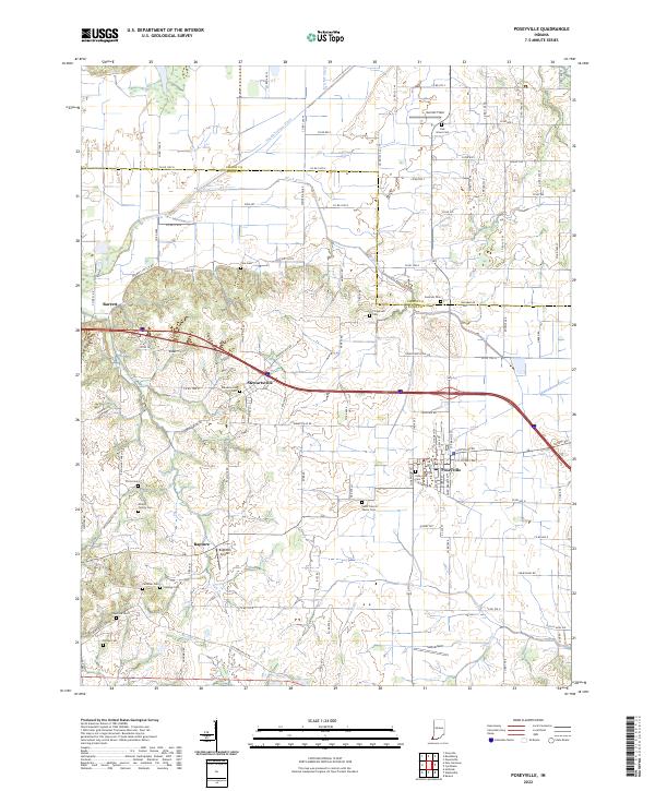 2022 Poseyville2022 Print · USGSThe Indiana countryside near Poseyville and Stewartsville is captured here in the early 2020s, showing a landscape defined by generational farms and rural hamlets. Researchers can trace local lineage through numerous sites like Oak Grove Cem, Cale Cem, and the small airstrip at Bugtown Airport.
 - 2022 Map of Oakland City, 2022 Print
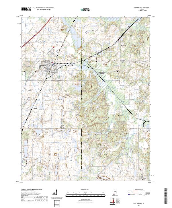 2022 Oakland City2022 Print · USGSOakland City and the surrounding Gibson County coal and farm lands are captured here in the early twenty-first century. Genealogists can trace family names across Montgomery Cem and Union Cem or locate the historic Old McCullough Mine.
 - 2022 Map of Francisco, 2022 Print
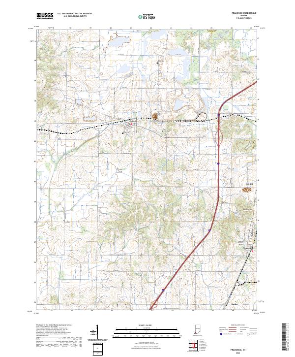 2022 Francisco2022 Print · USGSGibson County in the early twenty-first century reveals a landscape where organized township grids meet winding waterways like Halfmoon Cr. Genealogists and local historians can pinpoint the IOOF Cem and explore the rural outskirts of Francisco, Somerville, and Mackey.
 - 2022 Map of Union, 2022 Print
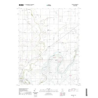
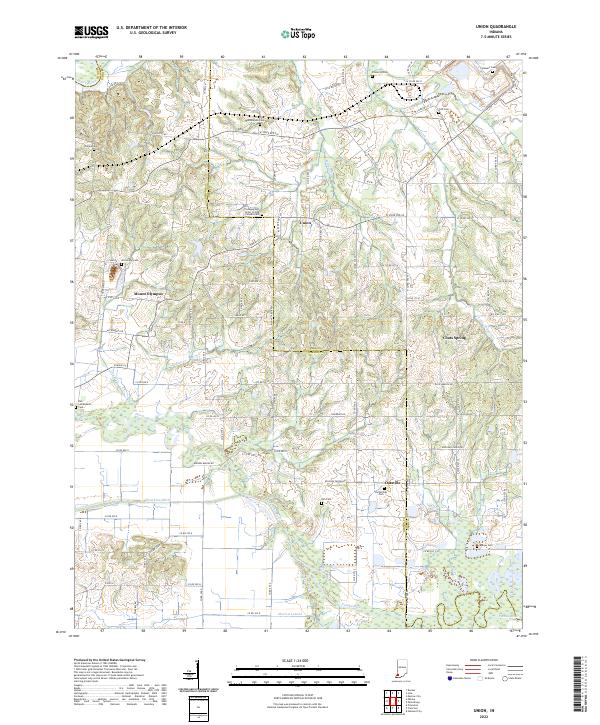 2022 Union2022 Print · USGSIndiana's Gibson and Pike counties meet along the meandering Patoka River in this detailed modern topographic survey. Researchers can locate numerous historic burial grounds including Bethlehem Cem, Frederick Cem, and the Richardson Cem while tracing the rural settlements of Union and Oatsville.
 - 2022 Map of East Mount Carmel, 2022 Print
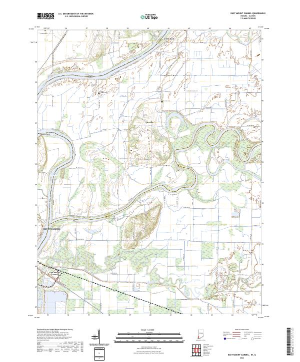 2022 East Mount Carmel2022 Print · USGSThe Indiana-Illinois borderlands come into focus in this recent survey of the Wabash and White River confluence. Genealogists and local researchers can trace the vicinity of East Mount Carmel and find landmarks like Scott Chapel Cem, Hanging Rock, and Orrville.
 - 2022 Map of New Harmony, 2022 Print
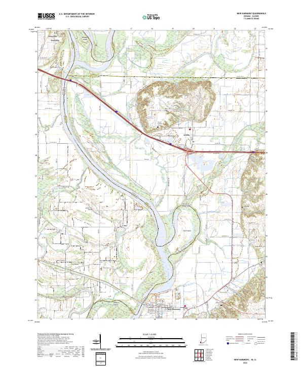 2022 New Harmony2022 Print · USGSThe Illinois-Indiana borderlands along the Wabash River are captured here in the early twenty-first century, showing a landscape shaped by shifting waters and historic town sites. Researchers can trace family roots at Mount Pleasant Cem or explore the river's path around Bull Island and Ribeyre Island.
 - 2022 Map of Haubstadt, 2022 Print
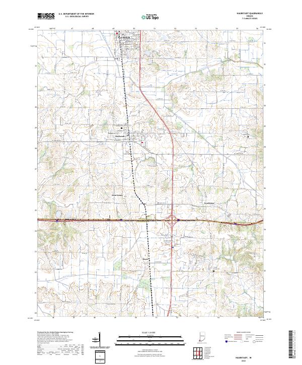 2022 Haubstadt2022 Print · USGSGibson and Vanderburgh counties are shown in this modern survey of southwestern Indiana's farming heartland. Genealogists can locate legacy sites like Saints Peter and Paul Cem and Trinity Parish Cem near the historic CSX rail line.
 - 2022 Map of Elberfeld, 2022 Print
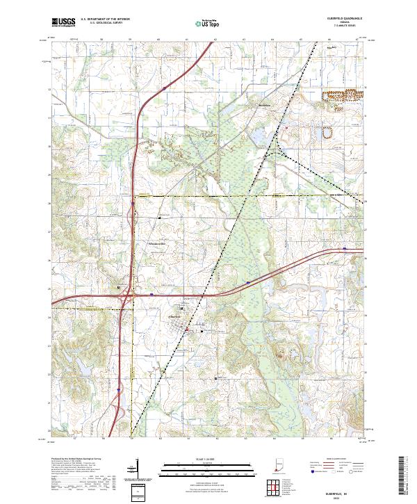 2022 Elberfeld2022 Print · USGSElberfeld and the tri-county borderlands of Gibson, Warrick, and Vanderburgh appear here in the early twenty-first century. Researchers can trace the path of the Wabash and Erie Canal and locate several burial grounds like Northview Cem and Susett Cem.
 - 2022 Map of Cynthiana, 2022 Print
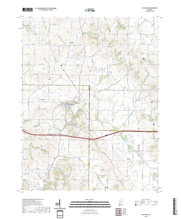 2022 Cynthiana2022 Print · USGSThe crossroads of Posey and Gibson counties come into focus in the early 2020s, centered on the historic town of Cynthiana. Researchers can trace ancestral roots through several local burial sites like Mount Moriah Cem and Benson Cem or locate rural hamlets such as Mounts and Nisbet.
 - 2022 Map of Petersburg, 2022 Print
 2022 Petersburg2022 Print · USGSPike County comes into focus in this recent survey, showcasing the hub of Petersburg and its surrounding river lowlands. Genealogists can locate over a dozen burial sites including Indian Mound Cem and Old Town Cem near West Petersburg.
 - 2023 Map of Lynnville, 2023 Print
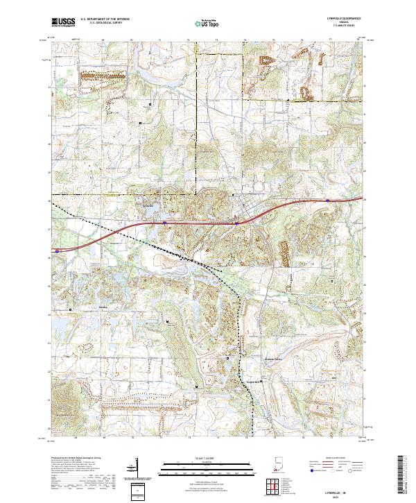 2023 Lynnville2023 Print · USGSModern Warrick County settlement patterns emerge around Lynnville in this recent survey. Local historians can trace family roots through numerous burial sites like Mount Olive Cem and Saint Pauls Cem or locate rural hamlets like Eby and Stanley.
 - 2024 Map of Mount Carmel, 2024 Print
 2024 Mount Carmel2024 Print · USGSThe Illinois-Indiana border comes alive in the mid-2020s, showing the settled grid of Mount Carmel alongside the Wabash River. Genealogists can trace family landmarks like Rose Hill Cem and the rural crossroads of Friendsville.
 - 2024 Map of Keensburg, 2024 Print
 2024 Keensburg2024 Print · USGSThe Wabash River borderlands of Illinois and Indiana come into sharp focus in this detailed modern survey. Genealogists and local historians can trace family locations near Keensburg and Johnson, or locate burial grounds such as Coffee Cem and Maumee Cem.
 - 2024 Map of Grayville, 2024 Print
 2024 Grayville2024 Print · USGSThe Illinois-Indiana borderlands come alive in this detailed look at the Wabash River valley near the turn of the decade. Genealogists and local historians can trace rural roots through the locations of Saint Johns Lutheran Church Cem, Wheeler Cem, and the river hamlets of Cowling and Grayville.
End of results
Showing maps 1-22 of 22
Top cities of Gibson County
- Princeton historical maps
- Johnson historical maps
- Oakland City historical maps
- Fort Branch historical maps
- White River historical maps
- Haubstadt historical maps
See more
Frequently asked questions
- What are the different types of historical maps available for Gibson County?
- What is the oldest map of Gibson County?
- Where can I purchase historical maps of Gibson County for my home or office?
- Where can I download high-res historical maps of Gibson County?
- Are there historical topographic maps available for Gibson County?
- Is there historical aerial imagery available for Gibson County?
- Where are historical maps of Gibson County sourced from?