2020s Maps of Lake County, Indiana
Explore 26 historic maps of Lake County from the 2020s. These maps offer a rare glimpse into what life looked like during the 2020s — showing old roads, neighborhoods, homes, and landmarks that have changed or disappeared over time.
Whether you're researching your family's past, planning a metal detecting trip, or studying how Lake County's landscape evolved across the 2020s, these high-resolution maps are a powerful tool for exploring the history of this region.
- Focus on a specific era: All maps on this page are from the 2020s, giving you a focused view of this time period.
- See what’s changed: Compare century-old streets, trails, and buildings to today's modern landscape using overlays and satellite layers.
- Research with precision: Use these maps for genealogy, historical research, land use analysis, or educational projects.
- View, download, or print: Maps are fully viewable online in high resolution, and can be downloaded or printed for your own records.
Start exploring Lake County's history through authentic maps from the 2020s. This is your window into the past.
Lake County, IN maps
(26)- 2021 Map of Beecher East, 2021 Print
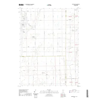 2021 Beecher East2021 Print · USGSCovers Lake County, including Beecher, Grant Park, and other nearby areas
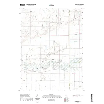
 - 2021 Map of Lake Calumet, 2021 Print
 2021 Lake Calumet2021 Print · USGSCovers Lake County, including Chicago, Hammond, and other nearby areas
 - 2021 Map of Illiana Heights, 2021 Print
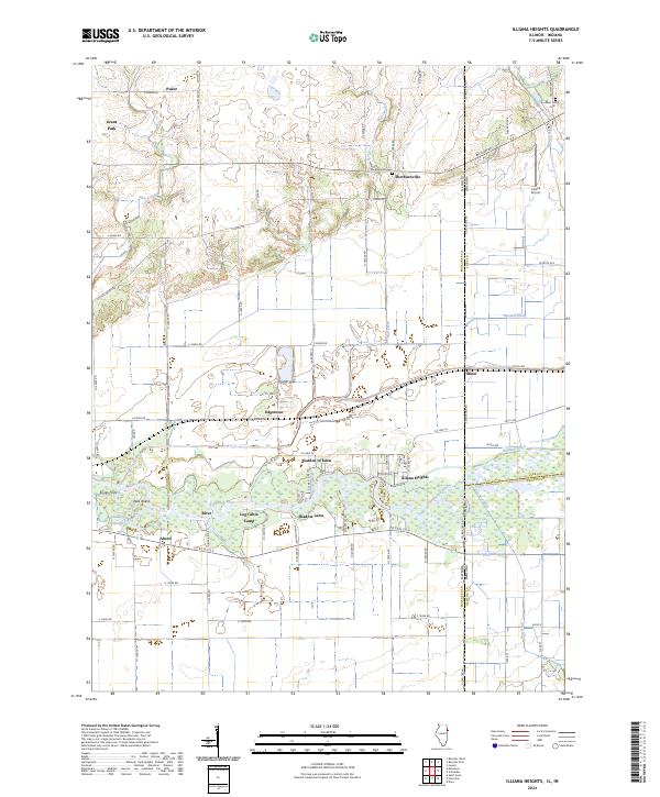
 2021 Illiana Heights2021 Print · USGSCovers Lake County, including Grant Park, Shadow Lawn, and other nearby areas
 - 2021 Map of Jackson Park, 2021 Print
 2021 Jackson Park2021 Print · USGSCovers Lake County, including Chicago, Lake Township, and other nearby areas
 - 2021 Map of Calumet City, 2021 Print
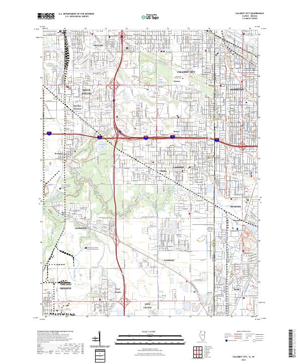
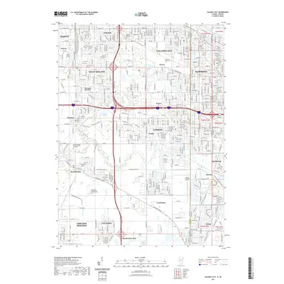 2021 Calumet City2021 Print · USGSCovers Lake County, including Hammond, Calumet City, and other nearby areas
 - 2022 Map of Gary OE N, 2022 Print
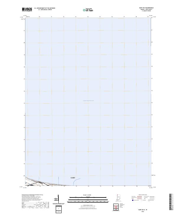 2022 Gary OE N2022 Print · USGSThe Indiana shoreline and the northern edge of the industrial lakefront are captured here in the early 2020s. Researchers can trace the coastal boundary of Gary where it meets the waters of Lake Michigan near the corner of T37N R8W.
 - 2022 Map of Leroy, 2022 Print
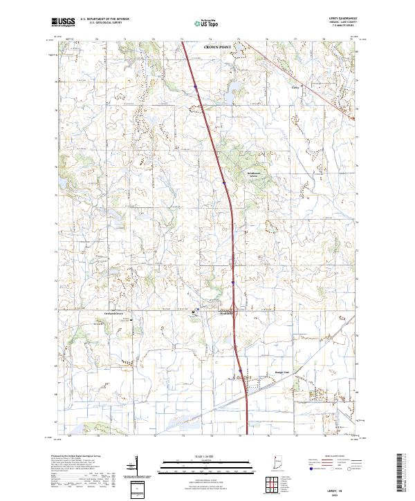 2022 Leroy2022 Print · USGSSouthern Lake County's agricultural heartland is documented here in the early twenty-first century. Genealogists and local historians can trace the rural communities of Leroy, Dinwiddie, and Orchard Grove, alongside family landmarks like Plum Grove Cem.
 - 2022 Map of Dyer, 2022 Print
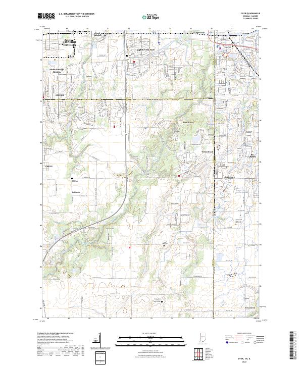 2022 Dyer2022 Print · USGSModern Northwest Indiana and suburban Illinois converge in this 2022 survey where developing residential grids meet historic rural landmarks. Researchers can trace family sites at Saint Joseph Cem and explore the legacy of local hamlets like Kreitzburg and Faithorn.
 - 2022 Map of Whiting, 2022 Print
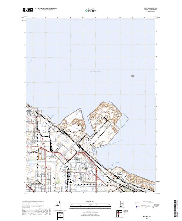 2022 Whiting2022 Print · USGSThe industrial lakefront of Northwest Indiana is captured in this recent survey, showcasing the dense urban and shipping network along Lake Michigan. Local historians can trace the paths of the Indiana Harbor Canal and find landmarks like Buffington and the Calumet College of Saint Joseph.
 - 2022 Map of Gary, 2022 Print
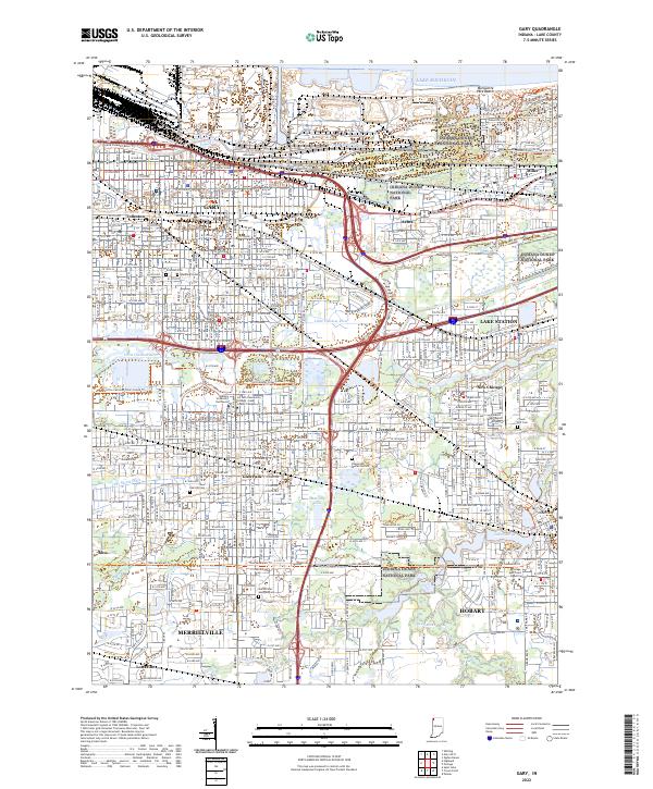 2022 Gary2022 Print · USGSThe industrial and lakeside landscapes of Northwest Indiana are captured here in the early 2020s, from the Lake Michigan shore to Hobart. Researchers can trace urban change and community landmarks like Oak Hill Cem, Hobart Sky Ranch Airport, and the protected reaches of Indiana Dunes National Park.
 - 2022 Map of Highland, 2022 Print
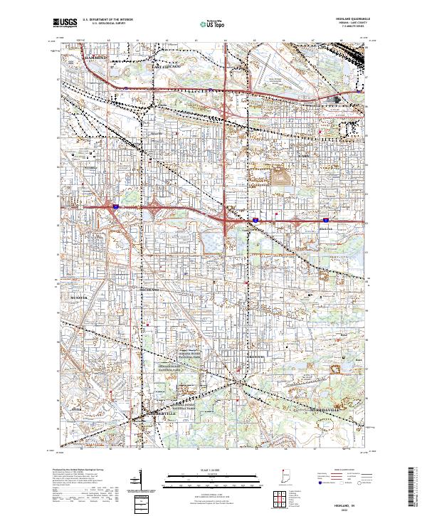 2022 Highland2022 Print · USGSThis Northwest Indiana industrial corridor comes to life in the early 2020s, showcasing the dense settlement between the Calumet rivers. Genealogists can locate family sites at Saint Marys Cem or Ridgelawn Cem, while others trace the Erie Lackawanna Cross Town Trl.
 - 2022 Map of Shelby, 2022 Print
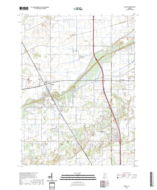 2022 Shelby2022 Print · USGSThe Kankakee River lowlands of Lake and Newton counties appear here in the early twenty-first century, showing a landscape defined by industrial-scale drainage and small-town roots. Researchers can trace the layout of Shelby, locate the Roselawn Cem, or follow the path of the historic Monon Rd.
 - 2022 Map of DeMotte, 2022 Print
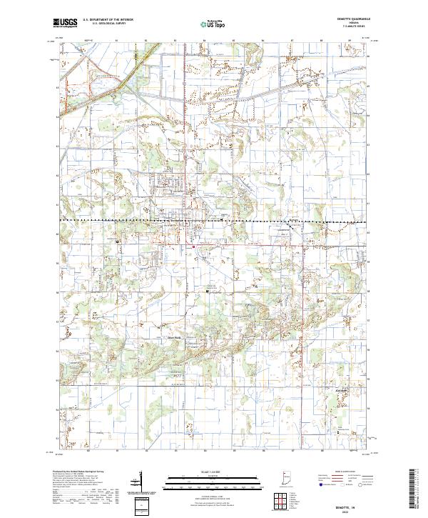 2022 DeMotte2022 Print · USGSJasper County agricultural life and the engineered landscape of the Kankakee Valley are shown here in the early 2020s. Researchers can locate family sites at Holland Cem or Faith Lutheran Cem and trace water management across Hodge Ditch and Wesner Ditch.
 - 2022 Map of Ogden Dunes, 2022 Print
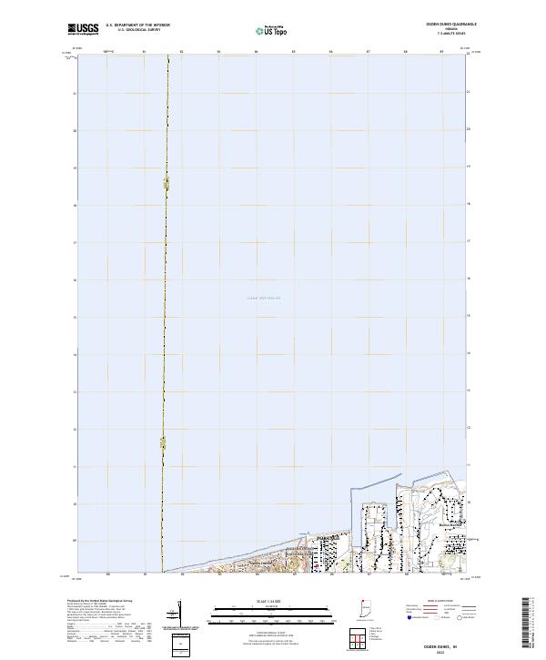 2022 Ogden Dunes2022 Print · USGSThe Indiana shoreline at the start of the 2020s shows a complex balance between massive industry and protected lakefront. Genealogists and local historians can trace the residential streets of Ogden Dunes or locate the sprawling footprints of Midwest Steel and Mittal Steel.
 - 2022 Map of Schneider, 2022 Print
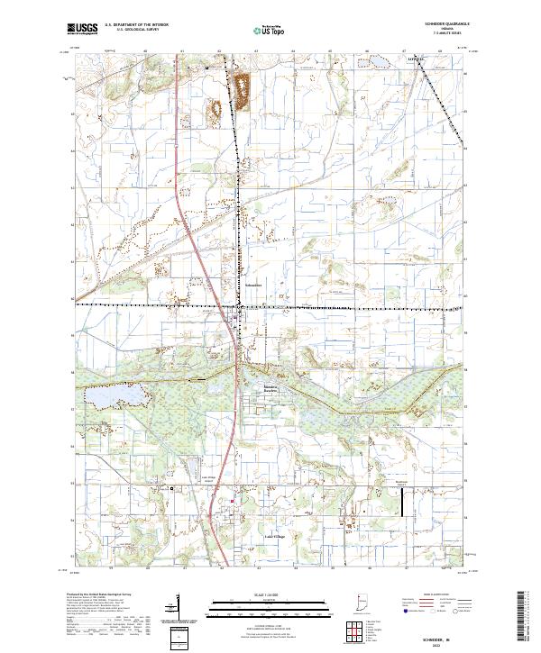 2022 Schneider2022 Print · USGSNorthwest Indiana's marshy lowlands are mapped here in the early 2020s, showing the intersection of agricultural engineering and rural settlement. Genealogists can locate Sanders Cem and Lake Village Cem among the many drainage works like Singleton Ditch.
 - 2022 Map of Portage, 2022 Print
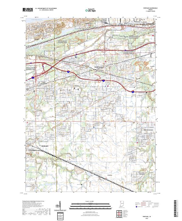 2022 Portage2022 Print · USGSThe industrial corridor of Northwest Indiana is captured here as it meets the preserved lakefront. Researchers can trace the development of Portage and Lake Station, locating historic sites like McCool Cem and the Flying M Airport.
 - 2022 Map of Saint John, 2022 Print
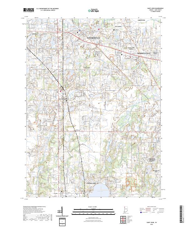 2022 Saint John2022 Print · USGSLake County suburban growth meets historic corridors in the modern era between St. John and Crown Point. Genealogists and local historians can trace legacy sites like the Hack Family Cem and follow the route of the Old Lincoln Hwy.
 - 2022 Map of Palmer, 2022 Print
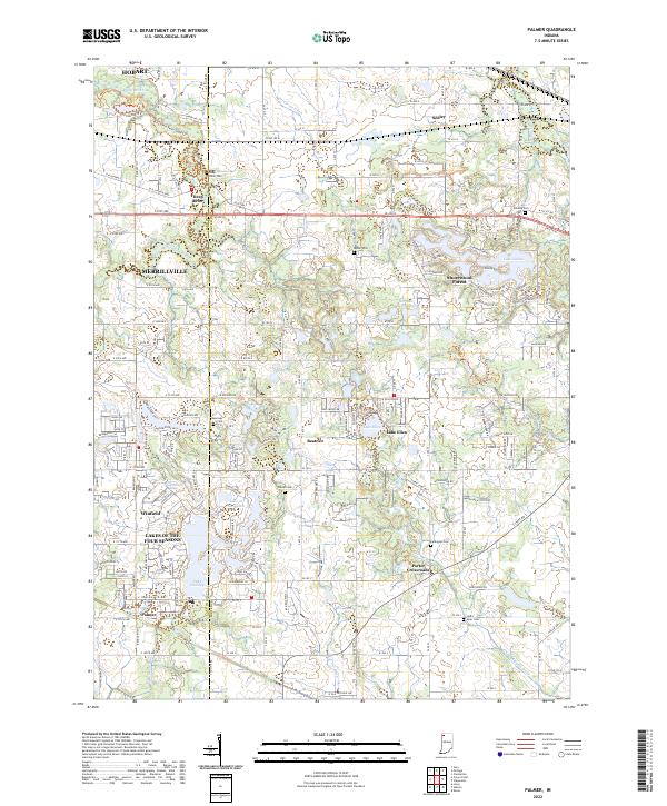 2022 Palmer2022 Print · USGSPorter County's shifting landscape between the early suburban expansion and rural drainage districts is captured here in the early 2020s. Genealogists and local historians can trace family plots at Deep River Cem or explore the growth of Winfield and Shorewood Forest.
 - 2022 Map of Lowell, 2022 Print
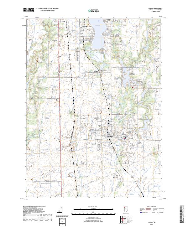 2022 Lowell2022 Print · USGSSouthern Lake County at the start of the 2020s shows a landscape of established towns and growing lakefront communities. Genealogists and local historians can trace family plots at German Methodist Episcopal Cem or Lowell Memorial Cem and locate landmarks like Wietbrock Airport.
 - 2022 Map of Crown Point, 2022 Print
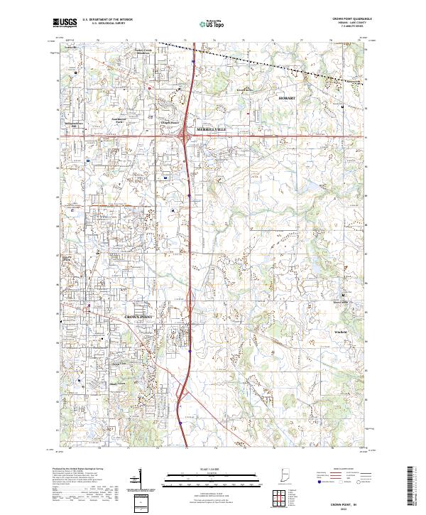 2022 Crown Point2022 Print · USGSThe suburban expansion and civic heart of Lake County are captured here in the early 2020s. Genealogists and local researchers can trace legacy sites like Saint Marys Cem, the Lake County Government Complex Courts Building, and the Old Lincoln Hwy.
 - 2022 Map of Hebron, 2022 Print
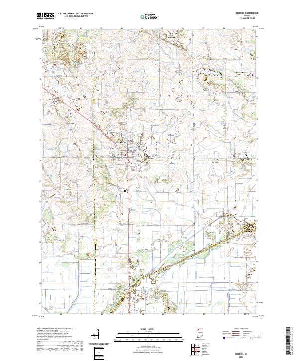 2022 Hebron2022 Print · USGSPorter County's agricultural heartland is documented here in the early 2020s, centered on the historic crossroads of Hebron. Genealogists and local historians can trace family plots at Hebron Cem or explore the intricate drainage networks of Singleton Ditch and the Kankakee River.
 - 2024 Map of Beecher East, 2024 Print
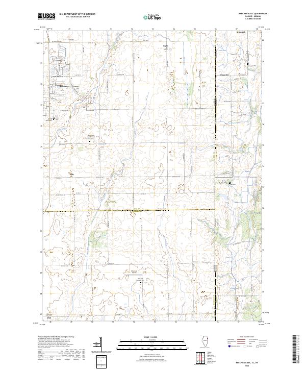 2024 Beecher East2024 Print · USGSThe Illinois-Indiana borderlands east of Beecher are shown here in modern detail, preserving the grid of old township roads and farmstead names. Genealogists can locate several historic burial grounds such as Fuller Cem, Saint Lukes Cem, and the parish site at Klaasville.
 - 2024 Map of Illiana Heights, 2024 Print
 2024 Illiana Heights2024 Print · USGSThe Illinois-Indiana borderlands come into focus in this contemporary survey of the rural corridor between Kankakee and Lake counties. Researchers can trace the riverfront clusters of Illiana Heights and Garden of Eden or locate local landmarks like Sherburnville Cem and the Lowell Airport.
 - 2024 Map of Lake Calumet, 2024 Print
 2024 Lake Calumet2024 Print · USGSThe industrial heart of the Illinois-Indiana borderlands is revealed in this modern survey of the Calumet region. Researchers can trace the layout of historic labor sites like Pullman National Monument and neighborhoods like Hegewisch and Altgeld Gardens.
 - 2024 Map of Calumet City, 2024 Print
 2024 Calumet City2024 Print · USGSThe Illinois-Indiana borderlands come into focus in this contemporary survey of the Calumet region’s dense urban and industrial landscape. Genealogists can locate numerous burial grounds like Berger Cem or Concordia Cem while tracing the historic Erie-Lackawanna RR corridor.
Showing maps 1-25 of 26
Top cities of Lake County
Frequently asked questions
- What are the different types of historical maps available for Lake County?
- What is the oldest map of Lake County?
- Where can I purchase historical maps of Lake County for my home or office?
- Where can I download high-res historical maps of Lake County?
- Are there historical topographic maps available for Lake County?
- Is there historical aerial imagery available for Lake County?
- Where are historical maps of Lake County sourced from?