1900s (20th Century) Maps of Lake County, Indiana
Explore 87 historic maps of Lake County from the 1900s (20th Century). These maps offer a rare glimpse into what life looked like during the 1900s — showing old roads, neighborhoods, homes, and landmarks that have changed or disappeared over time.
Whether you're researching your family's past, planning a metal detecting trip, or studying how Lake County's landscape evolved across the 1900s, these high-resolution maps are a powerful tool for exploring the history of this region.
- Focus on a specific era: All maps on this page are from the 1900s, giving you a focused view of this time period.
- See what’s changed: Compare century-old streets, trails, and buildings to today's modern landscape using overlays and satellite layers.
- Research with precision: Use these maps for genealogy, historical research, land use analysis, or educational projects.
- View, download, or print: Maps are fully viewable online in high resolution, and can be downloaded or printed for your own records.
Start exploring Lake County's history through authentic maps from the 1900s. This is your window into the past.
Lake County, IN maps
(87)- 1900 Map of Chicago
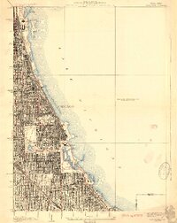
 1900 Chicago1900 Print · USGSChicago at the turn of the century shows a city of massive infrastructure, from its emerging park system to its complex rail hubs. Researchers can trace the development of early neighborhoods like Mayfair and South Lynn or locate grounds like Rose Hill Cemetery and the historic Illinois and Michigan Canal.
 - 1900 Map of Toleston
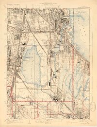
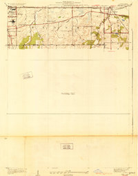
 1900 Toleston1900 Print · USGSLake County was a booming industrial and transit corridor at the end of the nineteenth century. Researchers can trace the early footprints of Whiting and East Chicago, and locate vanished or evolved rail stops like Clarke Station and Aetna.6 unique versions available
 - 1900 Map of Calumet
 1900 Calumet1900 Print · USGSSouthern Cook County and the Indiana borderlands are captured here at the peak of the rail era, showing a landscape of burgeoning industrial towns and complex rail junctions. Researchers can trace the layout of the historic company town of Pullman, the growth of Hammond, and the early footprints of Blue Island and Harvey.
 - 1901 Map of Calumet
 1901 Calumet1901 Print · USGSSouthern Chicago and the Calumet region are captured at the peak of their industrial expansion at the turn of the century. Genealogists and historians can trace the growth of rail-side towns like Pullman, Blue Island, and Hegewisch and locate landmarks like the Glenwood Industrial School.5 unique versions available
 - 1901 Map of Chicago
 1901 Chicago1901 Print · USGSChicago was a booming industrial and rail hub in the late nineteenth century, defined by its lakefront and canal systems. Genealogists and urban historians can trace early neighborhood boundaries and rail corridors through Elsdon, Chicago Lawn, and Rose Hill Cemetery.5 unique versions available
 - 1922 Map of Momence, 1958 Print
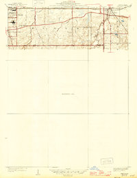
 1922 Momence1958 Print · USGSThe Kankakee River valley in the early twenties is a landscape of river islands and busy rail junctions. Genealogists and historians can locate dozens of country schools like Frogtown School and Searls School or trace the Illinois-Indiana border at Illinoi.
 - 1924 Map of Momence
 1924 Momence1924 Print · USGSEastern Illinois and the Indiana borderlands are captured here during the 1920s, showing a landscape defined by the Kankakee River and a web of rail lines. Researchers can trace dozens of legacy district schools like Frogtown School and locate family landmarks in Momence, St Anne, and Grant Park.2 unique versions available
 - 1929 Map of Calumet Lake
 1929 Calumet Lake1929 Print · USGSThe industrial heart of the South Side and the Indiana borderlands comes alive in this survey of the Calumet region. Genealogists and historians can trace the streets of Pullman, the extensive rail yards of the Belt Ry of Chicago, and early features like the Pullman Training School.3 unique versions available
 - 1929 Map of Calumet City
 1929 Calumet City1929 Print · USGSThe Calumet region during the late twenties shows a landscape transitioning from rural townships to industrial hubs. Genealogists and historians can trace the early rail networks, numerous family-named cemeteries like Oak Hill Cem, and local landmarks such as the Brickyard and Sunnybrook School.3 unique versions available
 - 1929 Map of Jackson Park
 1929 Jackson Park1929 Print · USGSThe South Side of Chicago during the late 1920s reveals a sophisticated network of grand parks and lakefront landmarks. Genealogists and urban historians can trace the grid from Oakwoods Cemetery to iconic sites like Soldiers Field and the Field Museum.3 unique versions available
 - 1929 Map of Dyer, 1946 Print
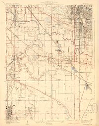
 1929 Dyer1946 Print · USGSThe industrial suburbs and agricultural lands of the Illinois-Indiana border are captured here in the late 1920s. Researchers can trace the path of the Lincoln Highway and locate long-standing landmarks like the Cats Corner School or Strassburg School.
 - 1930 Map of Dyer
 1930 Dyer1930 Print · USGSThe Illinois-Indiana borderlands appear in the late twenties during a period of industrial and automotive growth. Genealogists and local historians can trace early schoolhouse locations like Cats Corner School and the path of the famous Lincoln Highway near Dyer.
 - 1934 Map of Porter
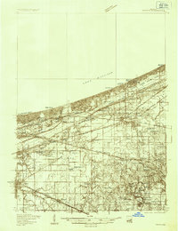 1934 Porter1934 Print · USGSThe Indiana shoreline of the mid-1930s is mapped here in detail, from the sands of Indiana Dunes State Park to the rail hubs of Chesterton. Trace local family history through sites like the Seven Dolors Shrine, Liberty Center Sch, and the Mc Cool Emergency Landing Field.
 - 1940 Map of Porter
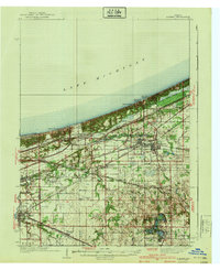 1940 Porter1940 Print · USGSPorter County's industrial and shoreline heritage is captured here in the years before World War II. Researchers can locate early lakefront settlements like Baillytown or trace the routes of the Wabash and Pere Marquette railroads past Tratebas Mill.3 unique versions available
 - 1949 Map of Crete
 1949 Crete1949 Print · USGSWill County and the surrounding borderlands are captured here in the late 1940s as a busy intersection of rail and road. Genealogists can locate dozens of country schools and churches like Beebe Grove Sch, St Annes Ch, and Crete Cem.
 - 1953 Map of Leroy, 1955 Print
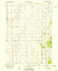
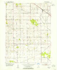 1953 Leroy1955 Print · USGSSouthern Lake County's agricultural heartland is captured here in the early 1950s as a complex system of drainage ditches reclaimed the prairie. Researchers can pinpoint long-standing landmarks including Leroy, the Riley Sch, and Plum Grove Cem.
 - 1953 Map of St. John, 1955 Print
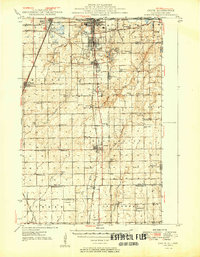
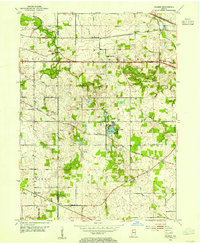
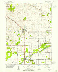
 1953 St. John1955 Print · USGSNorthwest Indiana during the early fifties reveals a landscape where historic rail lines and the Lincoln Highway meet growing lakeside communities. Genealogists and local historians can trace family-named sites like Dutton Cem and Hack Cem, or locate mid-century landmarks such as the Illiana Race Track.
 - 1953 Map of Palmer, 1955 Print
 1953 Palmer1955 Print · USGSPorter County's agricultural heartland is captured here in the early fifties, showing a rural landscape dominated by massive rail corridors and the Lincoln Highway. Genealogists can locate family landmarks like Betz Cem and Ludington Cem or trace the early development around Lake Eliza and Palmer.
 - 1953 Map of Gary, 1955 Print
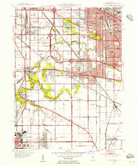
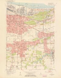 1953 Gary1955 Print · USGSMid-century Gary and the Calumet region are captured here during a peak era of industrial and suburban growth. Researchers can trace family roots through dozens of local landmarks like Holy Angels Sch, Oak Hill Cemetery, and the Miller neighborhood.
 - 1953 Map of Crown Point, 1955 Print
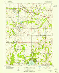
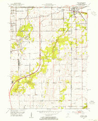
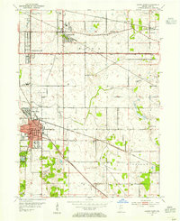 1953 Crown Point1955 Print · USGSLake County is captured in the early fifties as a landscape of established rail hubs and emerging suburbs connected by the historic Lincoln Highway. Researchers can trace local roots at the Bail School, Maplewood Cemetery, and the old County Fairground.
 - 1953 Map of Calumet City, 1955 Print
 1953 Calumet City1955 Print · USGSThe Calumet region during the early fifties shows a burgeoning industrial and suburban landscape spanning the Illinois Indiana state line. Trace the development of local neighborhoods and infrastructure from Chicago Hammond Airport to the Thornton Junction rail hub.
 - 1953 Map of Beecher East, 1955 Print
 1953 Beecher East1955 Print · USGSThe Illinois and Indiana borderlands are captured here in the early fifties, showing a rural landscape defined by rail and farm. Genealogists can locate family landmarks like Deeke Sch, St Johns Ch, and the settlements of Klaasville and Beecher.3 unique versions available
 - 1953 Map of Calumet Lake, 1955 Print
 1953 Calumet Lake1955 Print · USGSThe industrial corridor of the Chicago South Side and Northwest Indiana comes alive in this mid-century survey. Genealogists and historians can trace the footprint of neighborhoods like Pullman, Hegewisch, and Altgeld Gardens alongside the massive rail yards of the Pennsylvania Railroad.
 - 1953 Map of Hebron, 1955 Print
 1953 Hebron1955 Print · USGSPorter County in the early 1950s is defined by its rail-linked small towns and the managed waters of the Kankakee basin. Genealogists and local historians can trace the early layout of Hebron, explore rural Boone Grove, or locate family sites at Hebron Cem.
 - 1953 Map of Dyer, 1955 Print
 1953 Dyer1955 Print · USGSThe Illinois-Indiana border during the early fifties reveals a landscape of growing suburbs and traditional crossroads. Researchers can trace historic family roots at Eagle Lake Cem or locate lost landmarks like Klemme Sch and Lincoln Fields.
Showing maps 1-25 of 87
Top cities of Lake County
Frequently asked questions
- What are the different types of historical maps available for Lake County?
- What is the oldest map of Lake County?
- Where can I purchase historical maps of Lake County for my home or office?
- Where can I download high-res historical maps of Lake County?
- Are there historical topographic maps available for Lake County?
- Is there historical aerial imagery available for Lake County?
- Where are historical maps of Lake County sourced from?