1990s Maps of Lake County, Indiana
Explore 26 historic maps of Lake County from the 1990s. These maps offer a rare glimpse into what life looked like during the 1990s — showing old roads, neighborhoods, homes, and landmarks that have changed or disappeared over time.
Whether you're researching your family's past, planning a metal detecting trip, or studying how Lake County's landscape evolved across the 1990s, these high-resolution maps are a powerful tool for exploring the history of this region.
- Focus on a specific era: All maps on this page are from the 1990s, giving you a focused view of this time period.
- See what’s changed: Compare century-old streets, trails, and buildings to today's modern landscape using overlays and satellite layers.
- Research with precision: Use these maps for genealogy, historical research, land use analysis, or educational projects.
- View, download, or print: Maps are fully viewable online in high resolution, and can be downloaded or printed for your own records.
Start exploring Lake County's history through authentic maps from the 1990s. This is your window into the past.
Lake County, IN maps
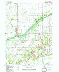
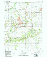
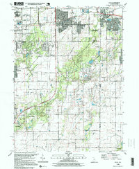
(26)- 1990 Map of Dyer, 1991 Print
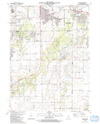 1990 Dyer1991 Print · USGSSuburban development meets the rural prairie at the Illinois and Indiana border in the early nineties. Researchers can trace family sites from Sauk Village to Dyer, including St James Cem and the small settlement of Kreitzburg.
 - 1990 Map of Beecher East, 1991 Print
 1990 Beecher East1991 Print · USGSThe Illinois-Indiana borderlands are captured here in the late twentieth century, showing a landscape of small farming communities and country roads. Genealogists and researchers can locate St Pauls Ch, trace the Old Railroad Grade, and find quiet cemeteries like Brunswick Cem.
 - 1991 Map of Kankakee
 1991 Kankakee1991 Print · USGSThe Illinois-Indiana borderlands come into focus during the early nineties, centered on the growing Kankakee valley and its sprawling drainage systems. Trace the rail-and-river economy through landmarks like the Wilton Railroad Grade, the Manteno State Hospital, and the historic Old Pioneer Cem.
 - 1991 Map of Gary
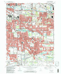
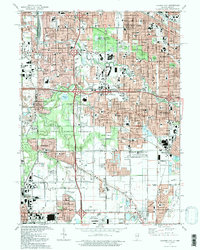
 1991 Gary1991 Print · USGSThe industrial heart of Northwest Indiana is captured here as the lakefront industrial complexes neighbor the Indiana Dunes National Lakeshore. Researchers can trace neighborhood evolution and family roots through dozens of local sites like Oak Hill Cemetery, Froebel Sch, and the Salvatorian Fathers Monastery.2 unique versions available
 - 1991 Map of Highland, 1992 Print
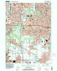
 1991 Highland1992 Print · USGSThe industrial heart of Lake County meets preserved nature in the early nineties, showing the dense growth of Highland and Griffith. Genealogists and historians can trace numerous parish sites and cemeteries like St Marys Cem or locate the Purdue University Calumet Center.
 - 1991 Map of Lake Calumet, 1992 Print
 1991 Lake Calumet1992 Print · USGSChicago's industrial southeast side and the Indiana borderlands are captured here at a time of heavy rail and river transit. Genealogists can locate family-named neighborhoods and parish schools like St Michael Sch, Robertsdale, and Altgeld Gardens.
 - 1991 Map of Whiting, 1992 Print
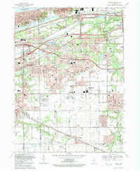
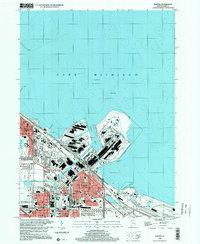
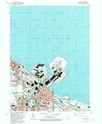 1991 Whiting1992 Print · USGSThe industrial heart of Northwest Indiana is captured in the early nineties, showing the massive harbor complexes and rail yards of the Lake Michigan shoreline. Genealogists and local historians can trace the neighborhoods around Whiting and East Chicago, locating landmarks like St Catherine Hospital and Mark Town Park.
 - 1991 Map of Calumet City, 1992 Print
 1991 Calumet City1992 Print · USGSThe Illinois and Indiana borderlands are captured here in the early nineties, showing the dense intersection of industry and nature. Researchers can trace family roots through local landmarks like Holy Cross Cemetery, Oakland Cem, and Thornridge High Sch.2 unique versions available
 - 1991 Map of Ogden Dunes, 1992 Print
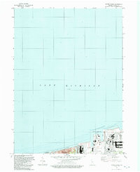 1991 Ogden Dunes1992 Print · USGSCoastal Indiana in the early nineties showcases a transition between industrial maritime hubs and protected dunes. Researchers can trace the boundaries of the Indiana Dunes National Lakeshore and the shipping infrastructure at the Port of Indiana.
 - 1992 Map of Portage
 1992 Portage1992 Print · USGSNear the Indiana shoreline in the early 1990s, the landscape of Portage shows a dense mesh of heavy industry and suburban expansion. Genealogists can locate several local burial sites such as Calvary Cemetery and McCool Cem, alongside the rails of the CONRAIL and CSX TRANSPORTATION.
 - 1992 Map of Palmer
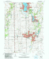
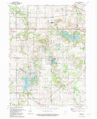 1992 Palmer1992 Print · USGSNorthwest Indiana near the turn of the millennium shows a transition from quiet rural townships to growing lakeside communities. Researchers can locate family roots at Mosier Cem or trace the early development surrounding Lake Eliza and Holiday Lake.
 - 1992 Map of Shelby
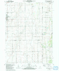
 1992 Shelby1992 Print · USGSNorthwestern Indiana's river-and-rail corridor is captured here in the early nineties, showing the managed wetlands of the Kankakee valley. Genealogists and local historians can trace the foundations of Shelby, Roselawn, and the Monon RR line that once drove the local economy.
 - 1992 Map of Crown Point
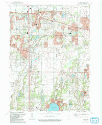
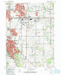 1992 Crown Point1992 Print · USGSCrown Point and Merrillville are shown in a period of significant suburban growth during the early nineties. Researchers can locate long-standing landmarks like the Lake County Fairground, Calumet Park Cemetery, and the Southlake Speedway.
 - 1992 Map of Hebron
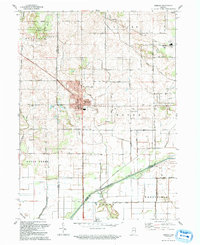 1992 Hebron1992 Print · USGSPorter County in the early nineties shows a landscape of established rail towns and extensive drainage projects. Genealogists and local historians can trace the Old Railroad Grade through Hebron or locate family plots at Hebron Cem and Cornell Cem.
 - 1992 Map of Lowell
 1992 Lowell1992 Print · USGSSouthern Lake County is captured here in the early nineties, showing a landscape of growing lakeside communities and deep-rooted farmsteads. Genealogists can trace family landmarks and local institutions, including St Edwards Cem, the settlement of North Hayden, and the sprawling Buckley Homestead County Park.
 - 1992 Map of De Motte
 1992 De Motte1992 Print · USGSJasper County is captured here in the early nineties, showing the organized drainage and agricultural growth surrounding DeMotte. Researchers can trace local lineage through several sites like the Holland Cem, Kniman, and the Cem of the Resurrection.
 - 1992 Map of Leroy
 1992 Leroy1992 Print · USGSLake County agriculture and small-town settlements are captured here in the early nineties, revealing a landscape of managed waterways and historic groves. Genealogists can locate family sites at Plum Grove Cem, the old village of Leroy, and Rangeline Ch.
 - 1992 Map of Schneider
 1992 Schneider1992 Print · USGSThe Kankakee River valley in northwest Indiana was a landscape of reclaimed marshlands and riverfront retreats by the early 1990s. Trace the rural layout of Schneider and Lake Village, and find family history at Sanders Cem or St Augusta Ch.
 - 1992 Map of St. John
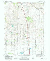
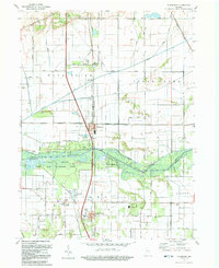
 1992 St. John1992 Print · USGSIn the early nineties, northwestern Indiana's suburban landscape was rapidly maturing between Schererville and Cedar Lake. Researchers can trace local school history at Hyles-Anderson College or locate family plots at Pleasant View Cem and Memory Lane Memorial Cem.
 - 1993 Map of Jackson Park
 1993 Jackson Park1993 Print · USGSThe South Side of Chicago and its iconic lakefront are captured here in the early nineties, showcasing a high-density urban grid of schools, hospitals, and parks. Researchers can trace the layout of the University of Chicago campus or locate family plots in the expansive Oakwoods Cemetery.
 - 1997 Map of Lake Calumet, 1999 Print
 1997 Lake Calumet1999 Print · USGSThe industrial heart of the South Side and Northwest Indiana comes alive in this late-twentieth-century study of the Calumet region. Genealogists and researchers can trace neighborhood landmarks from Hegewisch to Robertsdale, including numerous parochial schools like St Kevin Sch and the legacy of Altgeld Gardens.
 - 1998 Map of Jackson Park, 1999 Print
 1998 Jackson Park1999 Print · USGSThe Chicago lakefront at the close of the twentieth century reveals a dense network of South Side neighborhoods and iconic public spaces. Genealogists and historians can locate dozens of institutions, from Oakwoods Cemetery to the campus of Meigs Field and Soldier Field.
 - 1998 Map of Dyer, 1999 Print
 1998 Dyer1999 Print · USGSThe Illinois and Indiana borderlands at the end of the century reveal a landscape where industrial rail hubs meet expanding suburban life. Genealogists and historians can trace the foundations of Sauk Village and Dyer or locate markers like Eagle Lake Cem and St James Cem.
 - 1998 Map of Calumet City, 2000 Print
 1998 Calumet City2000 Print · USGSCalumet City and Lansing are shown in high detail during the late nineties, documenting the dense suburban and industrial growth along the Indiana border. Researchers can trace local institutions and cemeteries like Assumption Cemetery, St Margaret Hospital, and the Lansing Municipal Airport.
 - 1998 Map of Whiting, 2001 Print
 1998 Whiting2001 Print · USGSThe industrial shoreline of Lake Michigan comes alive in the late nineties, showcasing the massive steel and oil works of Northwest Indiana. Genealogists and urban historians can trace neighborhood landmarks from St Catherine Hospital to the Indiana Harbor Belt RR.
Showing maps 1-25 of 26
Top cities of Lake County
Frequently asked questions
- What are the different types of historical maps available for Lake County?
- What is the oldest map of Lake County?
- Where can I purchase historical maps of Lake County for my home or office?
- Where can I download high-res historical maps of Lake County?
- Are there historical topographic maps available for Lake County?
- Is there historical aerial imagery available for Lake County?
- Where are historical maps of Lake County sourced from?