Old Maps of Montgomery County, Iowa for Metal Detecting
Plan your next treasure hunt with 102 historic maps of Montgomery County. Find old homesites, ghost towns, trails, and gathering spots that may be lost to time — perfect for identifying promising metal detecting locations.
- Locate forgotten sites: Uncover places like long-lost settlements, abandoned rail lines, or gathering spots.
- Plan better hunts: Use map overlays combined with LiDAR or satellite views to narrow in on historically rich areas.
- Made for detectorists: Thousands of hobbyists use these maps to discover relics, coins, and hidden history.
Use these historic maps to boost your research and find new opportunities beneath the surface of Montgomery County.
Montgomery County, IA maps
(102)- 1954 Map of Omaha, 1967 Print
 1954 Omaha1967 Print · USGSMid-century development radiates from the river bluffs into the agricultural heartland during this period of post-war growth. Genealogists and historians can trace rail-connected towns like Atlantic and Red Oak or locate the sprawling grounds of Offutt Air Force Base and Manawa Lake.3 unique versions available
 - 1955 Map of Nebraska City, 1967 Print
 1955 Nebraska City1967 Print · USGSThe four-state region surrounding the Missouri River valley appears here in the mid-1950s, a landscape of rail-dependent market towns and rural school districts. Genealogists can locate family landmarks like the Rock Bluff School, St Oswald Church, and the Clarinda State Hospital.3 unique versions available
 - 1957 Map of Nebraska City
 1957 Nebraska City1957 Print · USGSThe four-state junction of Nebraska, Iowa, Missouri, and Kansas comes alive in this mid-fifties survey of the Missouri River valley. Genealogists and historians can trace the rail-and-road networks connecting Nebraska City, Maryville, and the Squaw Creek National Wildlife Refuge.
 - 1957 Map of Omaha
 1957 Omaha1957 Print · USGSWestern Iowa and the Missouri River valley are seen here in the mid-fifties during the height of the rail-and-road era. Researchers can trace the sprawling rail lines of the Chicago And North Western or locate Cold War landmarks like Offutt Air Force Base.
 - 1958 Map of Omaha
 1958 Omaha1958 Print · USGSOmaha and Council Bluffs stand at the center of this mid-fifties landscape, where the Missouri River splits the urban plains of Nebraska from the rolling hills of western Iowa. Genealogists can trace the rail lines of the Wabash RR and Illinois Central RR to rural settlements like Missouri Valley and Red Oak.2 unique versions available
 - 1958 Map of Nebraska City
 1958 Nebraska City1958 Print · USGSThe Missouri River Valley and its fertile four-state borderlands are captured here during the mid-century expansion of the regional highway and rail networks. Genealogists can trace family roots through numerous rural landmarks like Moulton School, Shady Grove Church, and the Clarinda State Hospital.
 - 1978 Map of Stanton
 1978 Stanton1978 Print · USGSStanton and the surrounding Montgomery County farmlands are captured in the late 1970s as the regional rail and water networks evolved. Genealogists and local historians can trace legacy sites like Mamre Cem and Arlington Cem or the emerging recreation at Viking Lake State Park.
 - 1978 Map of Carson
 1978 Carson1978 Print · USGSThe West Nishnabotna River valley near the Pottawattamie and Mills county line is captured here in the late seventies. Researchers can trace the legacy of regional transport through the Burlington Northern line and the Old Railroad Grade, or find family roots at Carson Cem and Farm Creek Cem.
 - 1978 Map of Griswold
 1978 Griswold1978 Print · USGSGriswold and Elliott sit along the East Nishnabotna River valley in the late seventies, showing the rail-connected agricultural landscape of southwestern Iowa. Researchers can locate numerous pioneer and local burial grounds including Flint Cem, Waveland Cem, and Hillside Cem near Coe.
 - 1978 Map of Emerson
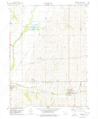 1978 Emerson1978 Print · USGSMills and Montgomery counties are captured here in the late seventies as the rail-and-river economy centered on Emerson and Hastings flourished. Genealogists can locate several local burial grounds including Hastings Cem and landmarks like the Nishua Valley Community Sch.
 - 1978 Map of Wallin
 1978 Wallin1978 Print · USGSMontgomery County’s rural townships are documented here during the late seventies, showing a landscape defined by the drainage of the Tarkio River system. Genealogists can trace family history through sites like Wallin, Tabor Ch, and Mission Cem.
 - 1978 Map of Wales
 1978 Wales1978 Print · USGSMontgomery County was a landscape of well-established farms and evolving transit in the late seventies. Genealogists and researchers can trace local roots at Gomer Cem or locate the site of the Drive-in Theater near McPherson.
 - 1978 Map of Coburg
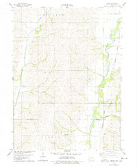 1978 Coburg1978 Print · USGSAgricultural life in southwestern Iowa during the late seventies is centered on the river valleys and rail lines of Montgomery and Page counties. Genealogists and historians can locate old burial grounds like Salem Cem and trace the paths of Coburg and Climax.
 - 1978 Map of Imogene
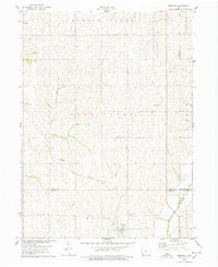 1978 Imogene1978 Print · USGSThe rural landscape of Fremont County is captured here in the late seventies, showing the rail-dependent settlement of Imogene and the surrounding farm country. Genealogists can trace family landmarks like Champion Hill Ch, the South Grove Cem, and the path of the Norfolk and Western railroad.
 - 1978 Map of Griswold NE
 1978 Griswold NE1978 Print · USGSCass and Montgomery counties meet in this late 1970s survey of Iowa’s agricultural heartland. Genealogists and local researchers can trace family lands near Lowman Cem or follow the paths of Sevenmile Creek and the Tarkio River.
 - 1978 Map of Red Oak South
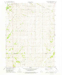 1978 Red Oak South1978 Print · USGSSouthern Montgomery County in the late seventies reveals a landscape of structured townships and winding river valleys. Genealogists and local historians can locate rural landmarks like Township Cem, the village of Nyman, and the Old Railroad Grade.
 - 1978 Map of Carson NE
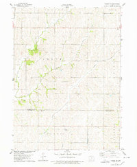 1978 Carson NE1978 Print · USGSThe agricultural heartland of Southwest Iowa comes into focus during the late seventies, showing the rural townships of Grove and Waveland. Genealogists and local historians can trace family roots through sites like Mormon Cem, Wheeler Grove Ch, and Pleasant Grove Cem.
 - 1978 Map of Red Oak North
 1978 Red Oak North1978 Print · USGSMontgomery County agriculture and industry meet in the late seventies along the East Nishnabotna River. Genealogists and local historians can trace the Burlington Northern line and locate sites like Stennett, Evergreen Cem, and Inman Sch.
 - 1980 Map of Grant, 1981 Print
 1980 Grant1981 Print · USGSSouthwestern Iowa farm country is documented here in the late seventies, showing the rural communities at the intersections of Montgomery, Cass, and Adams counties. Genealogists can trace family footprints across several rural burial grounds like Old East Cem, Reno Cem, and Newtons Grove Cem.
 - 1980 Map of Villisca, 1981 Print
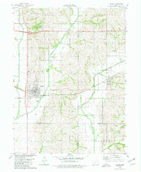 1980 Villisca1981 Print · USGSVillisca and the surrounding Iowa farmland are captured here in the early eighties, showcasing a landscape defined by the three branches of the Nodaway River. Genealogists can locate several local burial sites including Nodaway Cem and Findley Cem, while following the path of the Burlington Northern rail line.
 - 1980 Map of Morton Mills, 1981 Print
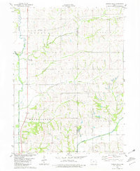 1980 Morton Mills1981 Print · USGSThe river valleys of southwestern Iowa are captured in the late seventies, showing the rural communities of Morton Mills and Sciola along the West Nodaway River. Genealogists can locate family landmarks like Lincoln Center Cem and Strand Ch.
 - 1985 Map of Creston
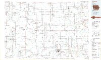 1985 Creston1985 Print · USGSSouthwest Iowa in the mid-eighties shows a landscape of established farm towns and growing regional hubs connected by vital rail lines. Genealogists and local historians can trace landmarks like Graceland Cem, the Southwestern Community College campus, and the Burlington Northern railroad route.
 - 1985 Map of Nebraska City
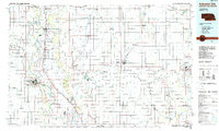 1985 Nebraska City1985 Print · USGSThe Missouri River borderlands of Nebraska, Iowa, and Missouri come into focus in the mid-1980s, showcasing a landscape of river navigation and rail-fed agriculture. Researchers can trace the heritage of Nebraska City, follow the Burlington Northern tracks, or explore river landmarks like Jones Point and McKissick Island.
 - 1985 Map of Mount Ayr
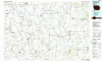 1985 Mount Ayr1985 Print · USGSThe Iowa-Missouri borderlands are captured here in the mid-eighties, showing a landscape defined by the branching forks of the Platte River and Grand River. Researchers can trace the heritage of rural communities and conservation sites like Lake of Three Fires State Park and Rose Hill Cemetery.2 unique versions available
 - 1985 Map of Omaha
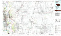 1985 Omaha1985 Print · USGSMid-century development and heavy rail infrastructure define the Missouri River corridor between Nebraska and Iowa. Genealogists and local historians can trace the footprints of Offutt Air Force Base, Forest Lawn Cemetery, and the Iowa School for the Deaf.2 unique versions available
Showing maps 1-25 of 102
Top cities of Montgomery County
- Red Oak historical maps
- Villisca historical maps
- Stanton historical maps
- Elliott historical maps
- Grant historical maps
- Coburg historical maps
Frequently asked questions
- What are the different types of historical maps available for Montgomery County?
- What is the oldest map of Montgomery County?
- Where can I purchase historical maps of Montgomery County for my home or office?
- Where can I download high-res historical maps of Montgomery County?
- Are there historical topographic maps available for Montgomery County?
- Is there historical aerial imagery available for Montgomery County?
- Where are historical maps of Montgomery County sourced from?