Old Maps of Allen County, Kansas for Genealogy
Trace your family roots with 148 historic maps of Allen County. These high-res maps reveal old neighborhoods, homesites, landmarks, and streets — helping you uncover where your ancestors lived and how the area evolved over time.
- Explore historic neighborhoods: Identify where your relatives may have lived in the 1800s or 1900s.
- Compare maps over time: Trace the changes in streets, buildings, and landmarks for multi-generational research.
- Perfect for genealogy & ancestry research: Used by family historians and researchers to map out lineage and migration.
These maps are an incredible resource for exploring your personal connection to Allen County's past.
Allen County, KS maps
(148)- 1885 Map of Burlington
 1885 Burlington1885 Print · USGSCoffey County was a hub of steam and steel in the 1880s, where several competing rail lines converged on the river valley. You can trace early family homesteads near Burlington, the small settlement of Bellgrade, and the junctions of the Kansas Southern Railroad.
 - 1885 Map of Garnett
 1885 Garnett1885 Print · USGSAnderson County during the late nineteenth-century rail boom shows a landscape of emerging towns and heavy steam-engine influence. Genealogists can trace family roots in early settlements like Garnett, Central City, and Elizabethtown before the modern highway era.
 - 1886 Map of Fredonia
 1886 Fredonia1886 Print · USGSSoutheast Kansas in the mid-1880s was a land of emerging rail hubs and river valley settlements. Researchers can trace early railroad expansion through Fredonia and Yates Center or locate long-standing communities like Toronto, New Albany, and Coyville.
 - 1886 Map of Iola
 1886 Iola1886 Print · USGSEastern Kansas was a bustling corridor of competing rail lines and river settlements during the mid-1880s. Genealogists and historians can trace the early footprints of Osage Mission, the growth of Iola, and vanished stops like Warnersburgh along the winding Neosho River.
 - 1893 Map of Iola
 1893 Iola1893 Print · USGSSoutheast Kansas at the end of the nineteenth century is captured here as a thriving rail and river corridor. Genealogists and historians can trace the early development of Iola, Erie, and Humboldt or locate smaller settlements like Odense and Veitsburgh.2 unique versions available
 - 1894 Map of Garnett
 1894 Garnett1894 Print · USGSAnderson County and its neighbors flourished during this Victorian-era railroad boom. Genealogists and historians can trace the exact routes of the Missouri Pacific Railroad and locate early settlements like Elizabethtown, Central City, and Mont Ida.5 unique versions available
 - 1894 Map of Fredonia
 1894 Fredonia1894 Print · USGSSoutheast Kansas is documented here during a period of rapid railway expansion and prairie settlement. Genealogists and local researchers can trace the early footprints of Fredonia, Yates Center, and vanished sites like Twin Mounds or Coyville.6 unique versions available
 - 1894 Map of Burlington
 1894 Burlington1894 Print · USGSCoffey County was a bustling intersection of iron and water in the 1880s, where the Neosho River met multiple competing railroads. Genealogists can trace family footprints in early settlements like Burlington, Leroy, and the Welsh community of Arvonia.5 unique versions available
 - 1904 Map of Iola
 1904 Iola1904 Print · USGSSoutheast Kansas at the start of the century was a land defined by the iron rail and the winding Neosho River. Genealogists and historians can trace the early footprints of Iola, Chamute, and Erie, alongside smaller depots like Gas and Savonburg.4 unique versions available
 - 1938 Map of Altoona, 1966 Print
 1938 Altoona1966 Print · USGSSoutheast Kansas in the late thirties was a landscape of dense rural communities and winding river valleys. Researchers can trace family history through dozens of named country schoolhouses like Ninety Nine Sch and Five Mounds Sch, or locate family plots at Buffalo Cem.
 - 1939 Map of Altoona
 1939 Altoona1939 Print · USGSSoutheast Kansas is shown at its rural peak in the late thirties, when the Verdigris River valley was dotted with small schoolhouses and family farms. Researchers can locate numerous local landmarks like Sorghum Valley Sch, Buffalo Cem, and the crossing at Barnhill Bridge.
 - 1943 Map of Altoona
 1943 Altoona1943 Print · USGSSoutheast Kansas comes alive in the late thirties as a landscape of river-valley farms and rail-connected towns. Genealogists can trace family roots through an exceptional density of country schools and churches, from Ninety Nine Sch to the Vilas Bethel Ch.2 unique versions available
 - 1947 Map of Lawrence, 1954 Print
 1947 Lawrence1954 Print · USGSEastern Kansas and western Missouri thrive in the late 1940s, showing a landscape defined by major river valleys and a dense railway network. Genealogists can trace family settlements from Lawrence to Greenwood and locate landmarks like Olathe Navy and Lake Lotawana.
 - 1947 Map of Joplin, 1954 Print
 1947 Joplin1954 Print · USGSThe borderlands of Missouri, Kansas, and Oklahoma are shown here during the late 1940s, a period of heavy industrial and military activity. Researchers can trace the extensive Tri-State Mining District, the layout of Camp Crowder, and local landmarks like Mount Hope Cem.
 - 1948 Map of Erie, 1960 Print
 1948 Erie1960 Print · USGSSoutheast Kansas at the end of the 1940s reveals a landscape of thriving rail-side towns and rural school districts. Genealogists and historians can trace family locations near Savonburg, St Paul, and dozens of country schools like Wannersburg Sch or Osborn Sch.
 - 1949 Map of Erie
 1949 Erie1949 Print · USGSSoutheast Kansas in the late 1940s reveals a landscape of thriving rail towns and rural schoolhouses amidst an active oil and gas boom. Genealogists can trace family footprints at St Francis Cem, the County Home, and numerous local schools like Maple Grove Sch.3 unique versions available
 - 1949 Map of Joplin
 1949 Joplin1949 Print · USGSThe Kansas-Missouri borderlands thrive in the late 1940s, showing a robust network of railroad towns and river valleys. Researchers can trace historic rail lines like the Missouri Pacific RR and locate rural centers such as Chanute, Iola, and Fort Scott.
 - 1950 Map of Lawrence
 1950 Lawrence1950 Print · USGSMid-century Kansas and Missouri come alive in this map of the river-valley corridors just as the interstate era was beginning. Researchers can trace the legacy of major rail lines like the Union Pacific RR and locate ancestral roots in towns from Lawrence to Harrisonville.
 - 1951 Map of Chanute
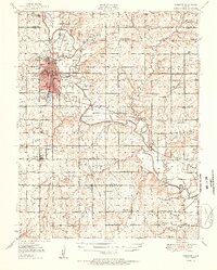 1951 Chanute1951 Print · USGSSoutheast Kansas at the start of the 1950s shows a landscape of busy rail junctions and active oil fields. Genealogists and local historians can trace dozens of country school sites like North Valley Sch and Summit Hill Sch, alongside landmarks like Greenwood Cem and the Santa Fe Reservoir.2 unique versions available
 - 1954 Map of Joplin, 1967 Print
 1954 Joplin1967 Print · USGSThe tri-state border region of Kansas, Missouri, and Oklahoma is captured here during a peak era of mid-century industrial and agricultural activity. Researchers can trace family history through dozens of rural cemeteries or locate landmarks like the Kansas Army Ammunition Plant and Pittsburg State University.3 unique versions available
 - 1956 Map of Lawrence, 1967 Print
 1956 Lawrence1967 Print · USGSEastern Kansas and the Missouri border country are captured here during the mid-century transition to the interstate era. Genealogists and local historians can trace family-named terrain like Summers Mound and the footprint of Sunflower Ordnance Works near Baldwin City.4 unique versions available
 - 1958 Map of Joplin
 1958 Joplin1958 Print · USGSThe tri-state border region of Missouri, Kansas, and Oklahoma is shown during the late fifties, a time of heavy rail traffic and mining activity. Local historians can trace the industrial landscape through the Joplin & Pittsburg Ry or locate family sites like Zion Ch and Bender Mounds.
 - 1959 Map of Joplin
 1959 Joplin1959 Print · USGSThe Tri-State region’s mining and rail-driven economy is on full display in the late fifties. Genealogists can locate Lead and Zinc Mines near Joplin, family markers at Oak Hill Cem, and military history at Camp Clark.
 - 1961 Map of Lawrence
 1961 Lawrence1961 Print · USGSThe Kansas-Missouri borderland shows its mid-century transition from a rail-dependent agricultural region to a suburbanizing landscape. Genealogists can trace family footprints through numerous Cem sites and distinctive terrain landmarks like Graves Mound and Summers Mound.
 - 1963 Map of Vilas, 1964 Print
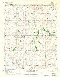 1963 Vilas1964 Print · USGSSoutheast Kansas in the early sixties was a landscape of rail-connected small towns and rural school districts. Genealogists and historians can trace family roots through sites like Vilas, the Vilas Bethel Cem, and the Union Valley Sch.
Showing maps 1-25 of 148
Top cities of Allen County
- Iola historical maps
- Humboldt historical maps
- La Harpe historical maps
- Gas historical maps
- Moran historical maps
- Carlyle historical maps
See more
Frequently asked questions
- What are the different types of historical maps available for Allen County?
- What is the oldest map of Allen County?
- Where can I purchase historical maps of Allen County for my home or office?
- Where can I download high-res historical maps of Allen County?
- Are there historical topographic maps available for Allen County?
- Is there historical aerial imagery available for Allen County?
- Where are historical maps of Allen County sourced from?