Old Maps of Cheyenne County, Kansas for Hiking & Exploration
Hike through history with 185 historic maps of Cheyenne County. Explore old trails, ghost towns, and forgotten backroads — perfect for outdoor adventurers and local explorers.
- Rediscover forgotten places: Map out old mining camps, roads, and footpaths that no longer exist on modern maps.
- Layer with modern tools: Combine with LiDAR or satellite views to plan hikes through historical terrain.
- Made for exploration: Popular among hikers, overlanders, and local history lovers.
Use these maps to find adventure and explore the hidden past of Cheyenne County.
Cheyenne County, KS maps
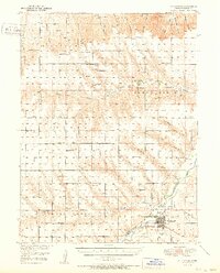
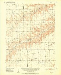
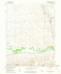
(185)- 1942 Map of St. Francis, 1943 Print
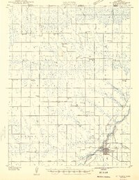 1942 St. Francis1943 Print · USGSCheyenne County and the Nebraska-Kansas border appear in the early 1940s as a landscape of rural schools and river-fed agriculture. Genealogists can locate family landmarks such as German Plains Sch, St Francis Cem, and the Zion Ch.
 - 1943 Map of St. Francis, 1949 Print
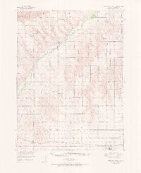
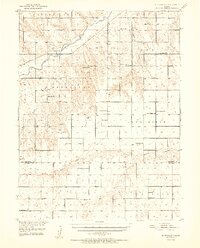
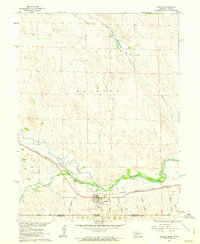
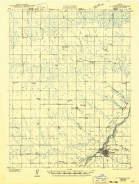 1943 St. Francis1949 Print · USGSWestern Kansas prairie life is captured here during the 1940s, centered on the river valley and rail lines of Cheyenne County. Trace the locations of rural schoolhouses and churches like German Plains Sch, Zion Ch, and the St Francis townsite.
 - 1950 Map of Bonny Reservoir, 1952 Print
 1950 Bonny Reservoir1952 Print · USGSThe high plains of the Colorado-Kansas border were undergoing a massive transformation in the early fifties with the completion of the Bonny Dam. Genealogists and local historians can locate several family-named landmarks including Burr Ranch and the Jacobs Cem, alongside long-gone schoolhouses like Happy Hollow Sch.3 unique versions available
 - 1950 Map of Mc Donald, 1966 Print
 1950 Mc Donald1966 Print · USGSThe rural landscape of Rawlins County, Kansas, is captured here at mid-century as a network of prairie schoolhouses and railroad-side townships. Genealogists can locate family-named landmarks and institutions like Grand Prairie School, Grace Cem, and the Lone Tree School.
 - 1951 Map of St Francis
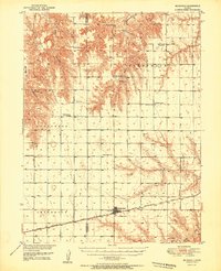
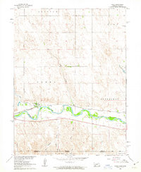
 1951 St Francis1951 Print · USGSNorthwest Kansas at mid-century reveals a landscape of dispersed prairie homesteads and a dense network of rural schoolhouses. Genealogists and local historians can trace the foundations of this community through landmarks like Scrivner Ranch, the German Plains Cem, and Northrup Sch.3 unique versions available
 - 1951 Map of Bird City North
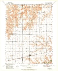
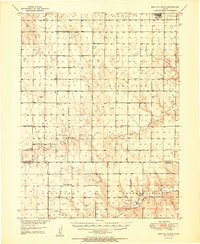
 1951 Bird City North1951 Print · USGSHigh Plains ranching and rail life define Cheyenne County in the early fifties, where canyons and draws crisscross the prairie. Genealogists can trace rural school districts like White Lily Sch and Mt Hope Sch or find family plots at Barley Cem.2 unique versions available
 - 1951 Map of Mc Donald
 1951 Mc Donald1951 Print · USGSRawlins and Cheyenne counties appear here in the early fifties, centering on the rail town of McDonald. Researchers can trace old rural school districts like Prairie Dog Sch and North School No 38 or locate the Grace Cem.
 - 1951 Map of Bird City South
 1951 Bird City South1951 Print · USGSThe northern Kansas high plains come alive in this mid-century survey of the settlements surrounding Bird City and the Cheyenne Co Sherman Co line. Researchers can trace the exact locations of rural schoolhouses and cemeteries like South Star Sch and Wheeler Cem.2 unique versions available
 - 1951 Map of Dewey Ranch, 1952 Print
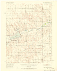
 1951 Dewey Ranch1952 Print · USGSNorthwest Kansas ranching country and the Missouri River Basin development are captured here in the early fifties. Genealogists can trace rural school districts and community centers like Prairie Gem Ch, Dewey Ranch, and Pleasant Valley Sch.
 - 1952 Map of St Francis 3
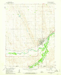
 1952 St Francis 31952 Print · USGSWestern Kansas ranching and farming communities are documented here in the early fifties, centered on the river valleys of Cheyenne County. Genealogists can trace rural landmarks including Neville Ch, Battle Creek Cem, and schools like Sunny Ridge Sch.2 unique versions available
 - 1954 Map of Limon
 1954 Limon1954 Print · USGSThe Eastern Colorado plains and the Kansas borderlands come alive in the mid-fifties, showing the vital rail-and-road corridor through Limon. Genealogists and historians can trace the Chicago Rock Island & Pacific line through Burlington and find remote outposts like Arickaree and Anton.4 unique versions available
 - 1954 Map of Sterling
 1954 Sterling1954 Print · USGSNortheastern Colorado and the Nebraska borderlands are defined by the river-and-rail corridors of the mid-twentieth century. Researchers can trace the development of agricultural hubs from Sterling and Fort Morgan to smaller rail stops along the Union Pacific and Burlington Northern lines.3 unique versions available
 - 1954 Map of McCook, 1966 Print
 1954 McCook1966 Print · USGSSouthwest Nebraska in the mid-fifties reveals a landscape shaped by major water projects and the Chicago Burlington and Quincy RR. Trace ancestral roots and defunct rail stops in McCook, Wauneta, and along the shores of Swanson Lake.2 unique versions available
 - 1954 Map of Goodland, 1976 Print
 1954 Goodland1976 Print · USGSNorthwest Kansas comes into focus during the mid-1950s, showing a landscape defined by its vital river forks and thriving rail towns. Researchers can trace the path of the Union Pacific through Colby or locate historic parks like Sheridan Co State Park.
 - 1956 Map of Goodland
 1956 Goodland1956 Print · USGSThe high plains of Northwest Kansas in the mid-fifties reveal a landscape of river-fed agriculture and expanding rail networks. Genealogists and historians can trace the development of county seats like Goodland and Atwood or locate landmarks such as the Arikaree Breaks.
 - 1957 Map of McCook
 1957 McCook1957 Print · USGSSouthwestern Nebraska in the mid-fifties is captured here during a period of significant water development and rail-based commerce. Researchers can trace the path of the Chicago Burlington and Quincy through Indianola and Bartley, or locate rural settlements like Chase Village and Ough near the Sand Hills.
 - 1957 Map of Limon
 1957 Limon1957 Print · USGSThe High Plains of Eastern Colorado and Western Kansas come alive in the mid-1950s, showing the vital rail-and-road connections of the era. You can trace the path of the Chicago Rock Island and Pacific through towns like Limon, Stratton, and Burlington or find the early footprint of Bonny Reservoir.
 - 1957 Map of Goodland
 1957 Goodland1957 Print · USGSNorthwest Kansas in the mid-1950s shows a landscape of high plains agriculture and vital rail junctions. Researchers can trace the river-valley settlements from Goodland to Oberlin and follow the paths of the Union Pacific and Sappa Creek.2 unique versions available
 - 1958 Map of Limon
 1958 Limon1958 Print · USGSEastern Colorado and the Kansas border meet in this late-fifties study of High Plains rail and river systems. Researchers can trace the path of the Chicago Rock Island and Pacific through Limon and Burlington, or locate the Bonny Dam and Bonny Reservoir.
 - 1958 Map of McCook
 1958 McCook1958 Print · USGSSouthwest Nebraska during the late fifties reveals a landscape of massive new reservoirs and established rail hubs like McCook. Genealogists can trace family footprints through rural centers like St Johns Church and the many grain elevators along the Union Pacific RR.2 unique versions available
 - 1958 Map of Sterling
 1958 Sterling1958 Print · USGSNortheastern Colorado thrived along the river and rail corridors during the late fifties. Genealogists and historians can trace family-named irrigation works like Davis Brothers Ditch and agricultural hubs from Peetz to Fort Morgan.
 - 1961 Map of Parks, 1963 Print
 1961 Parks1963 Print · USGSThe Republican River valley in the early sixties shows a landscape shaped by rail and water. Researchers can trace rural life through landmarks like Parks Cem, Union Sch, and the winding path of the Chicago Burlington and Quincy railroad.
 - 1961 Map of Benkelman, 1963 Print
 1961 Benkelman1963 Print · USGSBenkelman and the Republican River valley are documented in the early sixties as a center of rail and river life. Researchers can trace the Chicago Burlington and Quincy line past Doane or locate the Benkelman Cem and Benkelman State Fish Hatchery.
 - 1961 Map of Rock Creek Lake, 1963 Print
 1961 Rock Creek Lake1963 Print · USGSThe Republican River valley on the Nebraska-Kansas border is captured here in the early sixties, showing the vital rail-and-river corridor. Trace the path of the Chicago Burlington and Quincy railroad or locate local landmarks like the State Fish Hatchery and Rock Creek Lake.
 - 1961 Map of Haigler, 1963 Print
 1961 Haigler1963 Print · USGSThe confluence of the North Fork Republican River and Arikaree River dominates this 1960s borderlands survey. Trace the rail-side growth of Haigler through landmarks like the Haigler Canal and the Chicago Burlington and Quincy railroad.
Showing maps 1-25 of 185
Top cities of Cheyenne County
Frequently asked questions
- What are the different types of historical maps available for Cheyenne County?
- What is the oldest map of Cheyenne County?
- Where can I purchase historical maps of Cheyenne County for my home or office?
- Where can I download high-res historical maps of Cheyenne County?
- Are there historical topographic maps available for Cheyenne County?
- Is there historical aerial imagery available for Cheyenne County?
- Where are historical maps of Cheyenne County sourced from?