1960s Maps of Decatur County, Kansas
Explore 9 historic maps of Decatur County from the 1960s. These maps offer a rare glimpse into what life looked like during the 1960s — showing old roads, neighborhoods, homes, and landmarks that have changed or disappeared over time.
Whether you're researching your family's past, planning a metal detecting trip, or studying how Decatur County's landscape evolved across the 1960s, these high-resolution maps are a powerful tool for exploring the history of this region.
- Focus on a specific era: All maps on this page are from the 1960s, giving you a focused view of this time period.
- See what’s changed: Compare century-old streets, trails, and buildings to today's modern landscape using overlays and satellite layers.
- Research with precision: Use these maps for genealogy, historical research, land use analysis, or educational projects.
- View, download, or print: Maps are fully viewable online in high resolution, and can be downloaded or printed for your own records.
Start exploring Decatur County's history through authentic maps from the 1960s. This is your window into the past.
Decatur County, KS maps
(9)- 1965 Map of Kanona SE, 1966 Print
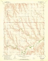
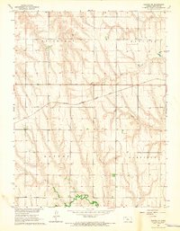 1965 Kanona SE1966 Print · USGSDecatur County's rural landscape is captured here in the mid-1960s, showing the intersection of railroad industry and pioneer-era land divisions. Researchers can trace the Chicago Burlington and Quincy line or locate the Big Timber Cem near the winding Big Timber Creek.
 - 1965 Map of Oberlin, 1966 Print
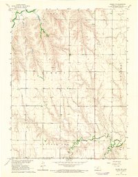
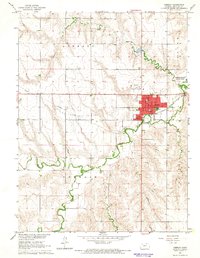 1965 Oberlin1966 Print · USGSOberlin and the surrounding High Plains of Decatur County are captured here during the mid-1960s as a vital agricultural and transit hub. Genealogists and historians can trace the town's development through landmarks like the High Sch, the Fairground, and the Chicago Burlington and Quincy rail line.
 - 1965 Map of Kanona, 1966 Print
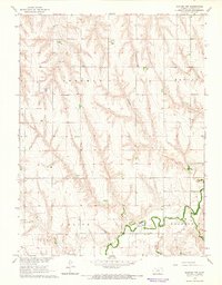
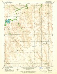 1965 Kanona1966 Print · USGSDecatur County in the mid-1960s reveals a prairie landscape defined by the Chicago Burlington and Quincy rail line. Researchers can trace the layout of Kanona, find the Kanona Cem, and explore the grounds of Oberlin-Sappa State Park.2 unique versions available
 - 1965 Map of Lyle, 1966 Print
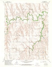 1965 Lyle1966 Print · USGSDecatur County and the surrounding townships are captured in the mid-1960s, showing a landscape shaped by the Sappa Creek valley. Researchers can locate remote family landmarks like Railsback Cem, Wray Cem, and the rural community center at Lyle.
 - 1965 Map of Oberlin SW, 1966 Print
 1965 Oberlin SW1966 Print · USGSDecatur and Rawlins counties in the mid-sixties are shown here as a landscape of winding draws and high plains townships. Trace the paths of North Fork Sappa Creek, locate St Johns Cem, and find industrial markers like the Radio Tower (KOMC-TV) and local Oil Wells.
 - 1965 Map of Kanona NW, 1966 Print
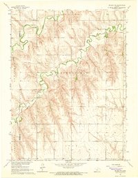
 1965 Kanona NW1966 Print · USGSThe rural expanses of Decatur County are captured in the mid-1960s, showing a landscape defined by township boundaries and sparse country roads. Local researchers can trace family landmarks like Vallonia Cem or locate community centers such as Sherman Chapel and Prairie Chapel.
 - 1965 Map of Selden NW, 1966 Print
 1965 Selden NW1966 Print · USGSDecatur County's rural landscape is captured here in the mid-1960s, showing the convergence of the forks of Sappa Creek. Local researchers can locate the Bassettville Cem, the site of Plainview Sch, and several small riverside industrial sites like a Gravel Pit.
 - 1965 Map of Kanona NE, 1966 Print
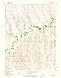 1965 Kanona NE1966 Print · USGSDecatur County's high plains and winding creek bottoms are captured here in the mid-1960s. Genealogists and researchers can locate the White Cem and trace the industrial footprint of the Warner Oil Field and various oil wells.
 - 1965 Map of Selden NE, 1966 Print
 1965 Selden NE1966 Print · USGSDecatur County in the mid-1960s was a landscape of remote farmsteads and small rural institutions shaped by the creek forks. Researchers can locate family roots at the Mennonite Cem, Shibboleth Cem, and the historic site of the Lund Sch.
End of results
Showing maps 1-9 of 9
Top cities of Decatur County
Frequently asked questions
- What are the different types of historical maps available for Decatur County?
- What is the oldest map of Decatur County?
- Where can I purchase historical maps of Decatur County for my home or office?
- Where can I download high-res historical maps of Decatur County?
- Are there historical topographic maps available for Decatur County?
- Is there historical aerial imagery available for Decatur County?
- Where are historical maps of Decatur County sourced from?