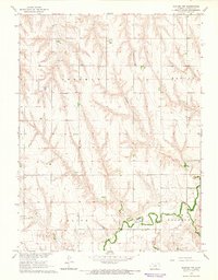
1965 Map of Kanona NW
USGS Topo · Published 1966About this map
Sappa Creek meanders through the southeastern corner of this Kansas landscape, defining the boundaries between Olive and Roosevelt townships. Surveyed in the mid-1960s as part of the Missouri River Basin development program, the area is characterized by a sparse, rural settlement pattern defined by local landmarks and agricultural activity. Small spiritual and communal anchors are scattered across the townships, including Sherman Chapel in Sherman and Prairie Chapel further south near Harlan. For genealogists and local historians, the Vallonia Cem serves as a vital point of interest near the southern edge of the quadrangle. The map also documents the local resource economy, noting small industrial sites like a Gravel Pit and a Sandpit situated along the drainage of the creek, providing a clear record of the area's physical and cultural geography during this era of mid-century development.
Find a feature on this map
11 named features on this map. Tap any name to fly to it.
Don’t see what you’re looking for? This feature index may not catch every label — zoom into the map to look around manually.
Map Details
Editions of this 1965 Kanona NW Map
This is the sole edition of this map. No revisions or reprints were ever made.
Other maps of this area

1951 · Oberlin
USGS Topo · 1:62,500

1951 · Kanona
USGS Topo · 1:62,500

1954 · McCook
USGS Topo · 1:250,000

1954 · Goodland
USGS Topo · 1:250,000

1956 · Goodland
USGS Topo · 1:250,000

1957 · McCook
USGS Topo · 1:250,000

1957 · Goodland
USGS Topo · 1:250,000

1957 · Danbury
USGS Topo · 1:24,000

1957 · Lebanon
USGS Topo · 1:24,000

1957 · McCook SE
USGS Topo · 1:24,000