Old Maps of Graham County, Kansas for Genealogy
Trace your family roots with 155 historic maps of Graham County. These high-res maps reveal old neighborhoods, homesites, landmarks, and streets — helping you uncover where your ancestors lived and how the area evolved over time.
- Explore historic neighborhoods: Identify where your relatives may have lived in the 1800s or 1900s.
- Compare maps over time: Trace the changes in streets, buildings, and landmarks for multi-generational research.
- Perfect for genealogy & ancestry research: Used by family historians and researchers to map out lineage and migration.
These maps are an incredible resource for exploring your personal connection to Graham County's past.
Graham County, KS maps
(155)- 1893 Map of Norton
 1893 Norton1893 Print · USGSNorthwest Kansas during the mid-1890s shows a region defined by the growth of railroad towns and water-carved valleys. Genealogists and historians can trace early town sites and rail lines including Norton, Almena, and the Pacific Railroad route through Logan.4 unique versions available
 - 1893 Map of Hill
 1893 Hill1893 Print · USGSNorthwestern Kansas in the early 1890s shows a landscape of developing prairie townships and the vital Union Pacific Railway corridor. Researchers can trace the early footprint of the historic colony at Nicodemus and find old stations like Millbrook and Paleo.4 unique versions available
 - 1954 Map of Goodland, 1976 Print
 1954 Goodland1976 Print · USGSNorthwest Kansas comes into focus during the mid-1950s, showing a landscape defined by its vital river forks and thriving rail towns. Researchers can trace the path of the Union Pacific through Colby or locate historic parks like Sheridan Co State Park.
 - 1955 Map of Beloit, 1971 Print
 1955 Beloit1971 Print · USGSNorth Central Kansas in the mid-fifties shows a landscape of river-valley agriculture and expanding water infrastructure. Genealogists can trace the rail lines of the Union Pacific through towns like Nicodemus, Cawker City, and the State Sanatorium.3 unique versions available
 - 1956 Map of Goodland
 1956 Goodland1956 Print · USGSThe high plains of Northwest Kansas in the mid-fifties reveal a landscape of river-fed agriculture and expanding rail networks. Genealogists and historians can trace the development of county seats like Goodland and Atwood or locate landmarks such as the Arikaree Breaks.
 - 1957 Map of Goodland
 1957 Goodland1957 Print · USGSNorthwest Kansas in the mid-1950s shows a landscape of high plains agriculture and vital rail junctions. Researchers can trace the river-valley settlements from Goodland to Oberlin and follow the paths of the Union Pacific and Sappa Creek.2 unique versions available
 - 1959 Map of Beloit
 1959 Beloit1959 Print · USGSNorth Central Kansas at mid-century reveals a landscape shaped by river valleys and the expansion of massive water reservoirs. Genealogists and historians can trace the rail-town connections of Beloit and Norton or locate the site of the new Webster Dam.3 unique versions available
 - 1969 Map of Nicodemus, 1971 Print
 1969 Nicodemus1971 Print · USGSThe historic settlement of Nicodemus and the surrounding Solomon Valley are captured here in the late sixties. Genealogists and researchers can trace family landmarks like Nicodemus Cem or the La Sage Oil Field along the South Fork Solomon River.
 - 1969 Map of Palco, 1971 Print
 1969 Palco1971 Print · USGSRooks County agricultural and oil-producing lands are captured here in the late sixties, centered on the Union Pacific rail line. Genealogists and local historians can locate St Joseph Cem and Palco Cem, or trace the development of the Gra-Rook North Oil Field.
 - 1978 Map of Clayton SW
 1978 Clayton SW1978 Print · USGSNorthwest Kansas in the late seventies is captured here at the junction of four counties. Researchers can trace land use through local markers like the Allison Ch and Roadside Park, while genealogists will find the boundaries of Adell and Allodium helpful for locating family homesteads.
 - 1978 Map of Lenora East, 1979 Print
 1978 Lenora East1979 Print · USGSThe high plains of northwest Kansas are captured here in the late seventies, centered on the community of Lenora and the winding North Fork Solomon River. Genealogists and local historians can locate the Modell Cem, trace the Missouri Pacific rail line, and find the County Park and Lake.
 - 1978 Map of Lenora West, 1979 Print
 1978 Lenora West1979 Print · USGSNorthwest Kansas in the late 1970s reveals a landscape of river-valley agriculture and quiet rural crossroads. Genealogists and local historians can trace the foundations of New Almelo and Lenora, including sites like St Joseph Cem and the Quarry.
 - 1978 Map of Edmond SE, 1979 Print
 1978 Edmond SE1979 Print · USGSNorthwestern Kansas in the late 1970s is captured here at the junction of Norton and Graham counties. Researchers can trace the riparian landscape along the North Fork Solomon River, Bow Creek, and a local Sandpit near the river bend.
 - 1979 Map of Lucerne
 1979 Lucerne1979 Print · USGSThe small community of Lucerne and its surrounding prairie landscape are documented here in the late seventies. Family historians and researchers can trace the course of Bow Creek and locate early Oil Field developments and isolated Wells.
 - 1979 Map of Bogue
 1979 Bogue1979 Print · USGSThe Solomon River valley in Graham County is captured here in the late seventies as a hub of rail transit and energy production. Genealogists can locate family burial sites like Wild Horse Cem and Samuels Cem or trace the historic town of Nicodemus.
 - 1979 Map of Logan SW
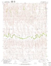 1979 Logan SW1979 Print · USGSThe rural borderlands of Norton and Graham counties come into focus in the late 1970s, defined by the winding course of Bow Creek. Genealogists can trace family footprints at Whitfield Cem and Buchanan Brown Cem or locate the local Townhall.
 - 1979 Map of Hill City South
 1979 Hill City South1979 Print · USGSGraham County in the late seventies is centered on Hill City and its proximity to the South Fork Solomon River. Genealogists and historians can trace the Union Pacific rail corridor and find local landmarks like the Drive-in Theater and Fairground.2 unique versions available
 - 1979 Map of Morland
 1979 Morland1979 Print · USGSMorland and the surrounding Graham County prairies are captured in the late seventies during a period of steady energy production. Researchers can trace the Union Pacific rail line through Morland or locate specific sites within the Solomon Oil Field.
 - 1979 Map of Penokee
 1979 Penokee1979 Print · USGSGraham County's agricultural and energy landscape is captured here during the late 1970s. Genealogists and historians can trace the Union Pacific corridor through Penokee or locate family sites near Penokee Cem and Brush Creek Cem.
 - 1979 Map of St Peter
 1979 St Peter1979 Print · USGSWestern Kansas at the close of the 1970s is defined by a landscape of grain and energy. Researchers can trace the rural infrastructure around St Peter, locating family landmarks like St Anthony Cem and the Leland Ch among active oil fields.
 - 1979 Map of Logan SE
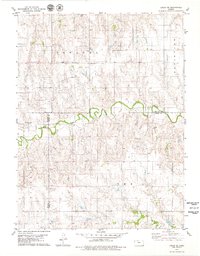 1979 Logan SE1979 Print · USGSPhillips and Rooks Counties at the close of the 1970s show a structured agricultural landscape shaped by local watercourses and early industry. Family historians can trace rural roots near Prairie Dale Cem or the settlement of Towanda, while following Bow Creek across the county lines.
 - 1979 Map of Hay Hollow
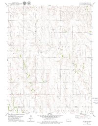 1979 Hay Hollow1979 Print · USGSThe Graham and Trego county line comes into focus in the late seventies, showing a High Plains landscape centered on petroleum production. Researchers can trace the extensive Oil Field development and local drainages like Hay Hollow and Happy Creek.
 - 1979 Map of Studley
 1979 Studley1979 Print · USGSThe High Plains of Sheridan County are captured here in the late seventies, showing the vital rail and river corridor through Studley. Genealogists and local historians can locate the Mount Pleasant Cem and trace the Union Pacific line as it parallels the South Fork Solomon River.
 - 1979 Map of Morland NE
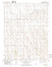 1979 Morland NE1979 Print · USGSGraham County’s rural townships are captured in the late seventies as the petroleum industry shaped the prairie landscape. Genealogists and historians can trace family land near the Anderson Cem or locate industrial sites like the Oil Field and various Oil Wells.
 - 1979 Map of Hill City NW
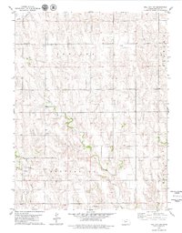 1979 Hill City NW1979 Print · USGSGraham County, Kansas, is documented here in the late seventies as a landscape of rural townships and winding creek beds. Genealogists can locate South Star Cem and Rock Creek Cem, or trace the industry of the era through scattered oil wells and quarries.
Showing maps 1-25 of 155
Top cities of Graham County
Frequently asked questions
- What are the different types of historical maps available for Graham County?
- What is the oldest map of Graham County?
- Where can I purchase historical maps of Graham County for my home or office?
- Where can I download high-res historical maps of Graham County?
- Are there historical topographic maps available for Graham County?
- Is there historical aerial imagery available for Graham County?
- Where are historical maps of Graham County sourced from?