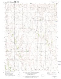
1979 Map of Hay Hollow
USGS Topo · Published 1979About this map
Oil fields and scattered oil wells dominate this 1970s landscape along the border of Graham and Trego counties. The terrain is defined by the sharp drainage patterns of Hay Hollow and Happy Creek, which flow southward toward the North Fork Saline River. This era of the High Plains reflects an economy built on energy extraction, shown through numerous petroleum sites and a quarry near the southeastern corner of the quadrangle. While organized settlements are absent, the map documents the rural infrastructure of townships like Bryant, Happy, and Wakeeney, tracing the network of unimproved roads and light-duty paths that connected the region's scattered agricultural and industrial operations during the late twentieth century.
Find a feature on this map
11 named features on this map. Tap any name to fly to it.
Don’t see what you’re looking for? This feature index may not catch every label — zoom into the map to look around manually.
Map Details
Editions of this 1979 Hay Hollow Map
This is the sole edition of this map. No revisions or reprints were ever made.
Other maps of this area

1893 · Hill
USGS Topo · 1:125,000

1954 · Goodland
USGS Topo · 1:250,000

1955 · Beloit
USGS Topo · 1:250,000

1956 · Goodland
USGS Topo · 1:250,000

1957 · Goodland
USGS Topo · 1:250,000

1959 · Beloit
USGS Topo · 1:250,000
1962 · Wa Keeney East
USGS Topo · 1:24,000
1963 · Wa Keeney West
USGS Topo · 1:24,000

1979 · Hill City South
USGS Topo · 1:24,000

1979 · Morland
USGS Topo · 1:24,000