1990s Maps of Johnson County, Kansas
Explore 13 historic maps of Johnson County from the 1990s. These maps offer a rare glimpse into what life looked like during the 1990s — showing old roads, neighborhoods, homes, and landmarks that have changed or disappeared over time.
Whether you're researching your family's past, planning a metal detecting trip, or studying how Johnson County's landscape evolved across the 1990s, these high-resolution maps are a powerful tool for exploring the history of this region.
- Focus on a specific era: All maps on this page are from the 1990s, giving you a focused view of this time period.
- See what’s changed: Compare century-old streets, trails, and buildings to today's modern landscape using overlays and satellite layers.
- Research with precision: Use these maps for genealogy, historical research, land use analysis, or educational projects.
- View, download, or print: Maps are fully viewable online in high resolution, and can be downloaded or printed for your own records.
Start exploring Johnson County's history through authentic maps from the 1990s. This is your window into the past.
Johnson County, KS maps
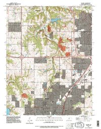
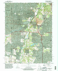
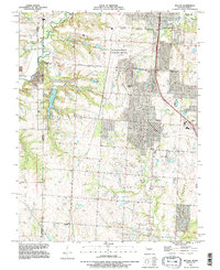
(13)- 1991 Map of Lenexa, 1995 Print
 1991 Lenexa1995 Print · USGSJohnson County is shown in the midst of its late-century expansion, capturing the suburban transformation of Lenexa and Overland Park. Trace the development of local institutions like Johnson County Community College or the residential growth near Turkey Creek.
 - 1991 Map of Olathe, 1995 Print
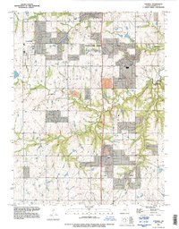
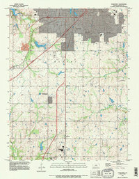
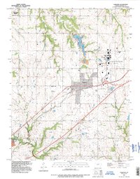
 1991 Olathe1995 Print · USGSJohnson County was experiencing rapid suburban transformation during the 1990s as it grew around traditional hubs. Genealogists and historians can trace institutional sites like the State School For The Deaf and County Farm, alongside older locales like Monticello and Lackmans.
 - 1991 Map of Stilwell, 1995 Print
 1991 Stilwell1995 Print · USGSSouthern Johnson County during the 1990s reveals a landscape of expanding suburbs and historic crossroads. Researchers can locate early township nodes like Stilwell, Morse, and Aubry or trace watercourses like the Blue River and Coffee Creek.
 - 1991 Map of Kansas City, 1995 Print
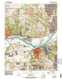
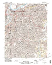 1991 Kansas City1995 Print · USGSGreater Kansas City in the 1990s showcases a dense network of historic neighborhoods, river crossings, and major cemeteries. Researchers can trace family history at Union Cemetery or Elmwood Cemetery and explore the industrial roots of Leeds.2 unique versions available
 - 1991 Map of Shawnee, 1995 Print
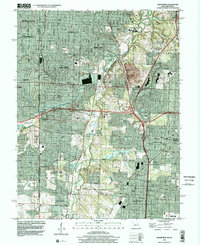
 1991 Shawnee1995 Print · USGSThe Kansas City metropolitan area comes into focus in the early nineties, revealing the industrial riverfronts and expanding suburban corridors. Trace historic family plots at Maple Hill Cemetery or follow the Atchison Topeka and Santa Fe RR through Turner.
 - 1991 Map of Grandview, 1996 Print
 1991 Grandview1996 Print · USGSSouth Kansas City and the Missouri-Kansas border show extensive suburban growth in the early nineties. Genealogists can trace family plots at Green Lawn Cemetery or explore the old rail hubs of Dodson and Martin City.
 - 1991 Map of Edwardsville, 1996 Print
 1991 Edwardsville1996 Print · USGSIn the early 1990s, the river valley west of Kansas City shows a transition from industrial hubs to suburban neighborhoods. Researchers can trace historic settlements like Edwardsville, Holliday, and Zarah alongside landmarks such as Quivira Lake and the County Fairgrounds.
 - 1991 Map of Ocheltree, 1996 Print
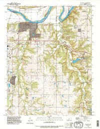
 1991 Ocheltree1996 Print · USGSThe growing outskirts of Olathe and Spring Hill are captured here in the early nineties as suburban expansion began meeting the traditional rural landscape. Researchers can trace the placement of Calvary Cem, the rail-side settlement of Bonita, and water features like New Olathe Lake.
 - 1991 Map of De Soto, 1996 Print
 1991 De Soto1996 Print · USGSThe Kansas River valley near De Soto is captured here in the early nineties as suburban expansion began meeting the area's industrial past. Trace the massive Sunflower Ordnance Works facility, the Murphy Cem, and the winding course of Cedar Creek.
 - 1991 Map of Belton, 1996 Print
 1991 Belton1996 Print · USGSThe Missouri-Kansas borderlands south of Kansas City are captured here in the early nineties as residential growth meets long-standing industrial sites. Researchers can trace family history through sites like Woodland Cem and the Richards-Gebaur Memorial Airport.
 - 1991 Map of Gardner, 1996 Print
 1991 Gardner1996 Print · USGSGardner and the surrounding townships are captured during a period of significant military and civic evolution. Researchers can trace the layout of the US Naval Air Station (Inactive) and find family sites at St Columbia Cem or Fuller Cem.
 - 1996 Map of Grandview, 2002 Print
 1996 Grandview2002 Print · USGSGrandview and southern Kansas City are shown during a period of rapid suburban growth in the late 1990s. Researchers can trace the evolution of old settlements like Hickman Mills, locate family plots in Mt Moriah Cemetery, or follow the path of the Blue River.
 - 1996 Map of Kansas City, 2002 Print
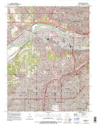
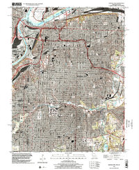 1996 Kansas City2002 Print · USGSKansas City at the turn of the millennium shows a dense urban fabric intertwined with a remarkable legacy of parks and river industry. Genealogists and historians can locate legacy burial grounds like Union Cemetery or trace the early aviation footprint of the Downtown Airport.
End of results
Showing maps 1-13 of 13
Top cities of Johnson County
- Overland Park historical maps
- Olathe historical maps
- Shawnee historical maps
- Lenexa historical maps
- Leawood historical maps
- Prairie Village historical maps
See more
Frequently asked questions
- What are the different types of historical maps available for Johnson County?
- What is the oldest map of Johnson County?
- Where can I purchase historical maps of Johnson County for my home or office?
- Where can I download high-res historical maps of Johnson County?
- Are there historical topographic maps available for Johnson County?
- Is there historical aerial imagery available for Johnson County?
- Where are historical maps of Johnson County sourced from?