1970s Maps of Labette County, Kansas
Explore 21 historic maps of Labette County from the 1970s. These maps offer a rare glimpse into what life looked like during the 1970s — showing old roads, neighborhoods, homes, and landmarks that have changed or disappeared over time.
Whether you're researching your family's past, planning a metal detecting trip, or studying how Labette County's landscape evolved across the 1970s, these high-resolution maps are a powerful tool for exploring the history of this region.
- Focus on a specific era: All maps on this page are from the 1970s, giving you a focused view of this time period.
- See what’s changed: Compare century-old streets, trails, and buildings to today's modern landscape using overlays and satellite layers.
- Research with precision: Use these maps for genealogy, historical research, land use analysis, or educational projects.
- View, download, or print: Maps are fully viewable online in high resolution, and can be downloaded or printed for your own records.
Start exploring Labette County's history through authentic maps from the 1970s. This is your window into the past.
Labette County, KS maps
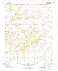
(21)- 1971 Map of Welch North, 1973 Print
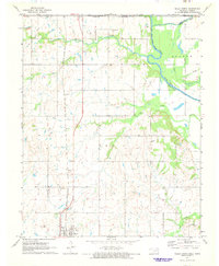 1971 Welch North1973 Print · USGSNortheastern Oklahoma and the Kansas borderlands appear in the early 1970s as a landscape of rural rail towns and prairie creek valleys. Trace the Missouri - Kansas - Texas rail line through Welch or locate family history at Russell Creek Cem and Maybelle Ch.
 - 1971 Map of Welch NW, 1973 Print
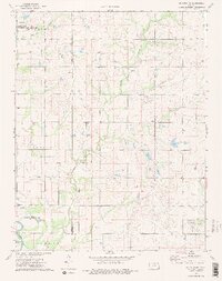
 1971 Welch NW1973 Print · USGSThe Oklahoma-Kansas borderlands in the early 1970s are defined here by a landscape of energy extraction and quiet rural landmarks. Genealogists can locate family-named sites like Rogers Cem and Walker Cem among the active Strip Mines and Gas Wells.2 unique versions available
 - 1972 Map of South Coffeyville, 1974 Print
 1972 South Coffeyville1974 Print · USGSSouth Coffeyville and the Verdigris River valley are shown here in the early seventies as the river winds toward the Oologah Lake reservoir. Researchers can trace rural lineages at Melton Cem and Hickory Creek Cem or locate old industrial sites like the Gravel Pits and Oil Wells.2 unique versions available
 - 1972 Map of Hayrick Mound, 1974 Print
 1972 Hayrick Mound1974 Print · USGSThe Oklahoma-Kansas borderlands in the early seventies reveal a rural landscape of winding creeks and community anchors. Researchers can trace family history through sites like Lain Cem, Plainview Cem, and Rock Creek Ch.
 - 1972 Map of Hollow, 1974 Print
 1972 Hollow1974 Print · USGSThe Oklahoma-Kansas borderlands come into focus in the early 1970s, showing a landscape shaped by local watercourses and rural industry. Genealogists and historians can trace the small communities of Hollow and Banzet, or locate the Sunshine Bible Ch and Ideal Sch.
 - 1973 Map of Mc Cune NE, 1975 Print
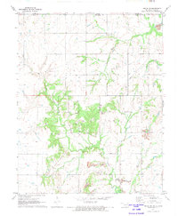
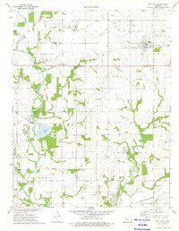
 1973 Mc Cune NE1975 Print · USGSSoutheast Kansas in the early seventies shows a landscape where active extraction and conservation meet at the junction of three counties. Genealogists and historians can trace rural landmarks like Valley City Cem, Green Elm Ch, and the oxbows of Halfmoon Lake.2 unique versions available
 - 1973 Map of Parsons East, 1975 Print
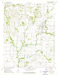
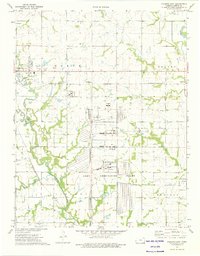 1973 Parsons East1975 Print · USGSLabette County's industrial and rural character is on full display in the early 1970s, as the massive Kansas Army Ammunition Plant operates alongside traditional prairie settlements. Researchers can trace family history through sites like Oakwood Cem and Center Bethel Ch or follow the paths of the St Louis - San Francisco railroad.
 - 1973 Map of Dennis, 1975 Print
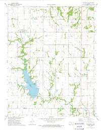
 1973 Dennis1975 Print · USGSLabette County at the mid-seventies shows a landscape in transition as the Big Hill Dam begins to reshape the valley. Genealogists and historians can locate the Bender Oil Field, Harmony Cem, and the old tracks of the St Louis-San Francisco railroad.
 - 1973 Map of Mc Cune, 1975 Print
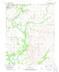
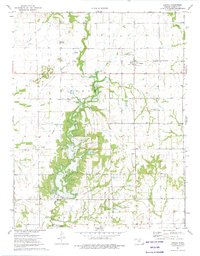
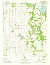
 1973 Mc Cune1975 Print · USGSSoutheast Kansas in the early 1970s reveals a landscape shaped by the Neosho River and the industrial reach of the St Louis - San Francisco railroad. Researchers can locate the rural Service Valley Sch, several family cemeteries, and old mining sites like the southern Strip Mine.
 - 1973 Map of South Mound, 1975 Print
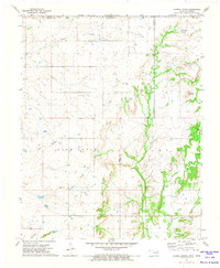
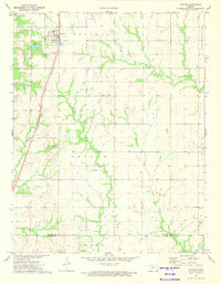
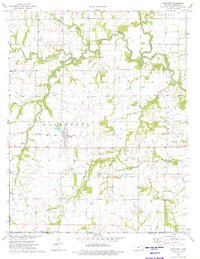
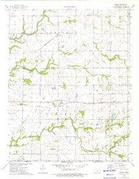
 1973 South Mound1975 Print · USGSThe Neosho River valley in the early 1970s shows a landscape of tight river bends and established rail corridors. Trace local family roots at Union Cem or explore the infrastructure of the day, from the Parsons Dam to the South Mound settlement.
 - 1973 Map of Thayer, 1975 Print
 1973 Thayer1975 Print · USGSThayer and the surrounding prairie of Neosho and Labette Counties are shown here during the early seventies. Genealogists and local historians can locate the Thayer Cem, the Otterbein Ch, and the extensive Oil Field that shaped the local economy.
 - 1973 Map of Parsons West, 1975 Print
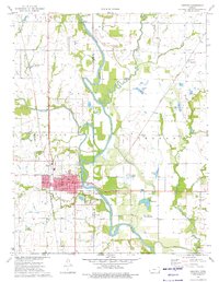
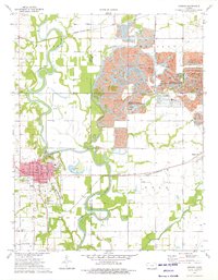
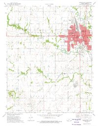 1973 Parsons West1975 Print · USGSParsons was a bustling Labette County hub in the early seventies, caught between its rail-industrial roots and its role as a regional medical and educational center. Researchers can trace family sites at Hopewell Ch, the Wilsonton Cem, or the Parsons State Hospital grounds.
 - 1973 Map of Galesburg, 1975 Print
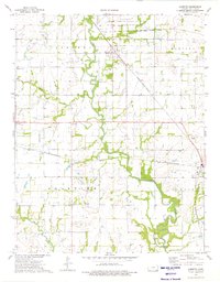
 1973 Galesburg1975 Print · USGSThe rural border of Neosho and Labette Counties is captured here in the early seventies, dominated by the railroad and the waters of Lake Parsons. Genealogists can trace local history through a high density of rural cemeteries like Mt Hope Cem and Ladore Cem.
 - 1974 Map of Bartlett, 1975 Print
 1974 Bartlett1975 Print · USGSSoutheast Kansas in the mid-seventies reveals a landscape defined by prairie creeks and the Old Indian Treaty Boundary. Genealogists and historians can trace the Missouri Pacific railroad through Bartlett or locate family plots at Hackberry Cem and Cecil Cem.
 - 1974 Map of Altamont, 1975 Print
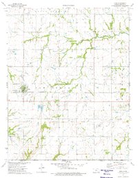
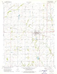 1974 Altamont1975 Print · USGSLabette County's agricultural and rail corridor is captured here in the mid-1970s, centered on the junction at Altamont. Researchers can trace local history through numerous landmarks, from the Edna Municipal Airport to rural burial sites like Wooden Cem and Vance Cem.
 - 1974 Map of Edna, 1975 Print
 1974 Edna1975 Print · USGSLabette County's rural character is well-preserved here in the mid-1970s, showcasing the intersection of prairie agriculture and the Lake Creek Oil Field. Genealogists can locate family landmarks like Edna Cem and the Elm Ch, while historians can trace the Old Indian Treaty Boundary across the terrain.
 - 1974 Map of Mound Valley, 1976 Print
 1974 Mound Valley1976 Print · USGSSoutheast Kansas in the mid-seventies reveals a landscape defined by the convergence of the St Louis - San Francisco railroad and the town of Mound Valley. Genealogists and historians can trace rural family sites at Penfield Cem and Richland Cem, or locate mid-century industry at the Mound Valley Field.
 - 1974 Map of Valeda, 1976 Print
 1974 Valeda1976 Print · USGSSouthern Kansas townships in the mid-1970s reveal a landscape shaped by competing rail lines and early territorial markers. Trace the legacy of family homesteads near Angola and Valeda, or locate ancestors at Leib Cem and Roberts Cem.
 - 1974 Map of Labette, 1976 Print
 1974 Labette1976 Print · USGSLabette County's rural landscape is captured here in the mid-seventies, showing a region defined by heavy rail and defense industry. Genealogists can trace family landmarks like Spring Valley Ch, Fairview Cem, and the old school at Fairview Sch.
 - 1974 Map of Chetopa, 1976 Print
 1974 Chetopa1976 Print · USGSSoutheast Kansas in the mid-1970s reveals a landscape defined by the winding Neosho River and the industrial hub of Chetopa. Genealogists and historians can trace the Indian Treaty Boundary and locate historic burial grounds like Oak Hill Cem and St Rose Cem.
 - 1974 Map of Oswego, 1976 Print
 1974 Oswego1976 Print · USGSOswego and the eastern Kansas plains are captured in the mid-1970s at a time of transition for the local landscape. Genealogists can locate several rural landmarks including Tibbetts Cem, Sunnyview Sch, and the old Strip Pits State Wildlife Management Area mines.
End of results
Showing maps 1-21 of 21
Top cities of Labette County
- Parsons historical maps
- Oswego historical maps
- Chetopa historical maps
- Altamont historical maps
- Edna historical maps
- Mound Valley historical maps
See more
Frequently asked questions
- What are the different types of historical maps available for Labette County?
- What is the oldest map of Labette County?
- Where can I purchase historical maps of Labette County for my home or office?
- Where can I download high-res historical maps of Labette County?
- Are there historical topographic maps available for Labette County?
- Is there historical aerial imagery available for Labette County?
- Where are historical maps of Labette County sourced from?