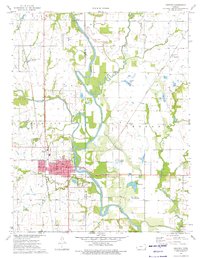
1974 Map of Chetopa
USGS Topo · Published 1976About this map
The Neosho River meanders through this southeast Kansas landscape, serving as a primary geographical anchor near the border of Labette and Cherokee Counties. The city of Chetopa is the clear focal point, showing a dense street grid that includes a Post Office, City Hall, and several local parks. A significant historical marker is the Indian Treaty Boundary, which runs east-west across the map south of the city, intersecting the river just below the Sewage Disposal Ponds.
Find a feature on this map
40 named features on this map. Tap any name to fly to it.
Don’t see what you’re looking for? This feature index may not catch every label — zoom into the map to look around manually.
Map Details
Editions of this 1974 Chetopa Map
This is the sole edition of this map. No revisions or reprints were ever made.
Other maps of this area

1886 · Joplin
USGS Topo · 1:125,000

1886 · Parsons
USGS Topo · 1:125,000

1893 · Parsons
USGS Topo · 1:125,000

1894 · Joplin
USGS Topo · 1:125,000

1901 · Vinita
USGS Topo · 1:125,000

1907 · Wyandotte
USGS Topo · 1:125,000

1909 · Wyandotte
USGS Topo · 1:125,000

1913 · Vinita
USGS Topo · 1:125,000

1918 · Columbus
USGS Topo · 1:62,500

1944 · Oswego
USGS Topo · 1:62,500