1980s Maps of Lyon County, Kansas
Explore 5 historic maps of Lyon County from the 1980s. These maps offer a rare glimpse into what life looked like during the 1980s — showing old roads, neighborhoods, homes, and landmarks that have changed or disappeared over time.
Whether you're researching your family's past, planning a metal detecting trip, or studying how Lyon County's landscape evolved across the 1980s, these high-resolution maps are a powerful tool for exploring the history of this region.
- Focus on a specific era: All maps on this page are from the 1980s, giving you a focused view of this time period.
- See what’s changed: Compare century-old streets, trails, and buildings to today's modern landscape using overlays and satellite layers.
- Research with precision: Use these maps for genealogy, historical research, land use analysis, or educational projects.
- View, download, or print: Maps are fully viewable online in high resolution, and can be downloaded or printed for your own records.
Start exploring Lyon County's history through authentic maps from the 1980s. This is your window into the past.
Lyon County, KS maps
(5)- 1983 Map of Lawrence, 1984 Print
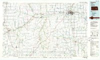
 1983 Lawrence1984 Print · USGSEastern Kansas in the early eighties shows a landscape of growing reservoirs and historic rail towns. Genealogists and historians can trace routes through Topeka and Ottawa, or locate smaller sites like Highland Cem and the settlement of Vassar.
 - 1985 Map of Emporia
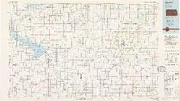
 1985 Emporia1985 Print · USGSThe Flint Hills of central Kansas appear in high detail during the 1980s, centering on the convergence of the Cottonwood and Neosho rivers. Researchers can trace the Old Indian Treaty Boundary or locate prairie outposts like Matfield Green, Saffordville, and Bazaar.2 unique versions available
 - 1985 Map of Garnett
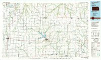
 1985 Garnett1985 Print · USGSAnderson County and its neighbors in the mid-eighties show a landscape of rising reservoirs and enduring rail towns. Genealogists and historians can trace the transition from rail to highway at Beto Junction or locate heritage sites like Silkville and Neosho Rapids.
 - 1985 Map of Council Grove
 1985 Council Grove1985 Print · USGSThe Flint Hills region of Kansas thrives in the mid-1980s as a vital crossroads for major rail lines and prairie water systems. Researchers can trace the path of the Atchison Topeka and Santa Fe through small towns like Hope and Burdick or locate landmarks like Lake Kahola.2 unique versions available
 - 1989 Map of Plymouth, 1990 Print
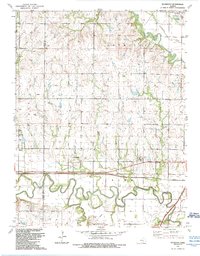 1989 Plymouth1990 Print · USGSLyon County at the end of the eighties shows a landscape shaped by the Cottonwood River and the rise of modern transit. Genealogists can locate rural landmarks like Hillside Cem, Saffordville Ch, and the settlement of Plymouth.
End of results
Showing maps 1-5 of 5
Top cities of Lyon County
- Emporia historical maps
- Americus historical maps
- Olpe historical maps
- Hartford historical maps
- Neosho Rapids historical maps
- Reading historical maps
See more
Frequently asked questions
- What are the different types of historical maps available for Lyon County?
- What is the oldest map of Lyon County?
- Where can I purchase historical maps of Lyon County for my home or office?
- Where can I download high-res historical maps of Lyon County?
- Are there historical topographic maps available for Lyon County?
- Is there historical aerial imagery available for Lyon County?
- Where are historical maps of Lyon County sourced from?