2020s Maps of Lyon County, Kansas
Explore 20 historic maps of Lyon County from the 2020s. These maps offer a rare glimpse into what life looked like during the 2020s — showing old roads, neighborhoods, homes, and landmarks that have changed or disappeared over time.
Whether you're researching your family's past, planning a metal detecting trip, or studying how Lyon County's landscape evolved across the 2020s, these high-resolution maps are a powerful tool for exploring the history of this region.
- Focus on a specific era: All maps on this page are from the 2020s, giving you a focused view of this time period.
- See what’s changed: Compare century-old streets, trails, and buildings to today's modern landscape using overlays and satellite layers.
- Research with precision: Use these maps for genealogy, historical research, land use analysis, or educational projects.
- View, download, or print: Maps are fully viewable online in high resolution, and can be downloaded or printed for your own records.
Start exploring Lyon County's history through authentic maps from the 2020s. This is your window into the past.
Lyon County, KS maps
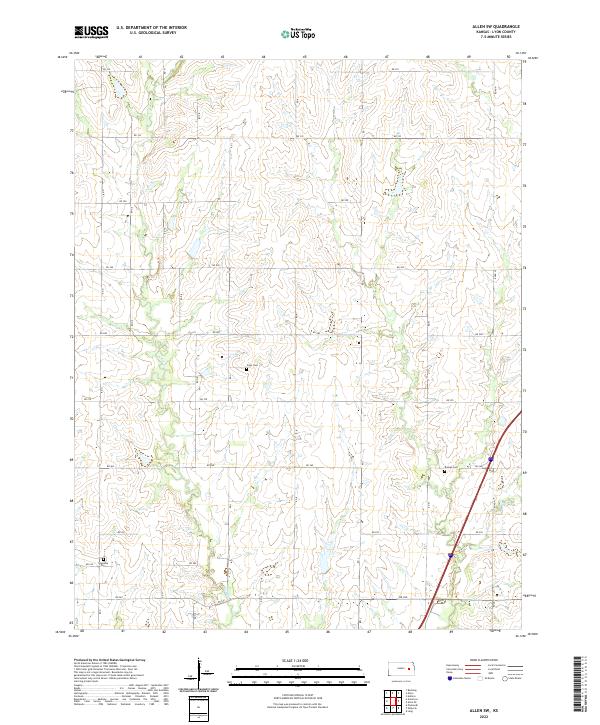
(20)- 2022 Map of Allen SE, 2022 Print
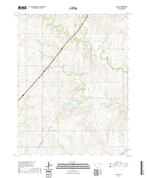 2022 Allen SE2022 Print · USGSLyon County at the start of the 2020s shows a rural landscape defined by prairie creeks and a persistent section-line road grid. Researchers can trace local burial sites at Ivy Cem and Phillips Cem or explore the drainage of One Hundred and Fortytwo Mile Cr.
 - 2022 Map of Phenis Creek, 2022 Print
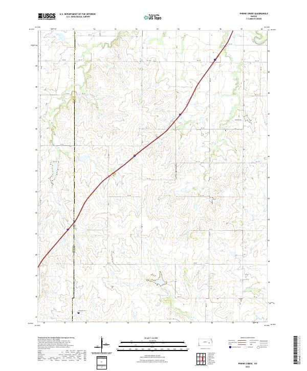 2022 Phenis Creek2022 Print · USGSThe rural borderlands of Lyon and Chase counties are captured here in the early 2020s, showcasing a landscape of winding creek beds and section-line roads. Researchers can locate the Goessel Cemetery and trace the paths of Phenis Creek and Jacob Creek.
 - 2022 Map of Emporia, 2022 Print
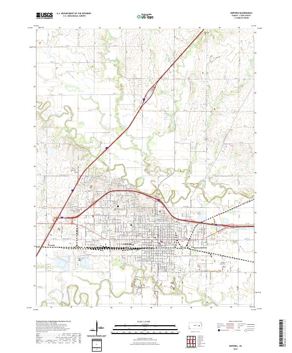 2022 Emporia2022 Print · USGSEmporia and its surrounding river valleys are captured here in the early twenty-first century, showing the city's dense street grid and academic institutions. Researchers can locate family heritage sites like Sacred Heart Cemetery or trace the rail-adjacent growth at Emporia Junction.
 - 2022 Map of Americus, 2022 Print
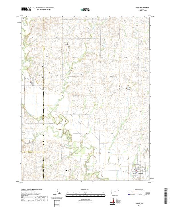 2022 Americus2022 Print · USGSThe Lyon County plains and the Neosho River valley are mapped here in the early twenty-first century. Genealogists can locate significant burial sites like the Dunlap African American Cem and the river-fed lands along Kahola Cr and Troublesome Cr.
 - 2022 Map of Plymouth, 2022 Print
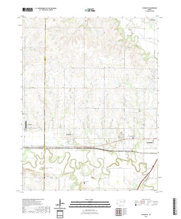 2022 Plymouth2022 Print · USGSCentral Kansas river valleys come alive in the 2020s as the Cottonwood River meets the Neosho River. Genealogists can trace family sites at Cottonwood Friends Cem, Grandview Cem, and the settlement of Plymouth.
 - 2022 Map of Emporia SE, 2022 Print
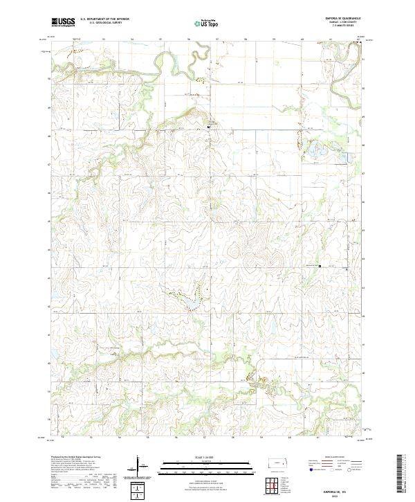 2022 Emporia SE2022 Print · USGSThe confluence of the Cottonwood River and Neosho River dominates this Lyon County landscape in the early 2020s. Researchers can trace rural lineages through the Chicago Mound Cem or the Mennonite Cem along the Olpe-Hartford Rd.
 - 2022 Map of Shaw Creek, 2022 Print
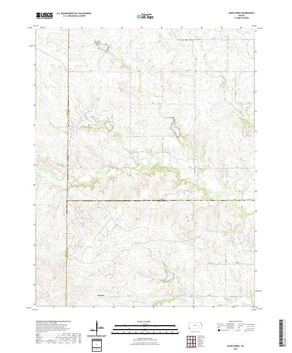 2022 Shaw Creek2022 Print · USGSThe rural borderlands of Lyon, Greenwood, and Chase Counties are captured here in a moment of quiet agricultural continuity. Genealogists and local historians can trace the landscape around Kenbro and follow the branching paths of the N Br Verdigris River and Shaw Cr.
 - 2022 Map of Miller, 2022 Print
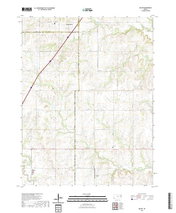 2022 Miller2022 Print · USGSThe intersection of Wabaunsee, Lyon, and Osage counties is captured here in the early twenty-first century. Researchers can trace the rural layouts of Wilmington and Miller, or locate family sites near Wilmington Cem and Rapp Cem.
 - 2022 Map of Lang, 2022 Print
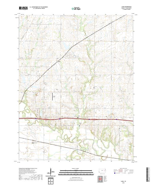 2022 Lang2022 Print · USGSLyon County at the start of the 2020s shows a landscape shaped by the Neosho River and Cottonwood River. Researchers can locate several historic burial sites like Forest Hill Cem and Fowler Cem, alongside the small settlement of Lang.
 - 2022 Map of Hartford, 2022 Print
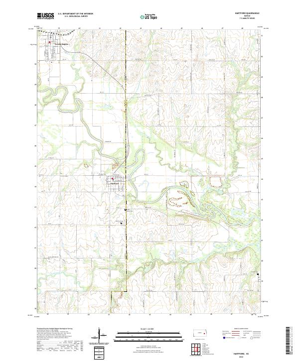 2022 Hartford2022 Print · USGSEastern Kansas farmland meets the winding Neosho River in this modern survey of the Lyon and Coffey county line. Genealogists and local historians can trace family plots at Saint Mary's Cem and Strawn Cem or explore the street grids of Hartford and Neosho Rapids.
 - 2022 Map of Gridley NW, 2022 Print
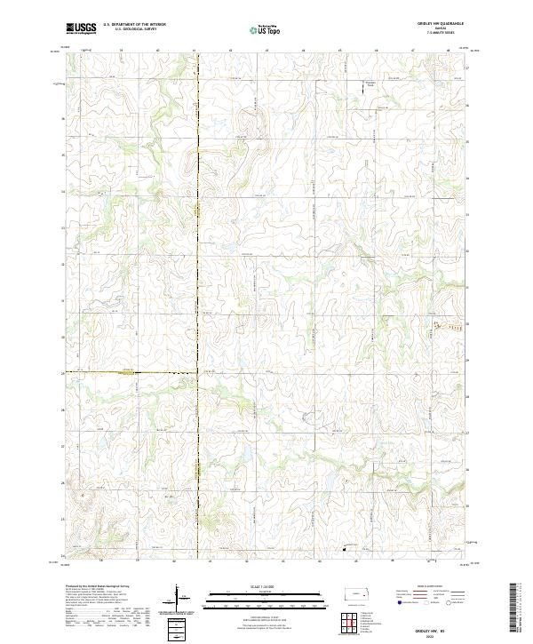 2022 Gridley NW2022 Print · USGSCoffey County prairie meets the borders of Lyon and Greenwood in the early 2020s, showing a landscape defined by ranching and rural township roads. Genealogists and researchers can locate the Apostolic Cem and trace the headwaters of Otter Cr and N Big Cr.
 - 2022 Map of Madison, 2022 Print
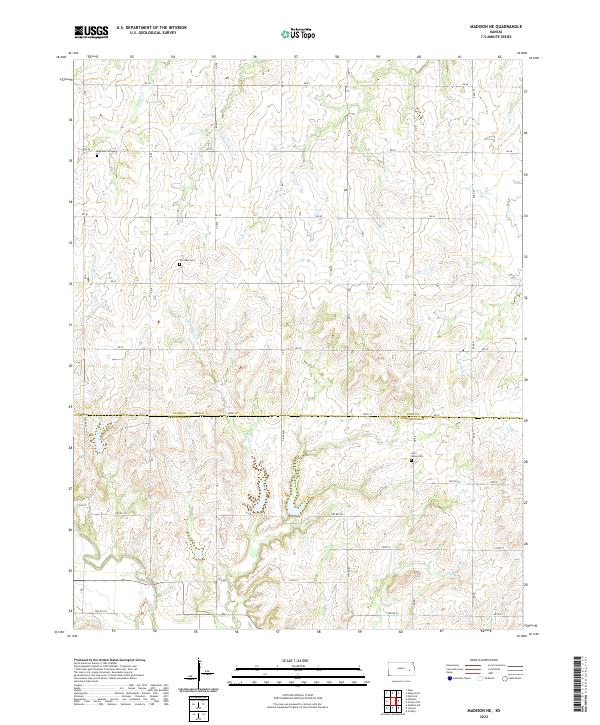
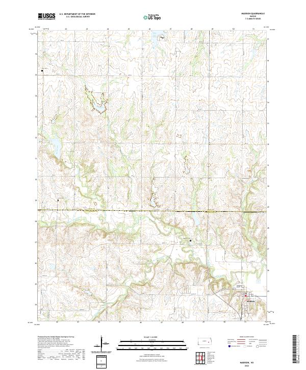 2022 Madison2022 Print · USGSThe rural border of Lyon and Greenwood Counties comes alive in this modern survey of the Kansas prairie. Genealogists and historians can trace family plots at Zion Cem and Blakely Cem or follow the winding Verdigris River through the heart of Madison.
 - 2022 Map of Lebo NW, 2022 Print
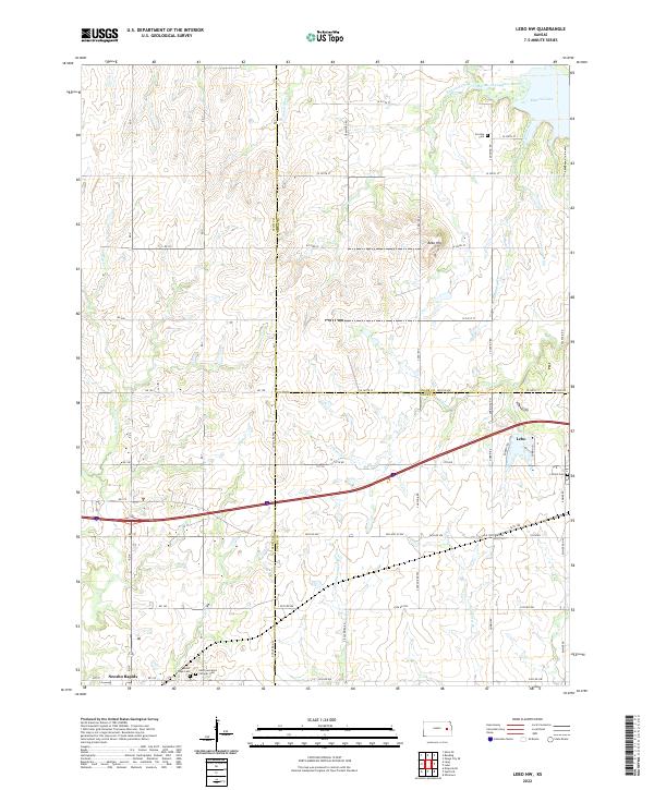 2022 Lebo NW2022 Print · USGSLyon County at the dawn of the 2020s shows a landscape defined by the western waters of Melvern Lake and the Marais des Cygnes River. Researchers can trace old family roots and community sites at Arvonia Cem, Mount Hope Cem, and the village of Neosho Rapids.
 - 2022 Map of Olpe, 2022 Print
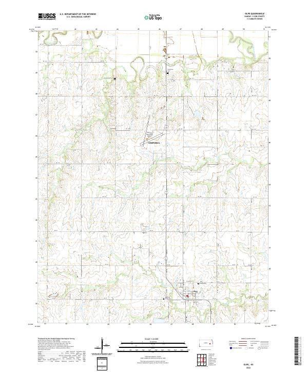 2022 Olpe2022 Print · USGSThe southern outskirts of the Flint Hills region are captured here in the early twenty-first century as the landscape balances aviation and agriculture. Researchers can locate family sites at Greenwood Cem or Pleasant Ridge Cem and trace the winding paths of Dry Cr and the Cottonwood River.
 - 2022 Map of Allen, 2022 Print
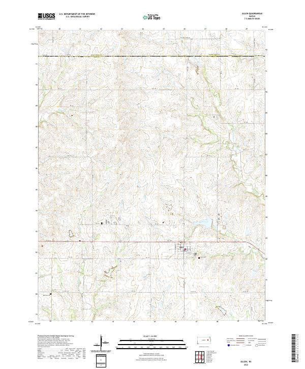 2022 Allen2022 Print · USGSThe Lyon County prairie near the Wabaunsee border is captured here in the early twenty-first century. Researchers can trace the layout of Allen and locate the Bushong Cem and Allen Cem along the winding banks of Hill Creek.
 - 2022 Map of Madison NE, 2022 Print
 2022 Madison NE2022 Print · USGSThe rural border of Lyon and Greenwood counties is documented here as it appeared in the early 2020s. Genealogists and local historians can locate early family burial grounds like Fairview and Lena Valley near the banks of Halderman Creek.
 - 2022 Map of Allen SW, 2022 Print
 2022 Allen SW2022 Print · USGSLyon County at the start of the 2020s remains a landscape of sprawling agricultural sections and quiet country roads. Genealogists can locate rural burial sites like Frost Cem, Rosean Cem, and Township Cem along the Allen Creek drainage.
 - 2022 Map of Admire, 2022 Print
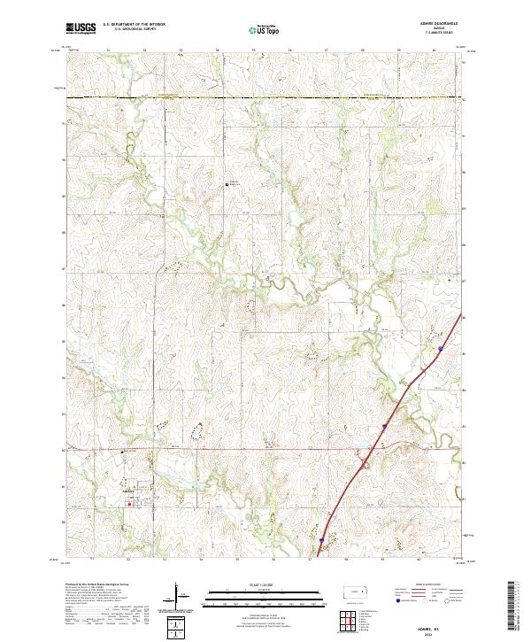 2022 Admire2022 Print · USGSThe rural landscape of northern Lyon County is captured here in the early twenty-first century, centered on the small community of Admire. Researchers can trace local heritage and land use through landmarks like Admire Cem and the uniquely named One Hundred and Fortytwo Mile Cr.
 - 2022 Map of Bushong, 2022 Print
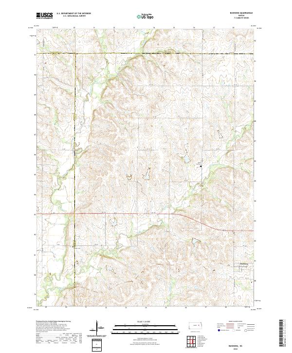 2022 Bushong2022 Print · USGSThe Flint Hills prairie at the convergence of Lyon, Morris, and Wabaunsee counties comes into focus in this recent survey. Researchers can trace rural lineages at Agnes City Cem or follow the winding courses of Bluff Creek and Rock Cr.
 - 2022 Map of Reading, 2022 Print
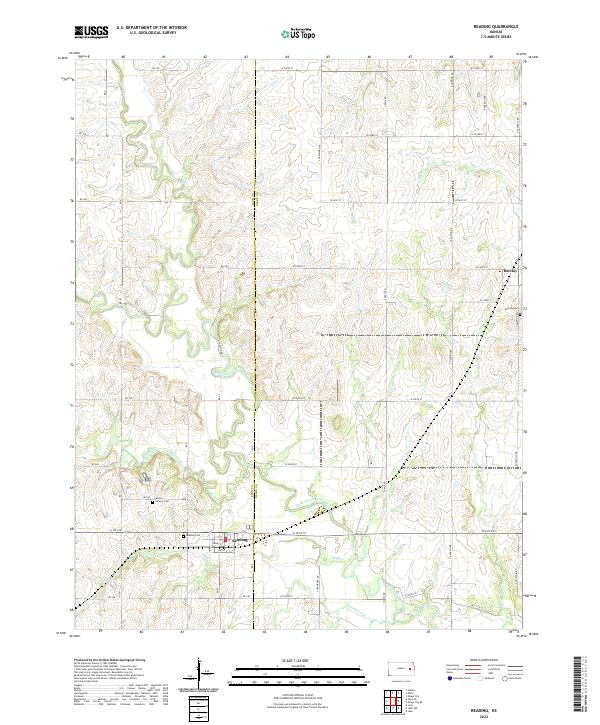 2022 Reading2022 Print · USGSThe borderlands of Lyon and Osage Counties come into focus in this contemporary survey of eastern Kansas prairie and river valleys. Researchers can trace family history at Reading Cem and Barclay Cem or follow the path of the Marais des Cygnes River.
End of results
Showing maps 1-20 of 20
Top cities of Lyon County
- Emporia historical maps
- Americus historical maps
- Olpe historical maps
- Hartford historical maps
- Neosho Rapids historical maps
- Reading historical maps
See more
Frequently asked questions
- What are the different types of historical maps available for Lyon County?
- What is the oldest map of Lyon County?
- Where can I purchase historical maps of Lyon County for my home or office?
- Where can I download high-res historical maps of Lyon County?
- Are there historical topographic maps available for Lyon County?
- Is there historical aerial imagery available for Lyon County?
- Where are historical maps of Lyon County sourced from?