1900s (20th Century) Maps of Wabaunsee County, Kansas
Explore 48 historic maps of Wabaunsee County from the 1900s (20th Century). These maps offer a rare glimpse into what life looked like during the 1900s — showing old roads, neighborhoods, homes, and landmarks that have changed or disappeared over time.
Whether you're researching your family's past, planning a metal detecting trip, or studying how Wabaunsee County's landscape evolved across the 1900s, these high-resolution maps are a powerful tool for exploring the history of this region.
- Focus on a specific era: All maps on this page are from the 1900s, giving you a focused view of this time period.
- See what’s changed: Compare century-old streets, trails, and buildings to today's modern landscape using overlays and satellite layers.
- Research with precision: Use these maps for genealogy, historical research, land use analysis, or educational projects.
- View, download, or print: Maps are fully viewable online in high resolution, and can be downloaded or printed for your own records.
Start exploring Wabaunsee County's history through authentic maps from the 1900s. This is your window into the past.
Wabaunsee County, KS maps
(48)- 1947 Map of Manhattan, 1954 Print
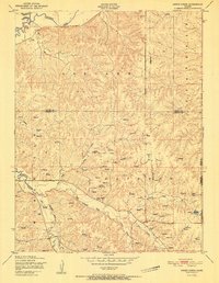
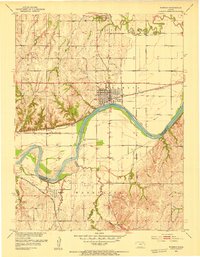
 1947 Manhattan1954 Print · USGSManhattan and the surrounding Kansas river valleys are shown here in the years immediately following World War II. Researchers can trace the extensive military works at Camp Funston, local education at College Hill Sch, and pioneer-era sites like St Patricks Cem.2 unique versions available
 - 1947 Map of Lawrence, 1954 Print
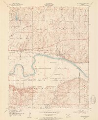
 1947 Lawrence1954 Print · USGSEastern Kansas and western Missouri thrive in the late 1940s, showing a landscape defined by major river valleys and a dense railway network. Genealogists can trace family settlements from Lawrence to Greenwood and locate landmarks like Olathe Navy and Lake Lotawana.
 - 1950 Map of Kansas City
 1950 Kansas City1950 Print · USGSMid-century Kansas and Missouri are captured here during a period of industrial growth and shifting transportation. Genealogists and historians can trace rail lines like the Wabash RR or locate ancestral homes near the Potawatomi Indian Reservation and Horton.
 - 1950 Map of Lawrence
 1950 Lawrence1950 Print · USGSMid-century Kansas and Missouri come alive in this map of the river-valley corridors just as the interstate era was beginning. Researchers can trace the legacy of major rail lines like the Union Pacific RR and locate ancestral roots in towns from Lawrence to Harrisonville.
 - 1951 Map of Swede Creek
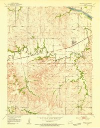
 1951 Swede Creek1951 Print · USGSThe rural borderlands of Geary and Riley counties are captured here in the early fifties, showing a landscape shaped by the McDowell Creek watershed. Researchers can trace family history through sites like Ashland Cemetery, Briggs School, and Cleveland School.2 unique versions available
 - 1952 Map of Rossville, 1953 Print
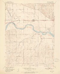
 1952 Rossville1953 Print · USGSThe rural borders of Shawnee and Jackson counties are captured here in the early fifties, a time when small country schoolhouses still dotted the prairie. You can trace family roots at Bohemian Cemetery, locate the Stone School, or follow the Union Pacific rail line.4 unique versions available
 - 1952 Map of Harveyville, 1953 Print
 1952 Harveyville1953 Print · USGSHarveyville and the surrounding prairie were captured in the early fifties as the local rail-and-water economy thrived. Genealogists and historians can trace the Atchison Topeka and Santa Fe line, the Bellview Sch (Abandoned), and the Cem north of town.3 unique versions available
 - 1952 Map of Dover, 1953 Print
 1952 Dover1953 Print · USGSShawnee County at the start of the fifties shows a landscape defined by old reservation lines and winding creek beds. Researchers can find numerous former local landmarks, including School No 6 (Abandoned), the Dover Cem, and the Girl Scout Camp near Mission Creek.3 unique versions available
 - 1952 Map of Willard, 1954 Print
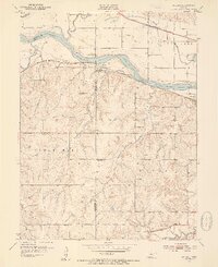 1952 Willard1954 Print · USGSThe Kansas River valley at mid-century reveals a bustling corridor of competing rail lines and riverfront settlements. Researchers can trace the legacy of family farms and rural communities through landmarks like West Union Ch, Green Cem, and the Valencia townsite.4 unique versions available
 - 1953 Map of Wamego, 1954 Print
 1953 Wamego1954 Print · USGSMid-century Kansas comes to life in this survey of the river valley settlements near the Pottawatomie and Wabaunsee county line. Genealogists and local historians can trace the paths of the Union Pacific, locate St. Bernard Cem, or find the historic Wabaunsee townsite.3 unique versions available
 - 1953 Map of St George, 1954 Print
 1953 St George1954 Print · USGSMid-century Pottawatomie County is defined here by the twin rail lines of the Union Pacific and the Rock Island flanking the river. Researchers can trace rural life through landmarks like Mt Zion Ch, Sunflower Sch, and the historic Pillsbury Crossing.4 unique versions available
 - 1953 Map of Maple Hill, 1954 Print
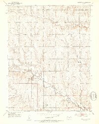
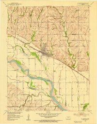
 1953 Maple Hill1954 Print · USGSWabaunsee County in the early fifties shows a landscape shaped by the winding Mill Creek and the busy Chicago Rock Island and Pacific railroad. Local historians can locate landmarks like Buffalo Mound, the settlement at Vera, and the rural Sunny Side Sch.2 unique versions available
 - 1953 Map of Belvue, 1954 Print
 1953 Belvue1954 Print · USGSThe Kansas River valley near the Pottawatomie and Wabaunsee county line is captured in the early fifties as a landscape of rail-fed towns and rural school districts. Genealogists can trace family footprints at Belvue Cem, Wells Creek Sch, and St Johns Ch.3 unique versions available
 - 1953 Map of St Marys, 1954 Print
 1953 St Marys1954 Print · USGSThe Kansas River valley in the early 1950s centered on the hub of St Marys, where the rail and river economies met. Genealogists and historians can trace local rural infrastructure through sites like St Marys Seminary, Turkey Creek Sch, and Mt Calvary Cem.2 unique versions available
 - 1953 Map of Wamego SW, 1955 Print
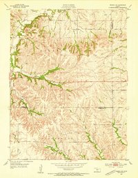 1953 Wamego SW1955 Print · USGSThe Riley and Wabaunsee county line in the early fifties shows a landscape of upland ridges and creek-fed valleys. Researchers can locate local landmarks like the Community Hall, the rural Tabor Sch, and a Windmill marking an early mid-century homestead.3 unique versions available
 - 1954 Map of Kansas City
 1954 Kansas City1954 Print · USGSThe Missouri-Kansas borderlands flourished in the post-war era as river commerce and rail networks converged at the Missouri River. Genealogists and historians can trace the foundations of Kansas City and smaller rural hubs like Hiawatha or Sabetha.
 - 1954 Map of Alma, 1955 Print
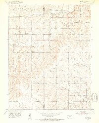
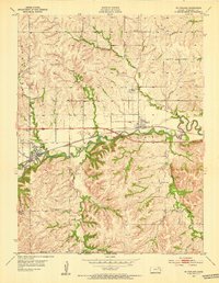
 1954 Alma1955 Print · USGSIn the mid-1950s, the railroad town of Alma stood at a critical junction of the Atchison Topeka and Santa Fe and Rock Island lines. Genealogists and local historians can trace the Potawatomi Reservation Boundary and locate rural landmarks like Hinerville Sch and Alma Cem.2 unique versions available
 - 1954 Map of Mc Farland, 1955 Print
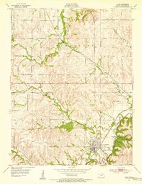
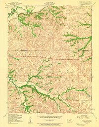
 1954 Mc Farland1955 Print · USGSThe rail-and-river corridor of Wabaunsee County is captured here in the mid-fifties, centered on the Chicago Rock Island and Pacific line. Researchers can trace the layout of McFarland and Paxico or locate rural sites like Bethlehem Cem and Newbury.2 unique versions available
 - 1955 Map of Swede Creek, 1958 Print
 1955 Swede Creek1958 Print · USGSThe rural borderlands of Geary and Riley counties are captured here in the mid-fifties, showing a landscape defined by creek valleys and farm life. Genealogists and researchers can locate landmarks like Ashland Cem, Briggs School, and the junction of McDowell Creek and Swede Creek.3 unique versions available
 - 1955 Map of Manhattan, 1964 Print
 1955 Manhattan1964 Print · USGSNorth Central Kansas is captured here in the mid-fifties, just as major flood control projects began reshaping the river valleys. Genealogists can locate family sites near St. Joseph Church, Sunset Cemetery, or along the busy tracks of the Rock Island RR.4 unique versions available
 - 1955 Map of Hutchinson, 1967 Print
 1955 Hutchinson1967 Print · USGSCentral Kansas in the mid-sixties reveals a landscape of growing reservoirs and evolving transportation corridors. Trace the development of towns like Hutchinson and Abilene alongside the Union Pacific Railroad and the expanding Interstate 70.3 unique versions available
 - 1956 Map of Manhattan
 1956 Manhattan1956 Print · USGSNorth-central Kansas in the mid-fifties reveals a landscape defined by the convergence of the Republican River and Smoky Hill River. Historians can trace the rail corridors of the Union Pacific RR and Missouri Pacific RR through towns like Manhattan and Clay Center.
 - 1956 Map of Kansas City, 1967 Print
 1956 Kansas City1967 Print · USGSThe Kansas-Missouri border region thrived during the mid-fifties, centered on the growing metropolitan cores and the busy river valleys. Researchers can trace the layout of significant government sites like Fort Leavenworth and the Lake City Army Ammunition Plant.4 unique versions available
 - 1956 Map of Lawrence, 1967 Print
 1956 Lawrence1967 Print · USGSEastern Kansas and the Missouri border country are captured here during the mid-century transition to the interstate era. Genealogists and local historians can trace family-named terrain like Summers Mound and the footprint of Sunflower Ordnance Works near Baldwin City.4 unique versions available
 - 1957 Map of Manhattan
 1957 Manhattan1957 Print · USGSNortheast Kansas in the mid-1950s reveals a landscape of expanding military installations and new water projects. Genealogists and historians can trace the rail-to-river economy through the Union Pacific RR and old settlements like Clay Center or Marysville.
Showing maps 1-25 of 48
Top cities of Wabaunsee County
- Newbury historical maps
- Alma historical maps
- Wilmington historical maps
- Eskridge historical maps
- Maple Hill historical maps
- Wabaunsee historical maps
See more
Frequently asked questions
- What are the different types of historical maps available for Wabaunsee County?
- What is the oldest map of Wabaunsee County?
- Where can I purchase historical maps of Wabaunsee County for my home or office?
- Where can I download high-res historical maps of Wabaunsee County?
- Are there historical topographic maps available for Wabaunsee County?
- Is there historical aerial imagery available for Wabaunsee County?
- Where are historical maps of Wabaunsee County sourced from?