Old Maps of McCracken County, Kentucky for Metal Detecting
Plan your next treasure hunt with 118 historic maps of McCracken County. Find old homesites, ghost towns, trails, and gathering spots that may be lost to time — perfect for identifying promising metal detecting locations.
- Locate forgotten sites: Uncover places like long-lost settlements, abandoned rail lines, or gathering spots.
- Plan better hunts: Use map overlays combined with LiDAR or satellite views to narrow in on historically rich areas.
- Made for detectorists: Thousands of hobbyists use these maps to discover relics, coins, and hidden history.
Use these historic maps to boost your research and find new opportunities beneath the surface of McCracken County.
McCracken County, KY maps
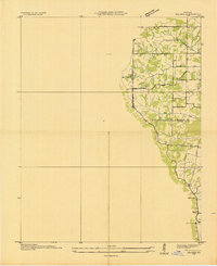
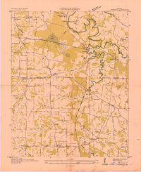
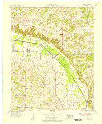
(118)- 1926 Map of Paducah, 1967 Print
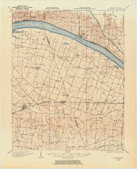
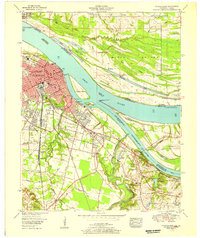
 1926 Paducah1967 Print · USGSThe riverfront cities of Paducah and Metropolis are shown at the height of the steam-and-rail era before the major mid-century dam projects. Genealogists can trace family names through dozens of rural landmarks like Weyer Cemetery, Hamilton Chapel, and the Little Union Sch.
 - 1928 Map of La Center, 1964 Print
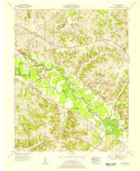
 1928 La Center1964 Print · USGSWestern Kentucky and Southern Illinois meet along the Ohio River in the late twenties, showing a landscape of small farming hamlets and river landings. Researchers can locate dozens of family-named schools and churches like Gum Corners Sch, Monkeys Eyebrow, and Ohio Chapel.
 - 1929 Map of Smithland
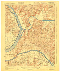 1929 Smithland1929 Print · USGSThe convergence of the Ohio, Tennessee, and Cumberland Rivers defines this late 1920s survey of the Kentucky-Illinois border. Genealogists and researchers can trace riverside life through Haddox Ferry, Smithland, and vanished schoolhouses like Yellowbird Sch.3 unique versions available
 - 1929 Map of Paducah
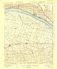
 1929 Paducah1929 Print · USGSThe confluence of the Ohio and Tennessee Rivers comes alive in the late twenties as a bustling hub of river and rail transport. Genealogists and historians can trace family roots through numerous local landmarks like West Paducah PO, Veyer Cemetery, and the County Sanitarium.4 unique versions available
 - 1932 Map of La Center
 1932 La Center1932 Print · USGSWestern Kentucky and southern Illinois meet along the Ohio River in the early 1930s, showing a landscape of river landings and rail-side towns. Genealogists can trace family roots through numerous rural landmarks like Monkeys Eyebrow, Hinkleville, and Gum Corners Sch.
 - 1936 Map of Melber
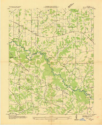
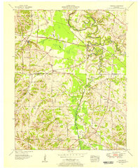
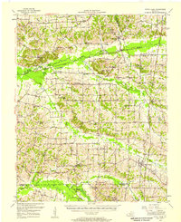
 1936 Melber1936 Print · USGSWestern Kentucky in the mid-1930s was a landscape of small schools and essential drainage projects along the McCracken and Graves county line. Researchers can trace rural community hubs like Houser Grove Ch and Boaz Sch or follow the Illinois Central rail line.
 - 1936 Map of Paducah
 1936 Paducah1936 Print · USGSPaducah thrived as a vital river and rail hub during the mid-thirties, situated at the confluence of the Ohio and Tennessee. Genealogists and historians can trace neighborhood growth through local schools like Hamilton Sch and family-named landmarks such as Nortons Bluff and Stiles Crossing.
 - 1936 Map of Elva
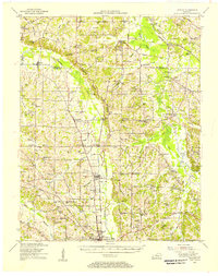
 1936 Elva1936 Print · USGSMarshall and McCracken Counties were deeply agricultural and river-dependent in the mid-1930s. Researchers can trace family homesteads near Mt Moriah Ch, navigate the rail stops at Elva, or locate vanished crossings like Harris Hill Ford.
 - 1936 Map of Smithland
 1936 Smithland1936 Print · USGSThe confluence of the Ohio and Tennessee Rivers is captured here in the mid-1930s, documenting a landscape of river-dependent towns and rural school districts. Genealogists can locate family sites like Sleeper Cemetery or Thompson Chapel and trace the original path of the Illinois Central Railroad.
 - 1936 Map of Symsonia
 1936 Symsonia1936 Print · USGSWestern Kentucky at the edge of the Graves and McCracken county line is documented here in the mid-1930s. Researchers can trace family roots through numerous local landmarks like Boaz Cem, Hard Money, and the community of Symsonia.
 - 1936 Map of Benton
 1936 Benton1936 Print · USGSWestern Kentucky's rural Marshall County is captured here in the mid-1930s, showing a landscape defined by river fords and small family settlements. Genealogists can trace hundreds of specific locations, from C C C Camp No 519 to Oak Level and Tatumsville.
 - 1936 Map of Little Cypress
 1936 Little Cypress1936 Print · USGSThe Ohio and Tennessee Rivers meet amidst a network of rural settlements in the mid-1930s. Researchers can trace family sites like Little Cypress or locate Kincaid Mounds and early churches like Chestnut Hill Ch.
 - 1940 Map of Paducah, 1958 Print
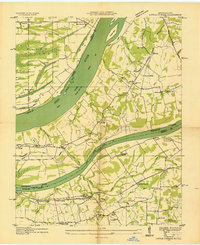
 1940 Paducah1958 Print · USGSAcross the river from Illinois at the start of the 1940s, this area captures Paducah and Metropolis at a peak of rail and river activity. Researchers can trace the Illinois Central RR lines, locate family markers at Veyer Cemetery, and find rural landmarks like Klondike Sch and Palestine Ch.
 - 1942 Map of Smithland, 1957 Print
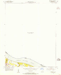
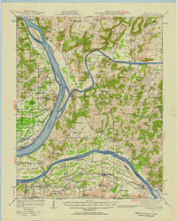 1942 Smithland1957 Print · USGSWestern Kentucky's river-driven economy is on full display during the early 1940s as the Ohio, Cumberland, and Tennessee rivers converge. Researchers can trace historic river crossings like Haddox Ferry and find family landmarks at Kincaid Mounds or the Klondike Mine.
 - 1949 Map of Paducah
 1949 Paducah1949 Print · USGSThe confluence of the Ohio, Mississippi, Tennessee, and Cumberland rivers at the close of the 1940s reveals a region bound by water and rail. Researchers can trace historic river landings, timberlands in the Shawnee National Forest, and the coal-mining infrastructure around West Frankfort and Herrin.2 unique versions available
 - 1950 Map of Paducah
 1950 Paducah1950 Print · USGSThe confluence of the great midwestern rivers defines this mid-century landscape at the intersection of Illinois, Kentucky, and Missouri. Genealogists and historians can trace the rail-and-river economy through the hubs of Paducah, Cairo, and Metropolis or locate family roots near the Wildcat Hills.
 - 1951 Map of Melber, 1956 Print
 1951 Melber1956 Print · USGSThe rural borderlands of Graves and McCracken Counties come into focus in this early 1950s study of the western Kentucky landscape. Genealogists can trace family names across dozens of sites like Tittsworth Cem and Allcock Cem, or locate rural landmarks like Diggs Chapel and the Illinois Central rail line.2 unique versions available
 - 1951 Map of Elva, 1956 Print
 1951 Elva1956 Print · USGSWestern Kentucky's rural river bottoms and early highway corridors are captured here in the early fifties. Genealogists can trace family landmarks and community centers such as Bethlehem Ch, Belton Cem, and the crossing at McCoy Ford Bridge.2 unique versions available
 - 1951 Map of Symsonia, 1956 Print
 1951 Symsonia1956 Print · USGSWestern Kentucky at the start of the fifties shows a landscape of river forks and small settlements like Symsonia and Hardmoney. Genealogists can trace family names through landmarks like Thompson Cem, Neece Chapel, and the Freemont Sch.2 unique versions available
 - 1951 Map of Hickory, 1957 Print
 1951 Hickory1957 Print · USGSIn the early 1950s, this area of Graves and McCracken County was a patchwork of small tobacco farms and rail-stop towns. Researchers can locate hundreds of family sites, from the Clay Pits near Hickory to remote landmarks like Neece Chapel and Old Casey Bridge.
 - 1952 Map of Fancy Farm, 1958 Print
 1952 Fancy Farm1958 Print · USGSWestern Kentucky's rural landscapes are documented here in the early fifties, showing the tight-knit farming communities of Graves and Carlisle counties. Trace family history through local landmarks like Fancy Farm, St Charles Sch, and Milburn Cem.
 - 1953 Map of Paducah East, 1956 Print
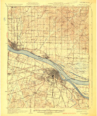
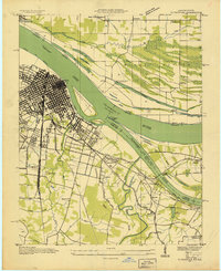
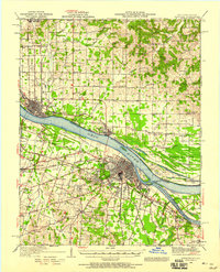
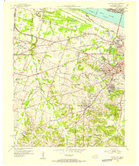
 1953 Paducah East1956 Print · USGSPaducah thrived at the strategic meeting of the Ohio and Tennessee Rivers during the early fifties, serving as a bustling railway and maritime center. Researchers can trace the mid-century city grid and outlying landmarks like Augusta Tilghman High School, Owens Island, and the sprawling Illinois Central Railroad yards.
 - 1954 Map of Paducah
 1954 Paducah1954 Print · USGSSouthern Illinois and Western Kentucky intersect at the great river confluences during this mid-century era of rail and river industry. Genealogists and historians can trace family roots and commerce through river towns like Cairo, Metropolis, and Golconda, or along the tracks of the Illinois Central Railroad.2 unique versions available
 - 1954 Map of Metropolis, 1955 Print
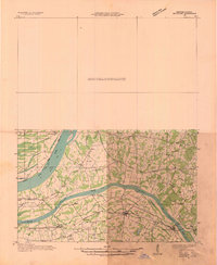
 1954 Metropolis1955 Print · USGSThe Ohio River borderland comes into focus in the mid-1950s, highlighting the essential river-and-rail infrastructure of the era. Researchers can trace the path of the Illinois Central Railroad and locate the historic Lock and Dam No 52 near Massac Creek.
 - 1954 Map of Paducah West, 1955 Print
 1954 Paducah West1955 Print · USGSWestern McCracken County during the mid-fifties shows the city of Paducah expanding into the surrounding countryside. Genealogists can locate family sites at the Mount Kenton Cemetery, Massac Cem, and the Palestine Ch.
Showing maps 1-25 of 118
Top cities of McCracken County
Frequently asked questions
- What are the different types of historical maps available for McCracken County?
- What is the oldest map of McCracken County?
- Where can I purchase historical maps of McCracken County for my home or office?
- Where can I download high-res historical maps of McCracken County?
- Are there historical topographic maps available for McCracken County?
- Is there historical aerial imagery available for McCracken County?
- Where are historical maps of McCracken County sourced from?