
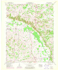
1951 Map of Melber
USGS Topo · Published 1956About this map
Melber and the surrounding farm country sit at the intersection of the McCracken and Graves County line, characterized by a transition from the rolling highlands of the Tennessee Valley Divide to the flat lowlands of Mayfield Creek. The landscape of the early 1950s is defined by a dense network of family cemeteries and rural congregations, reflecting a deeply rooted community structure. Notable sites include St Johns Ch and Diggs Chapel, while smaller crossroads like Kansas and Folsomdale serve as local anchors.
Find a feature on this map
41 named features on this map. Tap any name to fly to it.
Don’t see what you’re looking for? This feature index may not catch every label — zoom into the map to look around manually.
Map Details
Editions of this 1951 Melber Map
2 editions found
Other maps of this area

1926 · Paducah
USGS Topo · 1:62,500

1928 · La Center
USGS Topo · 1:62,500

1929 · Paducah
USGS Topo · 1:62,500

1932 · La Center
USGS Topo · 1:62,500

1936 · Melber
USGS Topo · 1:24,000

1936 · Paducah
USGS Topo · 1:24,000

1936 · Symsonia
USGS Topo · 1:24,000

1936 · Westplains
USGS Topo · 1:24,000

1940 · Paducah
USGS Topo · 1:62,500

1949 · Paducah
USGS Topo · 1:250,000