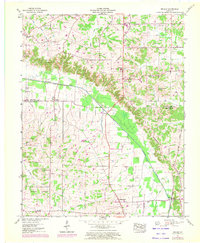
1951 Map of Melber
USGS Topo · Published 1972About this map
The Tennessee Valley Divide snakes through this landscape on the border of Graves and McCracken Counties, separating the drainages of Massac Creek and Mayfield Creek. The village of Melber sits at the county line, while the Illinois Central Railroad cuts through the southeastern corner near Boaz. This 1951 survey, updated in the early 1970s, reveals a dense network of family history markers, including nearly twenty burial grounds such as Thompson Cem, Purchase Cem, and the sprawling Woodlawn Memorial Gardens. Religious life centers on several rural congregations like St Johns Ch and Houser Grove Church. The mapping of the Drainage Canal alongside the natural winding of the creek beds shows a region actively managing its water for agriculture and settlement during the mid-20th century.
Find a feature on this map
43 named features on this map. Tap any name to fly to it.
Don’t see what you’re looking for? This feature index may not catch every label — zoom into the map to look around manually.
Map Details
Editions of this 1951 Melber Map
2 editions found

Other maps of this area

1926 · Paducah
USGS Topo · 1:62,500

1928 · La Center
USGS Topo · 1:62,500

1929 · Paducah
USGS Topo · 1:62,500

1932 · La Center
USGS Topo · 1:62,500

1936 · Melber
USGS Topo · 1:24,000

1936 · Paducah
USGS Topo · 1:24,000

1936 · Symsonia
USGS Topo · 1:24,000

1936 · Westplains
USGS Topo · 1:24,000

1940 · Paducah
USGS Topo · 1:62,500

1949 · Paducah
USGS Topo · 1:250,000