1970s Maps of Pulaski County, Kentucky
Explore 8 historic maps of Pulaski County from the 1970s. These maps offer a rare glimpse into what life looked like during the 1970s — showing old roads, neighborhoods, homes, and landmarks that have changed or disappeared over time.
Whether you're researching your family's past, planning a metal detecting trip, or studying how Pulaski County's landscape evolved across the 1970s, these high-resolution maps are a powerful tool for exploring the history of this region.
- Focus on a specific era: All maps on this page are from the 1970s, giving you a focused view of this time period.
- See what’s changed: Compare century-old streets, trails, and buildings to today's modern landscape using overlays and satellite layers.
- Research with precision: Use these maps for genealogy, historical research, land use analysis, or educational projects.
- View, download, or print: Maps are fully viewable online in high resolution, and can be downloaded or printed for your own records.
Start exploring Pulaski County's history through authentic maps from the 1970s. This is your window into the past.
Pulaski County, KY maps
(8)- 1973 Map of Eli, 1974 Print
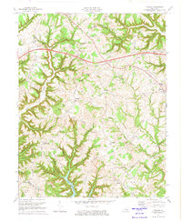
 1973 Eli1974 Print · USGSRussell and Pulaski counties are shown here in the early seventies as the region balanced its agrarian roots with modern infrastructure. Genealogists and historians can trace family locations near Irvins Store, Old Friendship Cem, and Locust Grove Ch.
 - 1973 Map of Delmer, 1974 Print
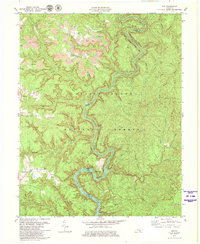
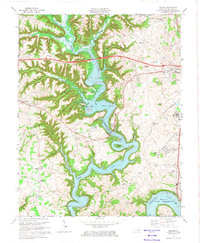 1973 Delmer1974 Print · USGSPulaski County's landscape is defined by the winding waters of the reservoir and the historic Mill Springs battlefield in the early seventies. Genealogists can trace family landmarks like Okalona Ch, Mill Springs National Cem, and the community of Shepola.2 unique versions available
 - 1973 Map of Faubush, 1974 Print
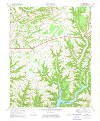
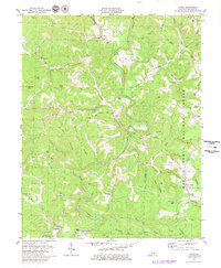
 1973 Faubush1974 Print · USGSPulaski County’s rolling ridge country is documented here in the early 1970s as the Cumberland Parkway bisects the rural landscape. Researchers can trace family roots at Cedar Point Cemetery, Mt Zion Ch, and the settlement of Faubush.2 unique versions available
 - 1973 Map of Somerset, 1974 Print
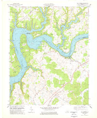
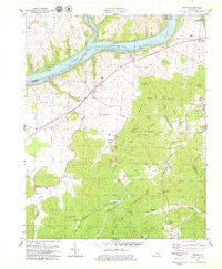
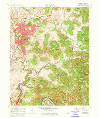 1973 Somerset1974 Print · USGSSomerset and southern Pulaski County are shown during a period of growth and transition in the early seventies. Trace the development of the Southern railroad corridor and locate rural landmarks like Clay Hill Ch and the rising waters of Lake Cumberland.2 unique versions available
 - 1978 Map of Mill Springs
 1978 Mill Springs1978 Print · USGSLake Cumberland was already a well-established recreational destination by the late seventies, reshaped by the impoundment of the river. Genealogists can trace family names and historic sites like Steubenville, Morrow Chapel, and the Mill Springs Battlefield.
 - 1978 Map of Frazer, 1979 Print
 1978 Frazer1979 Print · USGSThe border of Wayne and Pulaski Counties appears here in the late seventies as the river valley adjusts to the waters of Lake Cumberland. Genealogists can trace family names at Stigall Cem and Taylor Cem or locate the rural New Salem Ch.2 unique versions available
 - 1979 Map of Dykes, 1980 Print
 1979 Dykes1980 Print · USGSPulaski County at the close of the seventies reveals a landscape of high ridges and narrow hollows along the winding Buck Creek. Local historians can trace family roots through numerous remote burial grounds like Bent Cem and rural congregations such as New Hope Ch and Wesley Chapel.
 - 1979 Map of Ano, 1980 Print
 1979 Ano1980 Print · USGSThe Rockcastle River and its Wild River Boundary divide the dense forests of Pulaski and Laurel Counties during the late seventies. Family historians can locate several burial sites including Chapley Cem and Bald Rock Cem, or trace early roads near Ano and Mt Victory.2 unique versions available
End of results
Showing maps 1-8 of 8
Top cities of Pulaski County
- Somerset historical maps
- Ferguson historical maps
- Burnside historical maps
- Science Hill historical maps
- Eubank historical maps
Frequently asked questions
- What are the different types of historical maps available for Pulaski County?
- What is the oldest map of Pulaski County?
- Where can I purchase historical maps of Pulaski County for my home or office?
- Where can I download high-res historical maps of Pulaski County?
- Are there historical topographic maps available for Pulaski County?
- Is there historical aerial imagery available for Pulaski County?
- Where are historical maps of Pulaski County sourced from?