Old Maps of Pulaski County, Kentucky for Metal Detecting
Plan your next treasure hunt with 157 historic maps of Pulaski County. Find old homesites, ghost towns, trails, and gathering spots that may be lost to time — perfect for identifying promising metal detecting locations.
- Locate forgotten sites: Uncover places like long-lost settlements, abandoned rail lines, or gathering spots.
- Plan better hunts: Use map overlays combined with LiDAR or satellite views to narrow in on historically rich areas.
- Made for detectorists: Thousands of hobbyists use these maps to discover relics, coins, and hidden history.
Use these historic maps to boost your research and find new opportunities beneath the surface of Pulaski County.
Pulaski County, KY maps
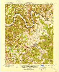
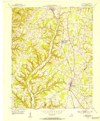
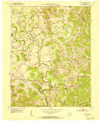
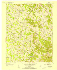
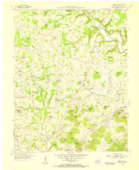
(157)- 1890 Map of Williamsburg
 1890 Williamsburg1890 Print · USGSThe Kentucky and Tennessee borderlands come alive in the late nineteenth century as the coal industry and railroads expand. Genealogists can trace family roots in Williamsburgh or locate early industrial sites like Beaver Mines and Steels Mill.2 unique versions available
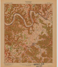
 - 1893 Map of London
 1893 London1893 Print · USGSSoutheast Kentucky's plateau country was undergoing a railway-driven transformation in the early 1890s. Genealogists and local historians can trace family roots through numerous small communities like Broadhead, Gum Sulphur, and Altamont along the Louisville and Nashville Railroad.
 - 1894 Map of Williamsburg
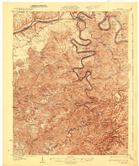
 1894 Williamsburg1894 Print · USGSThe Cumberland River valley and the Kentucky-Tennessee borderlands are captured here during the late nineteenth-century coal and rail expansion. Researchers can trace early industrial sites like Beaver Mines and Kensee Coal Mine or locate family roots in Whitley and Chitwood.5 unique versions available
 - 1897 Map of London
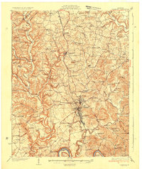
 1897 London1897 Print · USGSThe Kentucky interior near the close of the nineteenth century centers on the vital Louisville and Nashville Railroad corridor. Genealogists can trace early homesteads and rail stops from Mt. Vernon to Bee Lick and Hazlepatch.5 unique versions available
 - 1911 Map of Monticello, 1952 Print
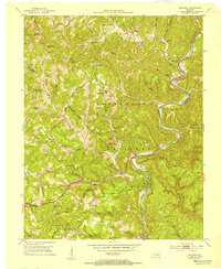
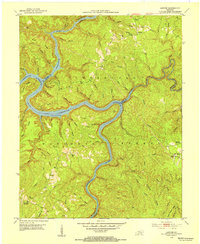
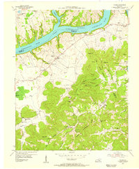
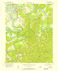
 1911 Monticello1952 Print · USGSWayne County and the southern loops of the Cumberland River are captured here in the early twentieth century before modern reservoirs changed the valley. Genealogists can locate dozens of country schools and churches, from Old Glory School to Union Church, alongside river landings like Rankin Landing.2 unique versions available
 - 1914 Map of Monticello
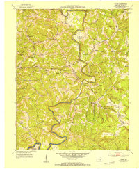
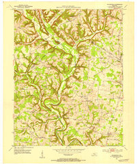
 1914 Monticello1914 Print · USGSWayne County life in the early twentieth century centered on the Cumberland River and the crossroads at Monticello. Genealogists and historians can trace numerous rural institutions like Old Glory School, Union Church, and the Ramsey Branch Stop PO.4 unique versions available
 - 1932 Map of Burnside
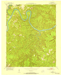
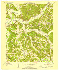
 1932 Burnside1932 Print · USGSThe Cumberland River and its South Fork are captured here in the early 1930s, showing the intricate river-and-rail topography of southern Kentucky. Researchers can locate dozens of country landmarks like Roberts Mill, Lovells Chapel, and Pole Bridge Sch.2 unique versions available
 - 1935 Map of Somerset
 1935 Somerset1935 Print · USGSIn the mid-1930s, the rural landscapes around Somerset were a dense network of one-room schools and river crossings. Genealogists can trace family connections through numerous landmarks like Mt Zion Sch, Waitsboro Ferry, and the Mills Springs National Cem.
 - 1952 Map of Eubank, 1953 Print
 1952 Eubank1953 Print · USGSThe Eubank area and the southern Lincoln County borderlands appear here in the early fifties, following the path of the Southern railroad. Researchers can trace rural lineages through numerous landmarks like Phillips Chapel, Double Spring Cem, and Walnut Grove Sch.
 - 1952 Map of Hail, 1953 Print
 1952 Hail1953 Print · USGSThe Cumberland River valley and the southern reaches of the Daniel Boone Forest appear here in the early fifties. Local historians can trace the paths to Hail P O, find the site of North Mill Creek Sch, and locate remote churches like Salem Ch.
 - 1952 Map of Billows, 1954 Print
 1952 Billows1954 Print · USGSThe Rockcastle River valley and Cumberland National Forest appear here in the early fifties, showing a rural landscape defined by steep ridges and small settlements. Genealogists can locate family landmarks like Whitaker Cem, several local schools, and the Indian Trail Lookout Tower.3 unique versions available
 - 1952 Map of Ano, 1954 Print
 1952 Ano1954 Print · USGSThe Rockcastle River forms a dramatic boundary between Laurel and Pulaski Counties in the early fifties, cutting through the heavy timber of the Cumberland National Forest. Researchers can trace the rural life of Ano and Goodwater through sites like the Hindsfield Sch and Garson Cem.3 unique versions available
 - 1952 Map of Dykes, 1954 Print
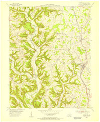
 1952 Dykes1954 Print · USGSPulaski County in the early fifties is a landscape of winding watercourses and high ridge-top settlements. Genealogists can trace family connections through landmarks like Randall Chapel, the White Lily School, and Pine-Thicket Cem along the bends of Buck Creek.2 unique versions available
 - 1952 Map of Shopville, 1954 Print
 1952 Shopville1954 Print · USGSPulaski and Rockcastle counties in the early fifties were a network of winding hollows and family-named knobs along Buck Creek. Genealogists and local historians can trace legacy sites like Silver Star Sch, Childress Cem, and the community of Shopville.2 unique versions available
 - 1952 Map of Sawyer, 1954 Print
 1952 Sawyer1954 Print · USGSThe confluence of the Rockcastle and Laurel Rivers in the early fifties shows a landscape of deep hollows and high ridges within the Cumberland National Forest. Researchers can trace old family sites and rural institutions like Sawyer, Franklin Sch No 2, and Poynters Ch.2 unique versions available
 - 1952 Map of Woodstock, 1954 Print
 1952 Woodstock1954 Print · USGSThe rural uplands of Pulaski and Lincoln counties are captured here in the early fifties, showing a landscape of high knobs and deep hollows. Researchers can trace ancestral locations through numerous country schools and churches like Penobscot Sch and Sweetgum Ch.2 unique versions available
 - 1953 Map of Phil, 1954 Print
 1953 Phil1954 Print · USGSCasey County in the early fifties is captured here as a landscape of interconnected ridges and hollows. Researchers can trace rural life through numerous country schools and churches like Tate Sch, Antioch Ch, and the historic Rubert Ford river crossing.2 unique versions available
 - 1953 Map of Maretburg, 1954 Print
 1953 Maretburg1954 Print · USGSRockcastle County in the early 1950s is a landscape of high knobs and creek-bottom settlements centered on the historic Wilderness Road. Genealogists can locate family landmarks like Sayers Cem, Double Springs, and many rural schoolhouses including Ottawa Sch.3 unique versions available
 - 1953 Map of Frazer, 1955 Print
 1953 Frazer1955 Print · USGSWayne and Pulaski Counties appear here in the early fifties as the landscape was being reshaped by the waters of the newly created Lake Cumberland. Researchers can trace rural lineages through numerous country schools and churches like New Salem Ch, Turpin Sch, and Meadow Creek Sch.2 unique versions available
 - 1953 Map of Mintonville, 1955 Print
 1953 Mintonville1955 Print · USGSThe Casey and Pulaski County line comes alive in the early fifties, showing a rural Kentucky landscape of ridge-top schools and creek-side settlements. Genealogists can locate family landmarks like Cains Store, Bradley Pleasure Church, and the Caintown Cemetery.3 unique versions available
 - 1953 Map of Mill Springs, 1955 Print
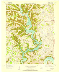
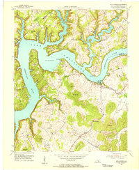 1953 Mill Springs1955 Print · USGSThe mid-century landscape of Wayne and Pulaski counties comes alive here, showing the region just as the rising waters of Lake Cumberland redefined the terrain. Genealogists and historians can trace family roots at Morrow Chapel, Simpson Spr, and the Mill Springs Battlefield.2 unique versions available
 - 1954 Map of Bobtown, 1955 Print
 1954 Bobtown1955 Print · USGSPulaski County at the mid-century is a landscape of high knobs and winding creek branches. Genealogists and local historians can trace family locations near Bobtown and Etna, or locate rural landmarks like the Camp Ground Sch and Hazeldell Cem.3 unique versions available
 - 1954 Map of Burnside, 1955 Print
 1954 Burnside1955 Print · USGSThe river loops and rugged ridges of Pulaski County are caught here in the mid-fifties, just as the Southern railroad served the timber and coal interests of the region. Researchers can locate vanished landmarks and family sites like Mt Union Sch, Owens Cem, and the old station at Sloans Valley.2 unique versions available
 - 1954 Map of Delmer, 1955 Print
 1954 Delmer1955 Print · USGSPulaski County's landscape is shown just as the reservoir system transformed the Cumberland River valley in the early fifties. Genealogists can trace family landmarks like Mill Springs National Cemetery, Oil Center, and Delmer Church.
 - 1954 Map of Science Hill, 1955 Print
 1954 Science Hill1955 Print · USGSMid-century Pulaski County is defined here by the Southern railroad line and a dense network of ridge-top farms and schools. Researchers can trace family history through dozens of localized landmarks like Center Post Sch, Freedom Ch, and the Van Hook Cem.
Showing maps 1-25 of 157
Top cities of Pulaski County
- Somerset historical maps
- Ferguson historical maps
- Burnside historical maps
- Science Hill historical maps
- Eubank historical maps
Frequently asked questions
- What are the different types of historical maps available for Pulaski County?
- What is the oldest map of Pulaski County?
- Where can I purchase historical maps of Pulaski County for my home or office?
- Where can I download high-res historical maps of Pulaski County?
- Are there historical topographic maps available for Pulaski County?
- Is there historical aerial imagery available for Pulaski County?
- Where are historical maps of Pulaski County sourced from?