Old Maps of Trigg County, Kentucky for Metal Detecting
Plan your next treasure hunt with 128 historic maps of Trigg County. Find old homesites, ghost towns, trails, and gathering spots that may be lost to time — perfect for identifying promising metal detecting locations.
- Locate forgotten sites: Uncover places like long-lost settlements, abandoned rail lines, or gathering spots.
- Plan better hunts: Use map overlays combined with LiDAR or satellite views to narrow in on historically rich areas.
- Made for detectorists: Thousands of hobbyists use these maps to discover relics, coins, and hidden history.
Use these historic maps to boost your research and find new opportunities beneath the surface of Trigg County.
Trigg County, KY maps
(128)- 1909 Map of Dawson Springs
 1909 Dawson Springs1909 Print · USGSWestern Kentucky at the peak of its rail-and-river era shows a landscape dotted with country schools and small depots. Genealogists can trace family roots through numerous landmarks like Hamby Sta, Pooles Mill Bridge, and Cross Roads Church.
 - 1911 Map of Dawson Springs
 1911 Dawson Springs1911 Print · USGSWestern Kentucky’s coal and rail corridors are captured here just after the turn of the century. Genealogists can trace family footprints through dozens of rural sites like the Daniel Boone School, Franklin's Store, and the Fox Run Mine.2 unique versions available
 - 1936 Map of Mont
 1936 Mont1936 Print · USGSThe Tennessee and Cumberland river basins meet here in the 1930s, showing a landscape of rural post offices and iron-industry remnants. Genealogists can locate family landmarks like Hillman Store, Woods Chapel, and the Fulton Sch.
 - 1936 Map of Fenton
 1936 Fenton1936 Print · USGSTrigg County sits at a crossroads of river and road in the mid-1930s, before modern reservoirs reshaped the landscape. Trace the old communities of Golden Pond and Fenton, and locate rural landmarks like Joycetown Cem and Oak Ridge Sch.
 - 1936 Map of Hiatt
 1936 Hiatt1936 Print · USGSThe Tennessee River corridor in the mid-1930s appears here before the formation of Kentucky Lake forever altered the local shoreline. Genealogists can locate family landmarks like Barnett Cem, rural centers like Faughns Store, and schools such as Collie Sch or Aurora Sch.
 - 1936 Map of Birmingham
 1936 Birmingham1936 Print · USGSThe Tennessee and Cumberland rivers converge in the mid-1930s, showing the riverfront town of Birmingham before the creation of Kentucky Lake. Genealogists and historians can trace numerous family burial sites like Birmingham Cem and rural centers such as Yale Sch and the Birmingham Ferry.
 - 1936 Map of Golden Pond
 1936 Golden Pond1936 Print · USGSWestern Kentucky’s river-locked interior is captured here in the mid-1930s, just before the creation of the great lakes. Local researchers can trace family roots at Birmingham or Fenton, and locate industrial landmarks like the Center Furnace and Star Lime Works.
 - 1936 Map of Rushing
 1936 Rushing1936 Print · USGSLife along the Tennessee River is documented here just before major dam projects reshaped the border of Kentucky and Tennessee. Genealogists and historians can trace old river access points like Dilday Landing and local landmarks such as Futrell Store or the Hendon Cem.
 - 1938 Map of Birmingham
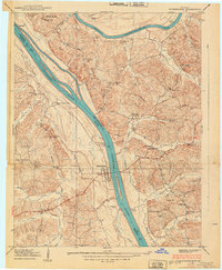 1938 Birmingham1938 Print · USGSThe Tennessee and Cumberland Rivers converge in Lyon County just before the regional landscape was transformed by dam projects. Genealogists can trace family footprints at Birmingham, find rural landmarks like Star Lime Works PO, or locate Harvard Ch and Birmingham Cem.
 - 1940 Map of Hiatt
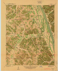 1940 Hiatt1940 Print · USGSThe Tennessee River valley is shown just before the landscape was transformed by damming. Genealogists can trace family landmarks like Faughn Cem, Inmans Store, and riverfront sites at Ironton Landing.
 - 1950 Map of Rushing Creek, 1953 Print
 1950 Rushing Creek1953 Print · USGSThe Tennessee and Kentucky borderlands appear here just after the filling of the reservoir, capturing a landscape defined by the new shoreline. Researchers can locate family burial grounds like Rushing Creek Cem and landmarks such as the Lookout Tower and Turkey Creek Ch.5 unique versions available
 - 1950 Map of Mont, 1953 Print
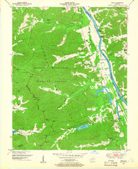 1950 Mont1953 Print · USGSThe Between the Rivers country of Western Kentucky is documented here in the mid-twentieth century, just before its major federal transformation. Genealogists and historians can trace family sites like Woodson Chapel, Henderson Chapel Cem, and industrial remnants including the Center Furnace (Ruins).2 unique versions available
 - 1950 Map of Fenton, 1953 Print
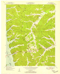 1950 Fenton1953 Print · USGSThe area of Trigg County between the Tennessee and Cumberland Rivers is shown here in the early fifties. Genealogists can trace family names at McWaters Cem or Newton Cem and locate the old sites of Fenton and Golden Pond.
 - 1950 Map of Caledonia, 1965 Print
 1950 Caledonia1965 Print · USGSTrigg and Christian Counties are captured in the mid-twentieth century as a landscape of rural schoolhouses, family cemeteries, and karst springs. Researchers can trace the heritage of Caledonia and Julien through landmarks like Binns Mill, Averitt Sch, and Locust Grove Ch.
 - 1951 Map of Caledonia
 1951 Caledonia1951 Print · USGSThe rural borderlands of Trigg and Christian counties are documented here in the early fifties, showing a landscape of sinkhole springs and small crossroads. Genealogists can locate family landmarks like Binns Mill, Locust Grove Ch, and the Old Presbyterian Cem.
 - 1951 Map of Model, 1953 Print
 1951 Model1953 Print · USGSThe Kentucky-Tennessee state line follows the ridge tops and river bends of the 1950s Cumberland Valley. Genealogists can trace family names through dozens of hilltop burial sites like Bethlehem Cem and rural centers such as Model and Tobaccoport.
 - 1951 Map of Roaring Spring, 1953 Print
 1951 Roaring Spring1953 Print · USGSThe Kentucky and Tennessee borderlands appear in the early fifties as the military presence transformed the landscape. Trace rural roots at Corinth Ch or find former homesites now marked as ruins inside the Fort Campbell Military Reservation.
 - 1951 Map of Johnson Hollow, 1953 Print
 1951 Johnson Hollow1953 Print · USGSThe Trigg County and Stewart County borderlands are captured here in the early fifties as the Fort Campbell Military Reservation expanded. Local historians can trace family roots through numerous burial sites and schools like McKinney Cem, Moore Cem, and Delmont Sch.
 - 1953 Map of Canton, 1954 Print
 1953 Canton1954 Print · USGSTrigg County's riverfront is captured here in the early 1950s, showing the land just before the landscape was altered by massive reservoir projects. Local historians can trace family roots through sites like Canton, Peals Chapel, and the Heindrick Cem.
 - 1953 Map of Gracey, 1954 Print
 1953 Gracey1954 Print · USGSChristian and Trigg counties appear here in the early fifties, during a period of steady rail-side growth and established farm life. Genealogists and historians can trace family roots through sites like Cerulean Springs, Montgomery Ch, and Roach Cem.
 - 1953 Map of Cobb, 1954 Print
 1953 Cobb1954 Print · USGSSettled farmland along the border of Trigg and Caldwell counties is captured here in the early fifties. Genealogists and historians can trace families via the numerous rural burial grounds like Merrick Cem and churches such as Mt Zion Ch.
 - 1953 Map of Dawson Springs SW, 1954 Print
 1953 Dawson Springs SW1954 Print · USGSMid-century Christian and Caldwell Counties are seen here during a period of rural stability, centered on the wooded expanse of the Pennyrile State Forest. Family historians can trace ancestral roots through several small churches and cemeteries, including Woods Chapel, Vanhooser Cem, and the settlement at Hawkins.
 - 1953 Map of Lamasco, 1954 Print
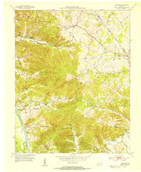 1953 Lamasco1954 Print · USGSWestern Kentucky's rural landscape is captured here in the early fifties, just as the traditional river-and-road network remained largely intact. Researchers can trace family history through dozens of landmarks like Trigg Furnace Sch, Siloam Ch, and Parker Cem.2 unique versions available
 - 1953 Map of Cadiz, 1955 Print
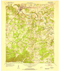 1953 Cadiz1955 Print · USGSTrigg County's river-driven geography is on full display during the early fifties, centering on the town of Cadiz. Genealogists and historians can trace family roots at Oak Grove Sch or locate numerous ancestral plots including Miller Cem and Wallace Cem.
 - 1954 Map of Evansville
 1954 Evansville1954 Print · USGSThe Ohio River borderlands between Indiana and Kentucky appear here during a period of robust industrial and military growth. Genealogists and researchers can trace the rail corridors of the Illinois Central and find landmarks like US Lock and Dam No 48 or Camp Breckinridge.
Showing maps 1-25 of 128
Top cities of Trigg County
Frequently asked questions
- What are the different types of historical maps available for Trigg County?
- What is the oldest map of Trigg County?
- Where can I purchase historical maps of Trigg County for my home or office?
- Where can I download high-res historical maps of Trigg County?
- Are there historical topographic maps available for Trigg County?
- Is there historical aerial imagery available for Trigg County?
- Where are historical maps of Trigg County sourced from?